
CAT | Nature
24
Kaminne Selo State Geological Reserve
No comments · Posted by Sergei Rzhevsky in Nature, Regions, Travel
Kaminne Selo (literally meaning “stone village”) is one of the little-known interesting places in Ukraine – several hectares of forest on which large boulders are scattered.
A lot of these stones resemble rural houses, there is a “square” with a “school”, and even a “church”. Most tourists visit a stone with “footprints of God”, there is a special ladder attached to it. Photos by: nastya_paw.
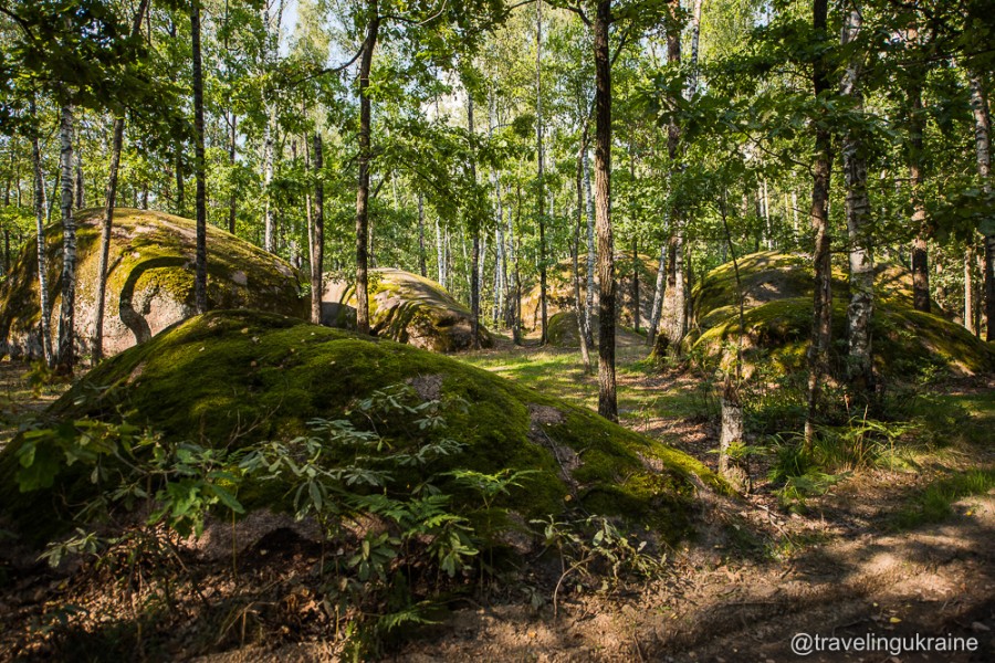

Tags: Zhitomir oblast
7
Hoverla – the Highest Mountain in Ukraine
No comments · Posted by Alex Smirnov in Nature, Travel, Video
Hoverla (in Romanian meaning “an impassable height”) is the highest mountain on the territory of Ukraine (2,061 meters).
This popular tourist destination is located on the border of the Zakarpattia and Ivano-Frankivsk regions, about 17 km from the border with Romania. Hoverla on Google Maps.
Tags: Ivano-Frankivsk oblast · Zakarpattia oblast
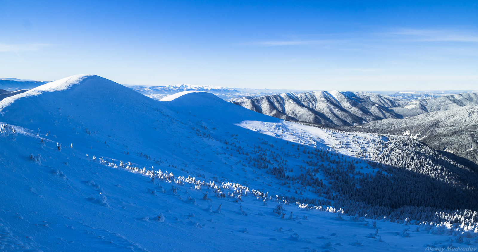
23
Winter on the mountain range Pishkonya
No comments · Posted by Sergei Rzhevsky in Nature, Travel
Pishkonya, a mountain range in the Ukrainian Carpathians, is located in the southeastern part of Mizhhiria district of the Zakarpattia region, within the National Park “Synevyr”.
The highest peaks are Nehrovets (1,707 m), Yasnovets (1,600 m), Darvayka (1,501 m). The most convenient ways to climb the range begin in the villages of Synevyr and Kolochava. Pishkonya on Google Maps. Photos by: Alexey Medvedev.
let’s go hiking in the mountains
Tags: Zakarpattia oblast
12
Top 10 photos of Ukrainian nature in 2016
No comments · Posted by Sergei Rzhevsky in Nature, Photos, Regions
Wiki Loves Earth is an annual international photo contest of the natural monuments and here are the best photos of the natural attractions of Ukraine taken in 2016.
Shypit waterfall – a hydrological natural monument located in the Ukrainian Carpathians, about 6 km from Pylypets village in Mizhhiria district of Zakarpattia oblast. Author: Yekaterina Krasnickaja.
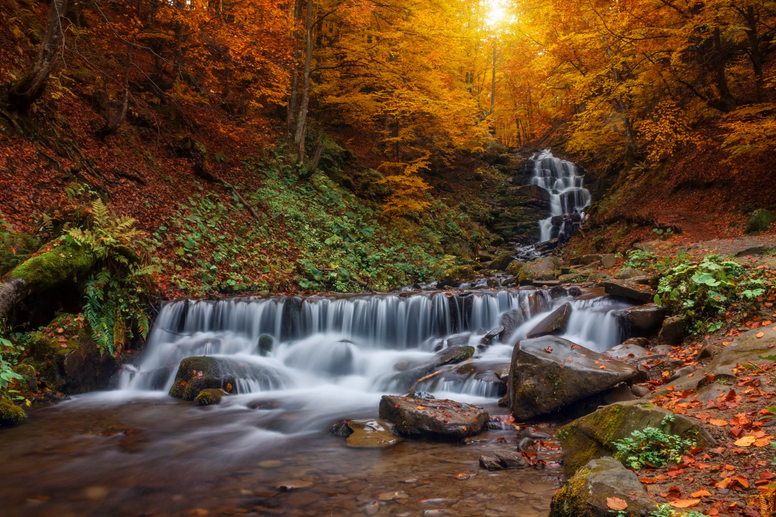
Tags: Chernovtsy oblast · Dnepropetrovsk oblast · Ivano-Frankivsk oblast · Nikolaev oblast · Zakarpattia oblast
1
One hot summer day near Berdyansk
No comments · Posted by Sergei Rzhevsky in Nature, Photos, Regions
Let’s fast forward from chilly winter weather on a hot summer day on the coast of the Azov Sea.
The following pictures were taken in the vicinity of Berdyansk – a city in the Zaporozhye region situated on the northern coast of the Sea of Azov. Wheat has already been harvested and sunflower is still ripening. Photos by: Alexei Novik.
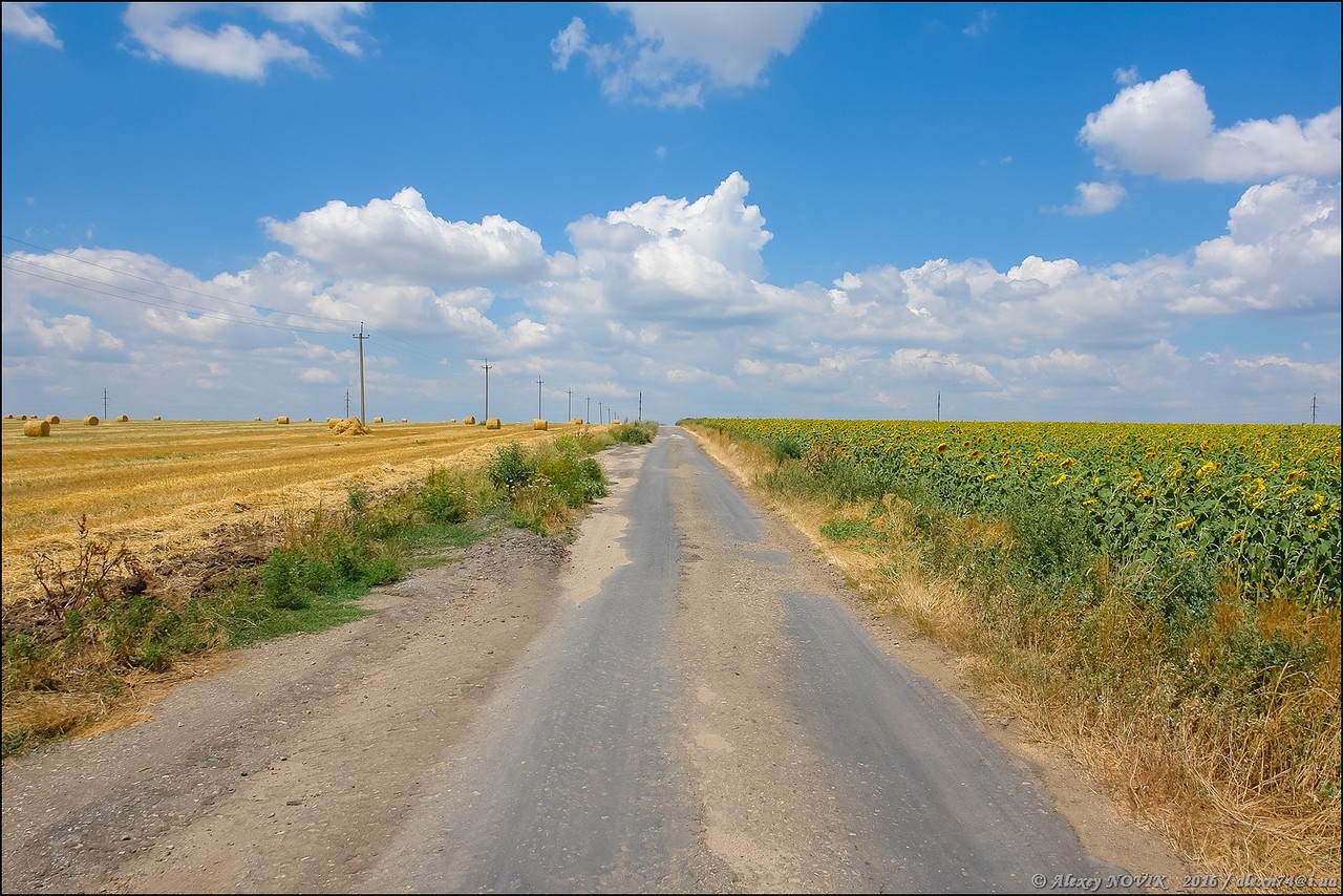
Tags: Berdyansk city · Zaporozhye oblast
6
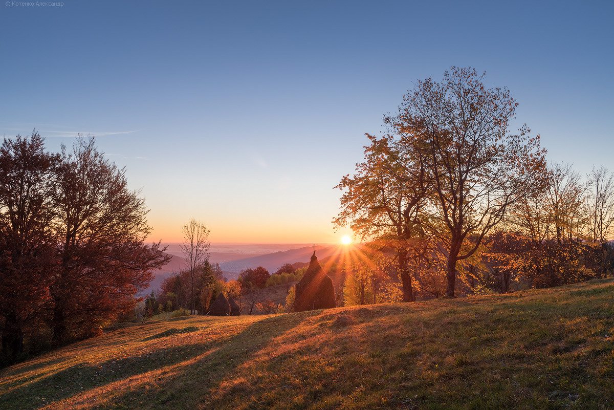
Golden Autumn on Sokilsky Ridge in the Carpathians
No comments · Posted by Sergei Rzhevsky in Nature, Regions, Travel
Sokilsky Ridge is located in Pokutsko-Bukovina Carpathians (part of the Ukrainian Carpathians), south of Kolomyya, in the Kosovsky district of the Ivano-Frankivsk region.
The length of the ridge is about 15 km, the maximum height – 940 m. It stretches from the northwest to the southeast between the rivers Ribnitsa and Cheremosh, from Sokolivka village to Velykyi Rozhyn village. Sokilsky Ridge on Google Maps. Photos by: Oleksandr Kotenko.
golden autumn in all its glory
Tags: Ivano-Frankivsk oblast
28
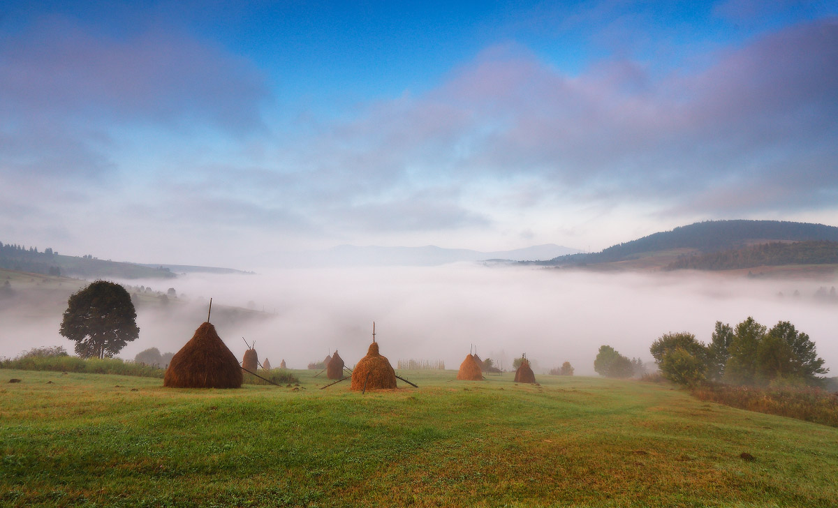
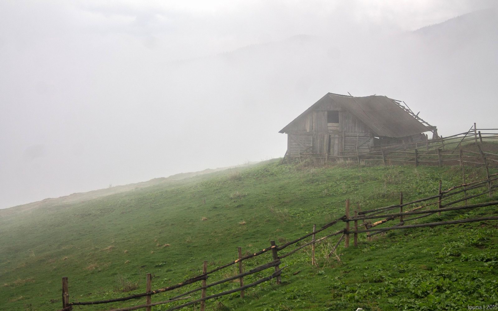
One foggy autumn morning in the Carpathians
No comments · Posted by Sergei Rzhevsky in Nature, Regions
The Ukrainian Carpathians, located in the west of Ukraine mainly in the Lviv, Ivano-Frankivsk, Zakarpattia, and Chernivtsi regions, are beautiful at any time of the year! One foggy morning in September. Photos by: Maxim Weise.
Tags: Chernovtsy oblast · Ivano-Frankivsk oblast · Lviv oblast · Zakarpattia oblast
8
Let’s go hiking on Chornohora range
No comments · Posted by Sergei Rzhevsky in Nature, Regions, Travel
Chornohora mountain range is one of the most beautiful places in Ukraine stretching for 40 kilometers from north-west to south-east. It is a border between Zakarpattia and Ivano-Frankivsk oblasts.
Chornohora is the highest mountain system in Ukraine. Only here you can find mountain peaks about 2 km high. This mountain range is known for its preserved mountain ecosystems and virgin forests. The area is part of the Carpathian reserve and Carpathian national park. Photos by: levk_777.
Tags: Ivano-Frankivsk oblast · Zakarpattia oblast
25
Nature without people – Chernobyl fish
No comments · Posted by Alex Smirnov in Nature, Video
Life goes on in spite of everything. The bypass channel of Chernobyl Nuclear Power Plant cooling pond in Pripyat is rich in various fish in the absence of fishermen.
Tags: Pripyat city
11
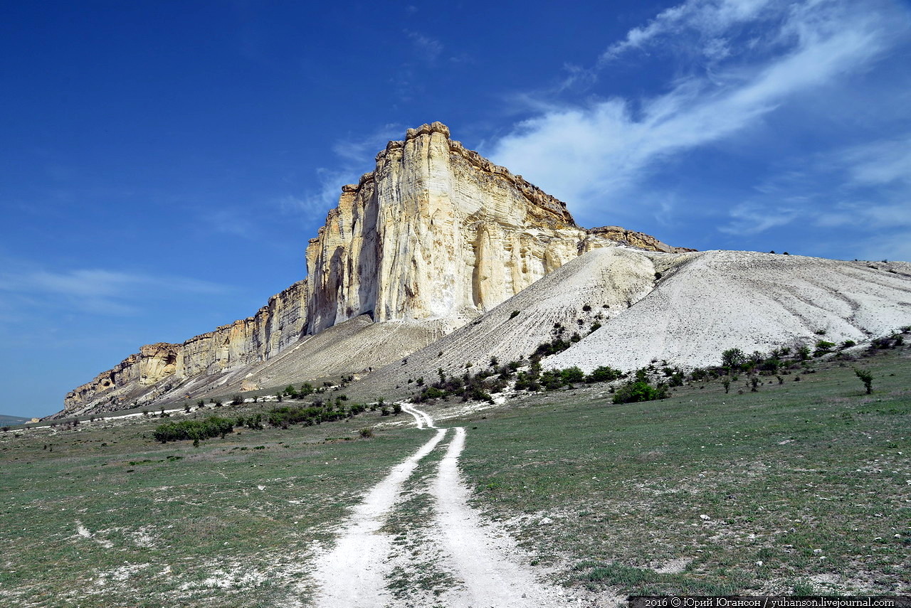
Belaya Skala – a wonderful natural monument in Crimea
No comments · Posted by Sergei Rzhevsky in Nature, Photos
Belaya Skala (White Rock) or Aq-Qaya is a vertical white rocky wall in Crimea, located near the village of Belaya Skala. The height of the cliff is 100 meters. This natural monument was created by erosion and weathering of the limestones and sandstones.
Almost all the inhabitants of the former USSR, as well as many people in the former socialist countries saw this beautiful landscape at least once because most movies about Indians and the American Wild West, shot in the Soviet era, included scenes filmed near this rock. Photos by: Yuri Yuhanson.
Tags: Crimea Republic