Chernivtsi Oblast - History
People began to settle this territory later known as Northern Bukovina since the time of the Paleolithic (about 40-15 thousand years ago). More than 50 monuments of the early iron era have been found here. It is possible that some of them were left by the tribe of Scythian plowmen mentioned by Herodotus, who settled mainly in the territory of the Dnieper River.
In the Chernivtsi region, there are more than 200 monuments of the Early Slavic Chernyakhov culture (the 2nd-6th centuries AD). The most outstanding site is the remains of the oldest glass workshop in Ukraine (the 3rd-4th centuries AD). More than 250 Slavic monuments of the 7th-14th centuries are located in many settlements of this region.
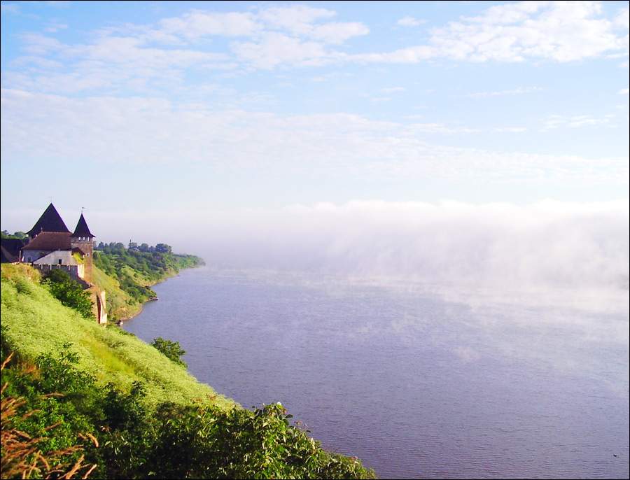
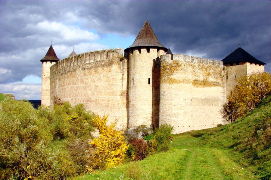
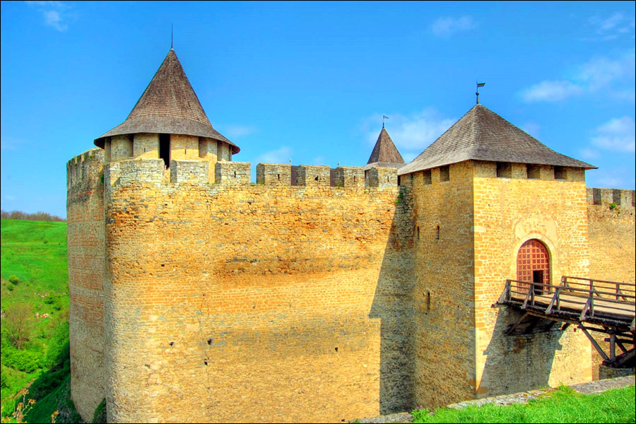
The history of the Chernivtsi region is associated with the foundation of the Khotyn fortress on the bank of the Dniester River in the 13th century. The fortress, originally built from wood at the behest of Prince Vladimir and then built of stone under the rule of Danilo Galitsky, became the first stone structure in the territory of present-day Ukraine and protected this land from nomad raids. Today, the Khotyn fortress is one of the main attractions of Chernivtsi Oblast.
In the 10th-12th centuries, the territory of the Chernivtsi region was part of Kievan Rus, then - the Galicia-Volyn principality, and the Golden Horde. In 1345, the region came under the control of the Hungarian Kingdom. From this moment the period began, which determined its originality and uniqueness. In 1359, the Moldavian Principality separated from Hungary and declared the right to this territory, called Bukovina, because of its thick beech (“buk”) forests.
More historical facts…
In 1514, the land of Bukovina was captured by the Ottoman Empire. Decisive events that made significant changes in the life of the Moldovan and Bukovinian people were associated with the Russian-Turkish war of 1768-1774. In the spring of 1769, Russian troops crossed the Dniester River and captured Khotyn.
According to the Treaty of Kuchuk-Kainarji of 1774, the Russian Empire regained the shores of the Black Sea from the Southern Bug to the Dnieper River. At the height of the war, Austria, fearing the influence of the Russians in the Balkans, offered the Ottomans to conclude an alliance against Russia. In September 1786, the Austrian emperor Joseph II issued a decree on the annexation of Bukovina as a district in Galicia.
According to the Treaty of Bucharest (1812) between the Ottoman Empire and the Russian Empire, the Khotyn district became part of the Russian Empire. Under this treaty, Bessarabia also joined Russia.
At the end of the 18th and the beginning of the 19th century, culture gradually developed in Bukovina. In 1784, the first town school was opened in Chernivtsi. In 1849, Bukovina became a separate province. In 1875, a university was opened in Chernivtsi. Classes were conducted in German.
With the beginning of the First World War, the government of the Austro-Hungarian Empire declared martial law in Bukovina. In 1916, during the famous Brusilov breakthrough, Russian troops occupied almost all of Bukovina. November 12, 1918, immediately after the signing of a truce between Germany and the countries of the Entente, the Romanian troops occupied Chernivitsi.
June 28, 1940, during the Second World War, the Red Army occupied Bessarabia and Northern Bukovina. August 7, 1940, Chernivtsi Oblast of the Ukrainian SSR was formed from the northern, with a predominantly Ukrainian population, part of Bukovina and the neighboring part of Bessarabia (with Khotyn). July 6, 1941, the Romanian and German troops occupied Chernivitsi. March 29, 1944, the Red Army regained Chernivtsi.
Today, Northern Bukovina in the form of Chernivtsi Oblast is part of an independent Ukraine. Southern Bukovina is a province of Romania. The center of this province, the city of Suceava, was the first capital of the principality of Moldova. And Chernivtsi is the former center of the Austrian province of Bukovina. These two centers are located on different sides of the border but at a distance of less than 100 kilometers from each other.
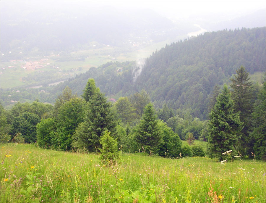
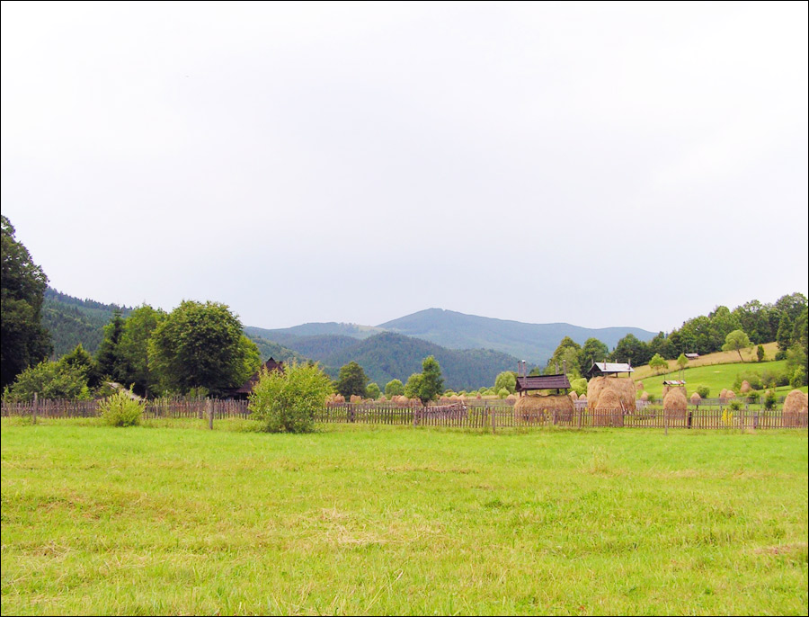
Beautiful nature of Chernivtsi Oblast
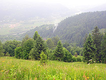
The Bukovina Carpathians in the Chernivtsi region
Author: Andriy O.L.
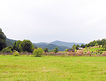
Country landscape in Chernivtsi Oblast
Author: J.Codrin
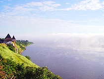
On the bank of the Dniester River near the Khotyn Fortress in the Chernivtsi region
Author: Sasha Rusnak
Chernivtsi Region - Features
The fate of this region of Ukraine is not similar to the history of other regions. It was part of several states, which affected its architectural appearance and historical heritage. Chernivtsi Oblast is one of the most unusual regions of Ukraine. Located in the west of the country, it doesn’t belong to Galicia (traditional western Ukraine). This region has never been part of Poland.
Bukovina can be divided into two main parts: the flat one - between the Prut and Dniester rivers and the mountain one - the Bukovina Carpathians. The highest point is Mount Yarovitsa (1,574 meters). The largest river of the region, which forms the border between Chernivtsi Oblast and neighboring northern regions - the Dniester River. The climate is moderately continental.
There are 331 protected nature areas with a total area of more than 1,035 square kilometers (12.8% of the territory of the Chernivtsi region). The objects of national importance are the natural parks of “Vyzhnytskyi”, “Cheremosh”, “Khotyn”, 10 nature reserves, 9 nature monuments, 2 dendrological parks, and the Chernivtsi Botanical Garden.
Chernivtsi Oblast has a favorable geographical and transport position. Chernivtsi, the capital of the region, has a convenient railway connection with Bucharest, Sofia, Belgrade, Moscow. The region is rich in natural resources. Four oil and natural gas fields have been discovered on the territory of Bukovina. The leading place in the local economy is occupied by industry and agriculture.
This region is distinguished by a multinational composition and a significant (about 25%) share of ethnic and linguistic minorities: Ukrainians (75.0%), Romanians (12.5%), Moldovans (7.3%), Russians (4.1%), Poles (0.4%), Belarusians (0.2%), Jews (0.2%), others (0.4%). Russian is the main language of their communication. By the percentage of the Russian-speaking population, Chernivtsi Oblast ranks first among all other regions of western Ukraine.
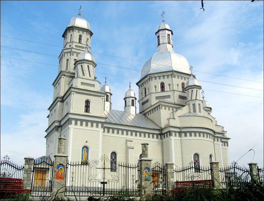
On the territory of the Chernivtsi region there are: 836 monuments of archeology (18 of national importance), 586 monuments of history (2), 779 monuments of architecture and urban planning (112), 42 monuments of monumental art. The list of historical settlements of Ukraine includes 11 local settlements: Vyzhnytsya, Hertsa, Hlyboka, Kelmentsi, Kitsman, Luzhany, Novoselytsya, Putyla, Storozhynets, Khotyn, Chernivtsi.
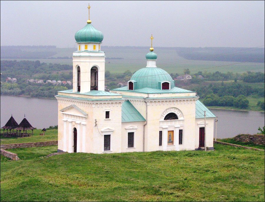
The most important and interesting man-made sights of the Chernivtsi region are the Residence of Metropolitans (University) in Chernivtsi, the Khotyn Fortress in Khotyn, and the Old Believer Assumption Cathedral in Bila Krynytsya.
Interesting Facts about Chernivtsi Oblast
The highest peak of the flat part of Ukraine is Mount Berda (515 meters) located on the Khotyn Upland.
The Khotyn Fortress is one of the most famous castles in Ukraine, which served as a backdrop in many historical films.
Emil Racovitza (also known as Popelyushka) Cave is one of the longest caves in the world and the only place in Ukraine where you can cross the state border of Ukraine (with Moldova) through a natural underground corridor.
The village of Seliatyn is the leader of Ukraine in the number of thundery days (about 45 days per year). The longest thunderstorm in Ukraine was also recorded here - 37 hours. It began on June 10, 2008 at 15:30 and ended on June 12 at 4:30.
Throughout the territory of Ukraine, only in the Berehomet Dendropark there are two golden larch trees, which can only be seen in their natural habitat in the Yangtze River Delta in China.
Zubrovytsya Nature Reserve is the only place in Ukraine where bison live.
Shurdyn - the highest car pass in Ukraine (1,173 meters above sea level).
The landscape reserve “Bukovina Waterfalls”, one of the pearls of the Carpathians, is located near the village of Roztoky in the Putyla District.
Bukovina is the birthplace of the famous Ukrainian singers Vladimir Ivasyuk, Nazariy Yaremchuk, Sophia Rotaru, Ani Lorak, actor Ivan Mykolaichuk, the first Ukrainian cosmonaut Leonid Kadenyuk.
The Hertsa District is the smallest district in Ukraine by territory, and the town of Hertsa is the smallest district center in terms of population. Another feature of this place is that more than 90% of the population speaks Romanian here.
The village of Bila Krynytsya is the world spiritual and historical center of the Old Believers.
In the village of Davydivka there are 7 wooden churches, most of which are of interest to lovers of wooden architecture.