History of Kherson Oblast
Kherson Land in Ancient Times
People lived in the territory of present Kherson Oblast, in particular, the area of the Lower Dnieper, already in the Late Paleolithic, more than 10 thousand years ago. In the 9th-8th centuries BC, this territory was controlled by the Cimmerians. In the 7th century BC, they were replaced by nomadic Scythian tribes.
Kherson steppes were part of Scythia, which took shape in the 6th century BC and reached its peak in the 4th century BC. More than 120 monuments of the Scythian time of the 6th-3rd centuries BC have been found on the territory of the Kherson region.
In the 3rd century BC, the decline of Scythia began. The lower Dnieper region, including the territory of the present Kherson region, became part of the newly formed state called Malaya (Small) Scythia, which center was in the Crimea. At that time, a new wave of nomads, the Sarmatians, appeared in the Azov and Lower Dnieper regions.
The culture of this region became very mixed. It closely intertwined elements of the Scythian, Sarmatian, Greek, Roman, and Thracian cultures. In addition, from the forest-steppe regions, a settled agricultural Slavic population began to move here too. The main territory of the Kherson region remained to be the place of nomadic pastoral tribes. Despite such a dangerous nomadic neighbors, Slavic settlements in the coastal regions of the Dnieper continued to exist.
More historical facts…
Kherson Region in the Middle Ages
With the emergence of the East Slavic state of Kievan Rus (882), the influx of Slavic population in the steppe increased, especially in the 12th century. Its proportion in settlements with a mixed ethnic composition increased significantly.
During this period, in the lower reaches of the Dnieper, there was a Slavic trading town repeatedly mentioned in the chronicles - Oleshye. It was one of the centers of fishing in the Black Sea, a significant port, which was of great strategic importance. On the one hand, it gave access to the sea, and on the other, it defended the entrance to the Dnieper River - the main waterway of South-Western Rus.
In the first half of the 13th century, a large number of cities and settlements of Russian principalities, including on the territory of the Lower Dnieper, were devastated and destroyed during the Mongol invasion. In the second half of the 14th century, the Grand Duchy of Lithuania took possession of the western and most of the southwestern and southern Russian lands, including the right bank of the Lower Dnieper.
In the second half of the 15th century, a large part of the territory of the right bank of the Lower Dnieper was captured by the Ottoman Empire (Turkey), and the entire left bank was under the rule of the Crimean Khanate, which arose in 1443 due to the collapse of the Golden Horde. Since 1475, the Crimean Khanate was in vassal dependence on the Ottoman Empire.
In the middle of the 16th century, with the foundation of the Zaporozhian Sich (a proto-state of Cossacks), the Lower Dnieper began to be actively settled by Cossacks, who also performed defensive functions protecting the regions located to the north from raids of the Crimean Tatars. The Cossacks took an active part in the settlement and economic development of the Lower Dnieper. They were engaged in cattle breeding, hunting, salt mining, agriculture, and fishing.
Kherson Region in the Russian Empire
After the Russian-Turkish war of 1768-1774, under the Treaty of Kuchuk-Kainarji, the Russian Empire gained the territory between the Dnieper and the Southern Bug (the right bank of the present Kherson region) and part of the left bank of the Dnieper estuary. The further need for the protection of its borders by the Cossacks ceased to be a necessity. In 1775, the Zaporozhian Sich was officially liquidated by the manifesto of Empress Catherine the Great.
In 1783, the Crimean Khanate ceased to exist. Crimea and Northern Tavria, including the territory of the left-bank Kherson region, became part of the Russian Empire. Russia received the right to freely navigate the Black Sea including the passage of its ships through the Bosphorus and Dardanelles. Since that time, intensive settlement and economic development of this region began.
After the liquidation of the Zaporozhian Sich, its lands were included in the newly created Azov Governorate (1775), as well as the New Russia Governorate (1764). In 1778, in connection with the need to create the Black Sea Fleet, the town of Kherson was founded with a shipyard and a fortress with a garrison of more than 20 thousand people.
In 1802, the New Russia Governorate was divided into three regions: Yekaterinoslav, Nikolaev and Tauride. In 1803, the center of the Nikolaev Governorate was moved to Kherson, and the province became known as the Kherson Governorate.
During the Crimean War of 1853-1856, the Kherson region was one of the closest rear areas where military reserves and artillery depots were concentrated, as well as military hospitals. The Russian troops passed through Kherson, Kakhovka, Berislav, Genichesk to defend Sevastopol.
In these territories, the percentage of serfs to the total number of settlers was small. Even before the peasant reform of 1861, this opened up wide opportunities for the development of capitalist relations in southern Ukraine. The territory of this region was included in the Pale of Settlement (the territory in the Russian Empire where permanent residency by Jews was allowed). German and Jewish agricultural colonies were created.
The life of the settlers was not easy. Steppe virgin soil was difficult for plowing; frequent droughts, dry winds and, as a result, crop failures became constant companions of their lives. People suffered especially from absence of trees, as well as lack of water.
Kherson Oblast in the 20th century and beyond
At the end of the 19th - beginning of the 20th centuries, the Kherson Governorate became one of the largest centers of handicraft industry in the south of Ukraine. In 1905, up to 300 artisanal workshops and small industrial enterprises operated in Kherson. Trade occupied an important place in the economic life of the region. Over 1 million tons of grain per year were exported through local ports. In 1907, the railway connected Kherson with Nikolaev.
The First World War and the ensuing events of the Civil War on the territory of the former Russian Empire led to dire consequences for the economy of the region. At the beginning of 1921, industrial production amounted to 20% of the pre-war period, sown area - 35%, livestock decreased by 65%. In 1914, there were 81.4 thousand people in Kherson, in 1923 - only about 40 thousand.
The construction of the Dnieper hydroelectric station and locks on the Dnieper significantly increased the importance of the Kherson port, especially after creating a continuous water connection from Kherson to the upper reaches of the Dnieper River. During the industrialization of the USSR (1929-1941), Kherson turned into a large industrial center of the region.
During the Second World War, the territory of the Kherson region was occupied by German troops by mid-September 1941. During the occupation, about 75 thousand people were killed, 37 thousand were taken out for forced labor in Germany. The region was liberated by mid-March 1944. About 100 thousand residents of the Kherson region served in the Red Army, of which about half were killed in battles.
March 30, 1944, a separate region of Soviet Ukraine was created - Kherson Oblast. There is the following legend about the reason for creating this region. On March 13, 1944, Yuri Levitan, the primary Soviet radio announcer during the war, read a summary of Soviet Information Bureau, which mistakenly mentioned the liberated city of Kherson as a regional center. So that the read out summary was not misinformation, Joseph Stalin allegedly ordered the creation of the Kherson region with the center in Kherson. However, in the actual text of this summary, there is no mention of Kherson as a regional center.
In 1944-1950, Kherson was rebuilt and turned into a large industrial, agricultural and cultural center in the south of the Ukrainian SSR. By 1950, industrial output in the region amounted to 92% of the pre-war level.
An important event in the history of the post-war Kherson region was the construction of the Kakhovka hydroelectric complex in 1950-1956. With its introduction, conditions were created for accelerated development of electrical, shipbuilding, machine-building, textile industries. It also helped to irrigate fertile arid lands of the Kherson, Zaporizhia and Crimean regions.
In independent Ukraine, especially since the beginning of the 21st century, the recreational territories of the Black Sea and the Azov coast and their infrastructure are being actively developed. Tourists come here not only from Ukraine, but also from near and far abroad countries.
Since May 17, 2014, the representative office of the President of Ukraine in the Autonomous Republic of Crimea is located in Kherson.
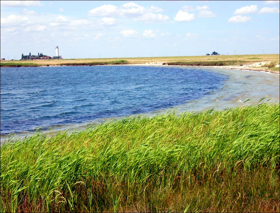
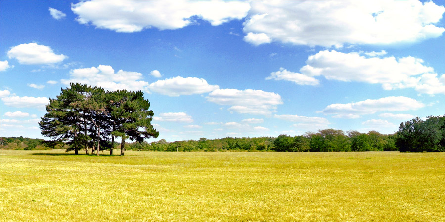
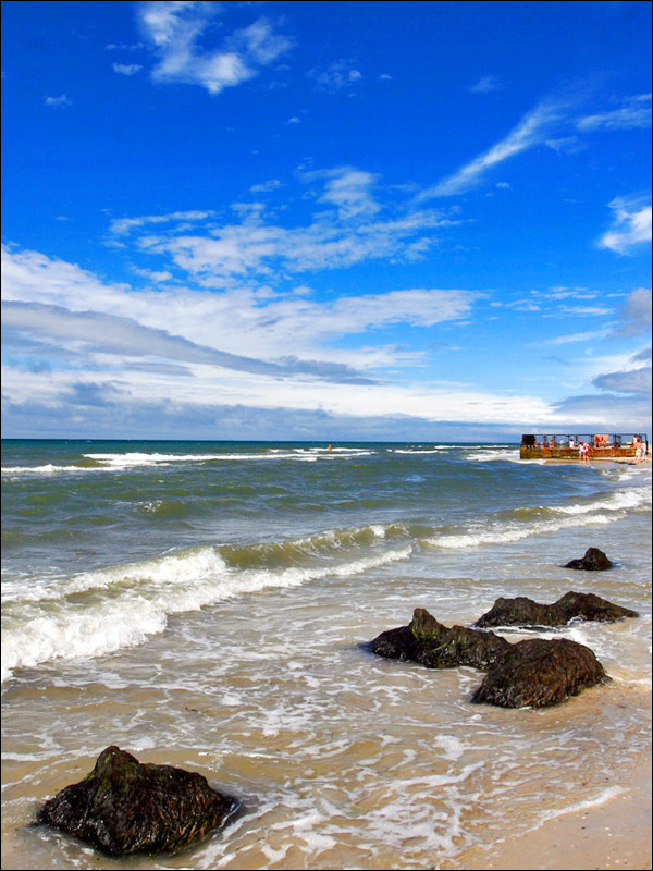
Diverse Landscapes of Kherson Oblast
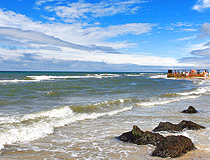
Summer in the Kherson region
Author: Sergey Pavlenko
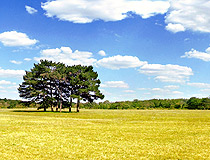
Field in Kherson Oblast
Author: Alexsandr Rudensky
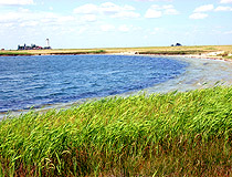
By the sea in the Kherson region
Author: Victor Galanin
Kherson Oblast - Features
The length of the Kherson region from north to south is 180 km, from west to east - 258 km. The Dnieper River divides it into two parts - the right-bank and left-bank. In the south, Kherson Oblast borders on the Autonomous Republic of Crimea, which has been under the control of Russia since 2014.
The main feature of its geographical location is the access to the Azov-Black Sea basin and the Dnieper waterway. This opens up great opportunities for the further development of sea and river transport, the leisure industry.
The climate of the Kherson region is temperate continental, arid. Winters are mostly warm, with little snow, autumns and springs are often dry and sunny, and summers are hot. The average temperature in January is minus 1.7 degrees Celsius, in July - plus 22.9 degrees Celsius.
There are few rivers and lakes in the region. The rivers belong to the Black Sea basin. The main waterway is the Dnieper River. On the shores of the Black and Azov Seas, there are salt lakes. Part of the Kakhovka reservoir is located within Kherson Oblast. The steppes of the Kherson region are almost completely plowed up. Forest vegetation and shrubs are rare (about 7% of the area). There are only small groves.
Kherson Oblast has a significant potential for the development of agricultural production. This is an important region for the cultivation of high-quality winter wheat, corn, rice, and sunflower. This region has significant areas of irrigated land, which allows to grow vegetable and melon crops. Kherson watermelons, tomatoes, and grapes enjoy well-deserved fame throughout Ukraine.
The relative proximity of important markets of the countries of the former USSR and the Middle East allows the Kherson region to export significant volumes of agricultural production.
Kherson Oblast with its rich historical and cultural heritage, favorable geographical location, unique natural recreational resources has great potential and plays an important role in the development of the tourism industry of Ukraine.
First of all, these are significant resort and recreational resources: the length of the sea coast is more than 200 km, deposits of healing mud, unique salt lakes, healing thermal and mineral waters, as well as objects and territories of the nature reserve fund. Of the four biosphere reserves of Ukraine, two are located in Kherson Oblast - the Black Sea Reserve and the Askania-Nova Reserve included in the list of natural protected areas of UNESCO.
Main Attractions of Kherson Oblast
Askania-Nova Biosphere Reserve (1874) - the oldest nature reserve in Ukraine included in the list of the most famous protected areas in the world, one of the 7 natural wonders of Ukraine. The main attraction of Askania-Nova is a preserved area of the pristine steppe. In addition to the steppe, the reserve has a zoo and a dendrological park.
In conditions close to natural, you can see more than 200 species of mammals and birds from all over the world. The steppe is especially beautiful during the flowering of feather grass in late spring. The reserve, located about 150 km southeast of Kherson, is open daily, seven days a week; the excursion season begins on April 1 and ends on November 10.
Oleshky Sands National Natural Park - the largest sand massif in Europe, which is sometimes not quite correctly called the largest European desert. The total area of the park is 2,100 square km, of which 1,000 square km are covered by the world’s largest man-made forests.
This semi-desert was formed in the lower reaches of the Dnieper in the 18th-19th centuries as a result of mass uncontrolled cattle grazing that destroyed vegetation, as well as due to the almost total deforestation. Today, the spread of the desert is stopped with the help of large massifs of pine forests planted around the perimeter. In 2010, a national natural park was created here.
Visiting the territory of this park located about 40 km southeast of Kherson without the notification and accompaniment of representatives of the park is strictly forbidden since its territory borders on a military training ground.
Arabat Spit Recreation Area - the largest sand spit in Ukraine (the length is 115 km, the width ranges from 270 m to 8 km) separating the Gulf of Sivash from the Sea of Azov, part of the Crimean Peninsula. It starts from the port town of Henichesk (about 208 km southeast of Kherson) and is a popular resort area. Today, only about 1/3 of the entire length of the spit can be reached because Crimea is controlled by Russia.
Dzharylhach Island - the largest island of the Black Sea and Ukraine, which is located opposite the port town of Skadovsk (about 100 km south of Kherson). Translated from Turkic, the name means “burnt trees”. Its entire territory, as well as the adjacent water area, are part of the Dzharylhach National Natural Park.
The fauna and flora of this island are so valuable that most species living here are listed in the Red Book. Here you can see deer, mouflon, raccoon dogs, hares, etc. The southern coast is a resort area. In 1902, a 24-meter lighthouse was installed at the extreme eastern tip of the island.
Prince Trubetskoy Winery (1898) in Vesele, about 73 km east of Kherson - an old winery that produces wines using traditional technology. This place combines gastronomic and historical tourism. There are guided tours of the wine cellars (constant temperature +14 degrees Celsius), as well as wine tasting.
Monument to Tachanka (1967) in Kakhovka, about 93 km east of Kherson - a grandiose sculptural composition standing on a high mound in the middle of the field. This monument of Soviet monumentalism was erected in honor of the mobile firing point - a cart with a machine gun, which was widely used during the Civil War, and praised in Soviet literature and art.
Lake Syvash - a bay in the west of the Sea of Azov separating the Crimean peninsula from the mainland. The name is translated from the Crimean Tatar language as “dirt”. This place is also often called the Rotten Sea, because in summer the water is very warm and doesn’t smell nice; it evaporates actively leaving numerous minerals. There are only three similar sites in the world: the Dead Sea, Kara-Bogaz-Gol Lake in Turkmenistan, and the Great Salt Lake in the United States.
Byriuchyi Island - a recreational area of the Azov-Syvash National Natural Park. The main inhabitants of the island are deer brought from Askania-Nova in 1928, as well as steppe antelopes, hares, foxes, raccoon Ussuri dogs, and pheasants. You can get here from the town of Henichesk by motor boat.
Oguz Burial Mound near Nyzhni Sirohozy (about 155 km east of Kherson) - a Scythian mound of the 4th century BC, the largest mound in Ukraine and one of the most important historical monuments discovered in the Kherson region. The artifacts found here are exhibited in the Scythian collections of the Ukrainian Treasures Museum (Lavrska Street, 9, Kyiv) and the Hermitage (Saint Petersburg, Russia).
Green Farms of Tavria - an open-air historical and entertainment complex located south of Kherson on the site of old farms that existed here at the beginning of the 20th century. Here Ukrainian folk traditions and crafts are revived. The complex combines cultural, educational, environmental, and entertainment-game components based on a synthesis of the history of the region, ecology, and contemporary art.
Fishing and Recreation Complex “Dnieper Delta” in Dniprovske. The complex is located in the lower reaches of the Dnieper River, which is ideal for fishing and outdoor activities.


The comments of our visitors