History of Mykolaiv Oblast
The first people and settlements in Mykolaiv Oblast
Despite its advantageous geographical location and relatively mild climate, the territory of the present Mykolaiv region was not been populated by people for a long time. During the Upper Paleolithic (about 40-12 thousand years ago), when in most of the territory of present-day Ukraine there were already small settlements, this region remained one of the few unpopulated.
The first settlements on this territory appeared about 6-5 thousand years ago. The first state entity that controlled the region was Scythia in the 7th-5th centuries BC. In 647-646 BC, people from the ancient Greek city of Miletus founded a colony known as Pontic Olbia or simply Olbia on the territory of the present Mykolaiv region, in the Dnieper and Buh rivers deltas. The city of the same name was its political and economic center.
Olbia became one of the largest economic, commercial, and cultural centers of the Northern Black Sea region. The remains of Olbia are located on the right bank of the Bug estuary near the village of Parutyne. Today, its territory is a national historical and archaeological reserve.
In the 2nd-1st centuries BC, Olbia suffered a deep economic and social crisis. It was constantly threatened by attacks from hostile tribes. In 48 BC, the Getae led by King Burebista captured and destroyed the city. In the 1st century AD, Olbia was rebuilt only on part of its former territory and was dependent on the Scythian kings. In the 2nd century AD, it was ruled by the Roman Empire. In the 3rd century AD, it was destroyed by the Goths. At the beginning of the 4th century, the Hun attacks led to the final destruction of Olbia.
More historical facts…
The nomadic Sarmatian tribes that drove the Scythians from the territory of the Mykolaiv region left behind a large number of burial mounds. For a long time, the Sarmatians waged wars with the Roman Empire, it became one of the main reasons why it could not deeply advance into the territory of present Ukraine.
After the split of the Roman Empire into Western and Eastern, the Byzantine period began in the history of the Northern Black Sea region. In the middle of the 3rd century AD, the Goth tribes invaded this territory. They drove out the Sarmatians and conquered Crimea.
Some historians believe that the Goths were also involved in the formation of the Chernyakhov culture of early Slavic tribes - one of the most interesting phenomena in preliterate history of this region. The decline of Chernyakhov culture was observed during the invasion of the Huns, who soon created a powerful state between the Don and the Carpathians, led by Attila.
Mykolaiv Oblast in the Middle Ages
At the end of the 5th century AD, after the collapse of the Hunnic union, the activity of Slavic tribes intensified. In the 9th century, the Hungarians migrated to the Northern Black Sea region. In 895, the Hungarians were defeated by the Bulgarians in the battle on the Southern Bug River and were forced to leave the Northern Black Sea region and migrate to the area of present Hungary.
This territory didn’t have strategic significance for Kievan Rus. Much of the region was gradually settled by nomadic tribes of the Cumans during the 12th century. Due to the lack of a sedentary population and large towns, it almost didn’t feel the Mongol invasion, there were no significant battles on its territory, compared to Russian lands. The Cumans, who had similar faith with the Mongols, entered the Mongol Empire relatively bloodlessly.
In 1449, the Crimean Khanate separated from the Golden Horde (the former north-western part of the Mongol Empire) and Islam established itself as the main religion in this territory. In 1475, the Crimean Khanate fell into vassal dependence on the Ottoman Empire. The period of the reign of the Ottomans, like previous periods, didn’t bring significant changes in the life of this region.
In the 17th century, while the southern part of the Mykolaiv region continued to remain under the control of the Crimean Khanate, its northern part passed under the control of the proto-state of the Cossacks known as the Zaporizhzhya Sich. At this time, Russian migrants began to settle on these territories, depopulated from the time of the Mongolian invasion and known as the Wild Fields.
Mykolaiv Oblast in the Russian Empire
The territory between the Southern Bug and the Dnieper became part of the Russian Empire after the Russo-Turkish war of 1768-1774, and the territory west of the Southern Bug - after the Russo-Turkish War of 1787-1792. The Mykolaiv region became part of Novorossiya (New Russia) Governorate.
Since the end of the 18th century, migrants from Central Europe began to arrive here, mainly from the German states. The Russian government took care of all the costs of resettlement. From 1809 to 1833, the German colonies of Rastadt (present Porichchya), Rohrbach (Novosvitlivka), Katerinental (Katerynivka), Landau (Shyrokolanivka), Waterloo (Stavky) appeared in the western part of the region.
Finally, a rapid population growth began. In 1788, the construction of the shipyard and the settlement of Nikolaev (Mykolaiv in Ukrainian) began on the Ingul River, which from the first years of its existence became a major center for military shipbuilding. Nikolaev became a town in 1790. It is believed that this name was given to the town in memory of the capture by Russian troops of the Turkish fortress of Ochakov in December 1788 - on the day of memory of St. Nicholas of Myra.
Intensive settlement of the territory of the region, especially west of the Southern Bug, continued in the first half of the 19th century. After the abolition of serfdom (1861) and the construction of railways, local industry began to develop at an accelerated pace. It specialized in mechanical engineering (shipbuilding) and metal processing (iron foundries).
In 1862, a commercial port was opened in Nikolaev. In 1893, an elevator was built in the port. After that the role of the Nikolaev region in the foreign trade of the Russian Empire increased.
Mykolaiv Oblast in the 20th century and beyond
In 1918-1920, the territory of the present Mykolaiv region became the scene of the Russian Civil War battles. At the end of the war, it became part of the Ukrainian Soviet Socialist Republic (Soviet Ukraine). In 1922, this region became part of the Odessa province and then Odessa Oblast. September 22, 1937, a separate Nikolaev Oblast was allocated from Odessa Oblast.
During the Second World War, the region was occupied by German and Romanian troops from August 1941 to March 1944. During this time, 30,699 prisoners of war and 74,662 civilians were killed on its territory, and 25,884 people were moved to Germany for forced labor.
In the postwar period, Nikolaev became one of the centers of shipbuilding in the USSR. In 1978, the only shipbuilding and fleet museum in Ukraine was opened in Nikolaev.
On December 1, 1991, residents of Nikolaev Oblast at an all-Ukrainian referendum confirmed the Declaration of Independence of Ukraine with a result of 89.45%.
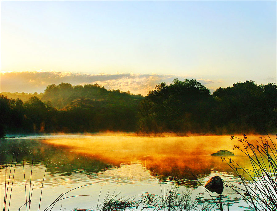
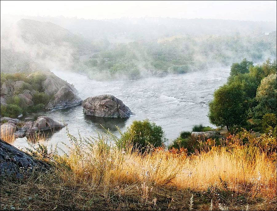
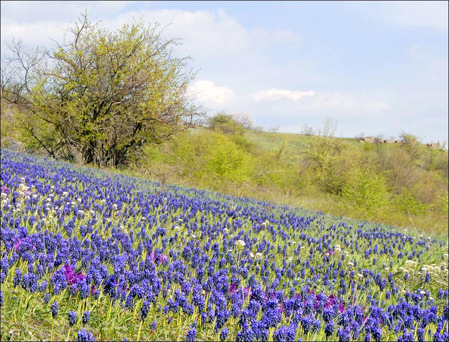
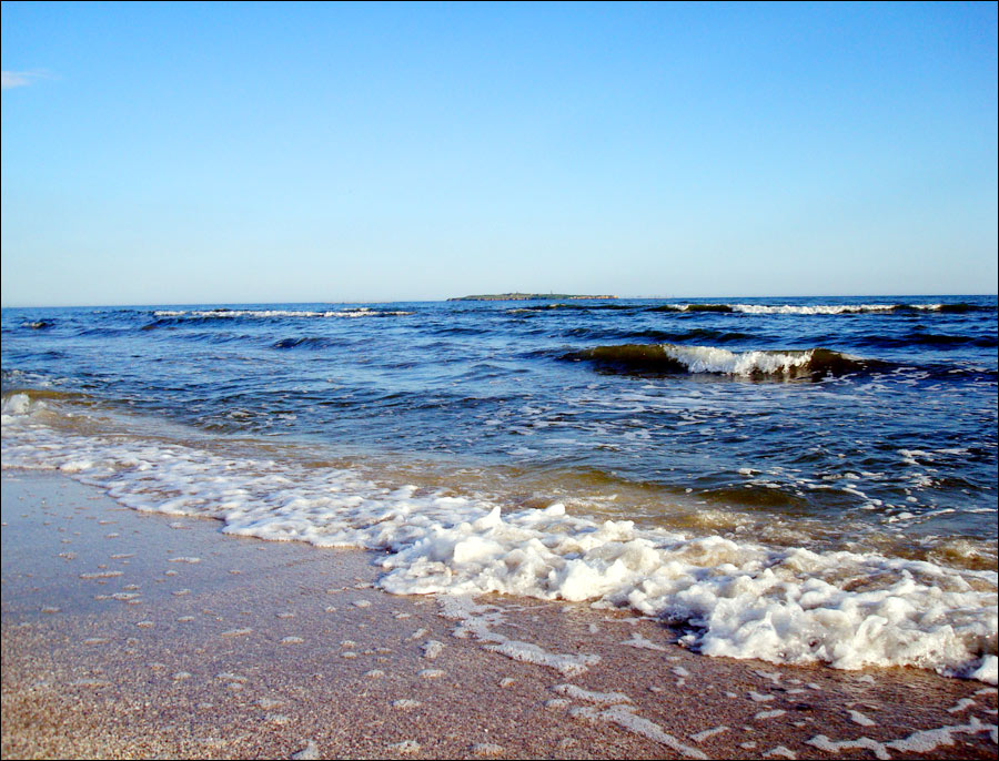
Beautiful nature of Mykolaiv Oblast
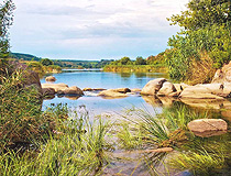
Rocky river bank in Mykolaiv Oblast
Author: Alexander Batursky

Summer in the Mykolaiv Region
Author: Alexander Batursky

Picturesque river scenery in Mykolaiv Oblast
Author: Alexander Batursky
Mykolaiv Oblast - Features
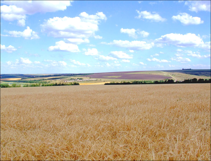
The territory of Mykolaiv Oblast is a plain, which gradually falls from north to south to the Black Sea. The region stretches from north to south for 194 km, from west to east - for 204 km. The north-western part lies in the area of forest-steppes, the south-eastern part - in the steppes. Almost the entire territory of the region is plowed. The area of forests and shrubs is only about 2%.
The main rivers are the Southern Bug, which crosses the western part of the region from the northwest to the southeast, the Inhul (the left tributary of the Southern Bug), and the Inhulets (the right tributary of the Dnieper).
The Mykolaiv region is relatively poor in mineral resources. There are reserves of building materials (granite, limestone, marl, kaolin, gypsum, quartz sand, clay), as well as deposits of graphite, brown coal, peat. There are sources of mineral waters, therapeutic mud.
The climate is temperate continental. Summers are hot and windy. The average temperature in July is about plus 22 degrees Celsius. Winters are not snowy, relatively warm. The average temperature in January is about minus 3 degrees Celsius.
Mykolaiv Oblast is among the most developed industrial regions of Ukraine. The South Ukraine Nuclear Power Station located in the city of Yuzhnoukrainsk produces almost all of the electricity in the region.
Three shipbuilding enterprises produce tankers, bulk carriers, container ships, refrigerators, trawlers, and boats. Non-ferrous metallurgy is represented by one of the largest non-ferrous industry enterprises in Europe - Mykolaiv Alumina Refinery.
The total area of agricultural land is about 20,000 square km, about 17,000 square km of which are arable land (about 5.0% of Ukraine’s arable land). Winter wheat, spring barley, corn, sunflower, sugar beets, vegetable and melon crops are grown here. Horticulture and viticulture are also developed. On average, this region annually produces up to 2 million tons of grain, more than 230 thousand tons of sunflower, up to 200 thousand tons of sugar beets, more than 200 thousand tons of vegetables.
Three sea ports, one river port, three large terminals make up a single Bug-Dnieper sea transport hub on the northern Black Sea coast. Navigation in the ports lasts a whole year.
Main Attractions of the Mykolaiv Region
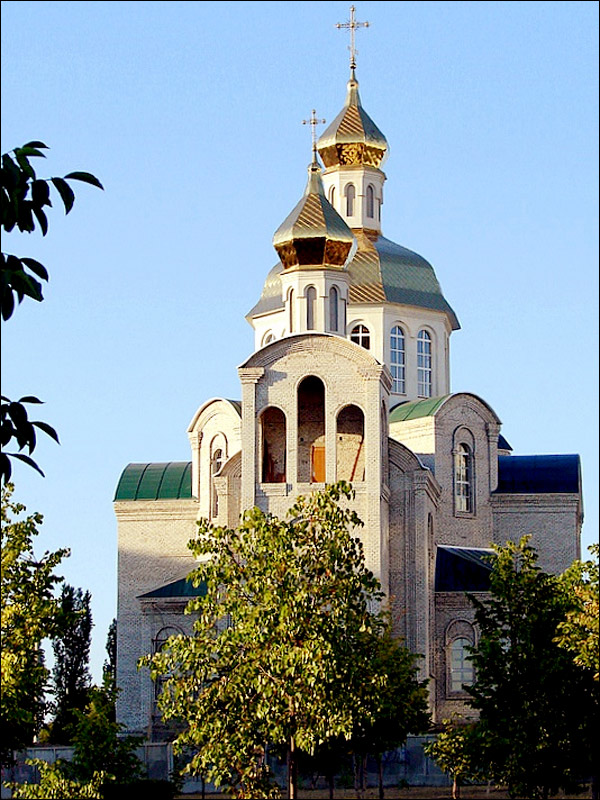
A large number of attractions of Mykolaiv Oblast, including the unique Museum of Shipbuilding and Fleet, are located in the capital of the region - the city of Mykolaiv. And here are the most interesting places located in other parts of the region.
Myhiya Rapids on the Southern Bug River near Myhiya, about 157 km northwest of Mykolaiv - the most famous part of the Buzk’s Gard National Nature Park and the Granite-Steppe Lands of Bug Regional Landscape Park. This is a narrow rocky canyon on the Southern Bug River, which is especially popular among lovers of extreme water sports (rafting, slalom).
Skarzhinsky Water Mill (1888) in Myhiya. This picturesque five-story building resembles a small medieval castle. In Soviet times, the mill was converted into a hydroelectric power station. Not far from it there is an observation deck.
Trykraty Forest near Trykraty, about 108 km northwest of Mykolaiv - an artificial forest created in the 1870s. Today, it is a large forest-park with a beautiful lake, a lot of paths and bridges thrown over the river branches and artificial canals. That’s why this place is also known as the Labyrinth. This forest has about 350 old oaks, which have already celebrated their 120th anniversary, and some of them are up to 500 years old. There are special areas for recreation and picnics.
Aktove Canyon near Aktove, about 113 km northwest of Mykolaiv. It is also known as Devil’s Valley or Small Crimea. This canyon with a depth of 40-50 meters is a unique complex of forest and water ecosystems with an ensemble of rocks and granite boulders. It is the only canyon in Europe, which in its geological and landscape features resembles the famous canyons of North America. The rugged terrain doesn’t allow rafting on the river, but attracts lovers of extreme and climbers.
Olbia National Historical and Cultural Reserve near Parutyne, about 42 km south of Mykolaiv. The ruins of the ancient Greek city of Olbia are located on the southern outskirts of the village of Parutyne, on the bank of the Bug estuary. Pontic Olbia was one of the four largest antique policies in the Northern Black Sea region, which lasted a millennium - from the 6th century BC until the 4th century AD.
In addition to the ancient ruins, there is also a museum open in the premises of the old lighthouse, where the finds made during excavations are presented. You can also visit an antique crypt dungeon, as well as a lapidarium with old tombstones and antique architectural fragments.
Berezan Island near Rybakivka and Ochakiv, about 80 km southwest of Mykolaiv. A small 1 km long uninhabited island of Berezan is located opposite the mouth of the Southern Bug River in the Black Sea, near the town of Ochakiv.
This place is interesting for its history, which dates back to antiquity. Then it was a peninsula on which from the end of the 7th century BC, the ancient Greek settlement of Borisfen was located. You can go around the whole island in 2 hours. You can get there by boat from Rybakivka resort, the trip takes about half an hour. Guided tours are organized in Ochakiv.
Kinburn Spit opposite Ochakiv - the western tip of the peninsula that separates the Dnieper estuary from the Black Sea. The length is about 40 km, the width - 8-10 km. It is one of the most favorite vacation spots for residents of the southern regions of Ukraine. The main feature of this peninsula is that on one side it is washed by the fresh waters of the Dnieper River and on the other - by the salty waters of the Black Sea.
A lot of myths and legends are associated with this place: about the temple of Demeter, the sacred grove of Hekate, Scythian gold, and athletic games in honor of the victory of Achilles in the naval battle, after which the Greeks named it Achilles Run. In the 15th-18th centuries, the Turkish fortress of Kinburn stood here.
About 60 species of animals listed in the Red Book of Ukraine inhabit this territory, 240 species of birds nest here (swans, pink pelicans, geese, pheasants, herons, white-tailed eagles, etc.). It attracts tourists with empty and clean beaches.
Savannah Ostrich Farm in Stavky, about 113 km northwest of Mykolaiv - one of the largest ostrich farms in the south of Ukraine. The activities of the farm also include green tourism, the production of ostrich leather products, other souvenirs.