History of Kharkiv Oblast
Early History of the Kharkiv Region
The territory of the present Kharkiv region began to be populated already in the Late Paleolithic era (about 30-40 thousand years ago). In the 10th-12th centuries, a significant part of this territory was under the rule of the Khazar Khaganate. In the 960s, Sviatoslav I Igorevich, a Grand Prince of Kiev, inflicted a number of defeats on it. This moment is considered the end of an independent Khazar state.
On the site of an old settlement, the Slavic town of Donets was laid, which soon became one of the most important outposts of Kievan Rus in the fight against nomads, as well as a center for crafts and trade. Like many other settlements, Donets was destroyed during the Mongol invasion in the middle of the 13th century.
After the devastating raids of the Mongols, the vast territory of the Seversky Donets River basin was uninhabited for a long time and became known as “The Wild Fields”. In the late 15th and early 16th centuries, people began to return here: hunters, fishermen, migrants, who, for various reasons, were forced to seek refuge and a new place of residence.
But settling here was still dangerous since these lands became a kind of springboard from where nomads of the southern steppes and Crimea raided. As a rule, attacks were carried out along the old steppe roads leading from the Black Sea and the Sea of Azov to the north. The most important of these roads was the Muravsky Road, which originated from Perekop (the Crimean peninsula), ran near Kharkiv and reached Tula.
More historical facts…
Sloboda Ukraine
The Tsardom of Russia, trying to protect its southern borders from devastating raids, encouraged the settlement of these lands, providing migrants with benefits and tax exemptions. By order of the Moscow Tsar Boris Godunov, the fortress of Tsareborisov (present Oskil in Izium District) was founded in 1600. In 1635-1658, a system of Russian fortifications (the Belgorod line), was built on the lands of the region. In 1680, a new defensive line with a length of over 500 km was built - the Izyum line.
The revival of the region was associated with the national liberation war of the Ukrainian people of 1648-1654. It is traditionally believed that the founders of Kharkiv (1654) and many other settlements were Ukrainian Cossacks and peasants, who gradually settled in these lands, which were only nominally part of Russia. The newly formed settlements began to be called “sloboda” (meaning “free”), and the whole region, starting from the 17th century, - Sloboda Ukraine.
Thus, two migration flows - Ukrainian migrants from the west and Russians from the north - formed here a unique historical-geographical area. In the middle of the 17th century, to protect this territory from the raids of the Crimean Tatars, Kharkiv, Izyum, Akhtyrska, Sumy, and Ostrogozhsk Cossack regiments were created. Kharkiv quickly became a military-administrative, and later - trade, craft and economic center of the entire region.
The flow of migrants did not decrease in the subsequent 1660-1680s. The oldest stone building in Sloboda Ukraine, the five-domed Transfiguration Cathedral (1684) built in the Ukrainian Baroque style, has been preserved in Izyum. Horticulture, winemaking, sericulture, and trade developed simultaneously with agriculture and cattle breeding. Fairs were held in large towns and settlements.
Kharkiv Province of the Russian Empire
In the 18th century, significant changes took place in the public life of the region. In 1765, Cossack self-government was abolished. In 1781, Empress Catherine II granted Kharkiv Province a new coat of arms depicting a cornucopia and a rod of Mercury, which symbolized the prosperity of this region and active local trade. This was the official emblem of the Kharkiv region until 1917. Today, it is the coat of arms of Kharkiv Oblast.
The Kharkiv region became a major center of crafts and trade in the south of the Russian Empire. To a large extent this was facilitated by its geographical position at the crossroads of routes from Moscow, St. Petersburg, Kiev to the Crimea and the Caucasus. In the middle of the 19th century, the trade turnover of Kharkiv fairs amounted to almost 50% of the trade turnover of all fairs in Ukraine.
In 1805, at the initiative of the scientist and public figure V.N. Karazin, Kharkiv University was established. Since the mid-19th century, the development of industry was taking place at a fast pace in the Kharkiv province. In the 1880s, metalworking and machine-building industries began to develop in the region, especially in Kharkiv.
In the 19th century, important railways from the industrial center to the southern coal and metallurgical centers, grain areas and seaports were laid through the Kharkiv province. In the early 20th century, Kharkiv had a railway connection with almost all regions and major cities of the Russian Empire.
The population of the Kharkiv region significantly increased. In the early 1860s, a little more than 1.5 million people lived in the territory of the Kharkiv province. In 1897, it was already 2.5 million, and by 1917 - about 3.5 million. In the late 19th and early 20th centuries, the development of local industry took place with the active participation of foreign capital.
Kharkiv Oblast of Soviet Ukraine
During the Civil War, in 1918-1919, power in the territory of the Kharkiv region changed several times. The formation of the USSR radically changed the life of Kharkiv - from a large industrial, but provincial town, it turned into the capital of Ukraine (from 1919 to 1934).
The second half of the 1920-1930s was a period of rapid industrialization of the Kharkiv region, which became one of the most developed regions of Ukraine. In the years of the first five-year plans, enterprises were built that became the basis of the industrial potential of not only the Kharkiv region, but also the whole Ukraine and USSR: a tractor plant (one of the largest in the world), a turbogenerator, machine tool, and aircraft factories.
At the same time, collectivization of agriculture by violent methods, dispossession, eviction of the best farmers, the famine of the early 1930s, which led to the destruction of the traditional village life, as well as industrialization, which required a large number of workers, changed the social structure of the towns and villages of the Kharkiv region.
Kharkiv Oblast was formed on February 27, 1932. In 1937, Poltava Oblast was separated from it, and in 1939 - Sumy Oblast. Kharkiv was then the second largest city in Ukraine and the fourth in the USSR, the largest transport hub in Eastern Europe, one of the leading scientific and cultural centers.
The period of the Second World War was the most tragic in the history of Kharkiv Oblast. The German occupation of the region lasted from September 20, 1941 to September 20, 1943. Hundreds of thousands of people were forcibly moved to work in Germany. More than 500,000 soldiers of the Soviet Army and civilians were killed in numerous battles. Kharkiv was one of the most destroyed cities in Europe. Restoration work began immediately in the fall of 1943.
The primary task was to raise from the ruins the most important objects of industry, transport, power plants. Along with the restoration of factories destroyed during the war, new ones were built (bearing plant, food, construction and light industry enterprises). Enterprises, as a rule, were rebuilt on a new technological base. In the early 1950s, new equipment and technologies were especially intensively introduced at engineering enterprises.
In 1956, the Shebelinsky gas field, which was then the largest gas field in the European part of the USSR, was commissioned. Gas pipelines from Shebelinka were laid to Kharkiv, Kiev, Dnepropetrovsk, Zaporozhye, and other cities. Kharkiv Oblast became one of the centers for the production of sophisticated equipment, instruments for the space industry.
In August 1975, the first section of the Kharkiv Metro was opened. In the 1970s and 1980s, industry growth slowed. These years in the history of the USSR became known as a period of “zastoy” (“stagnation”). Although, at that time, people of Kharkiv Oblast made an important contribution to the study of superconductivity, the creation of superpower turbines and artificial diamonds. But still, the region, like the whole USSR, was gradually entering a period of crisis.
In 1985, a reform policy began to be pursued in the USSR (“perestroika”). The democratization process ultimately led to the collapse of the Soviet Union and the proclamation of an independent Ukrainian state - Ukraine.
A large-scale privatization of all aspects of life, primarily the economy, began, which led to significant changes not only in the structure of industry and agriculture, but also in demographic processes, etc. The reform of the economy resulted in the privatization of state enterprises, the creation of a market economy infrastructure.
Today, Kharkiv Oblast is one of the largest and most developed industrial regions of Ukraine, a leading center of science, education, culture.
Scenic views of Kharkiv Oblast
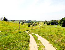
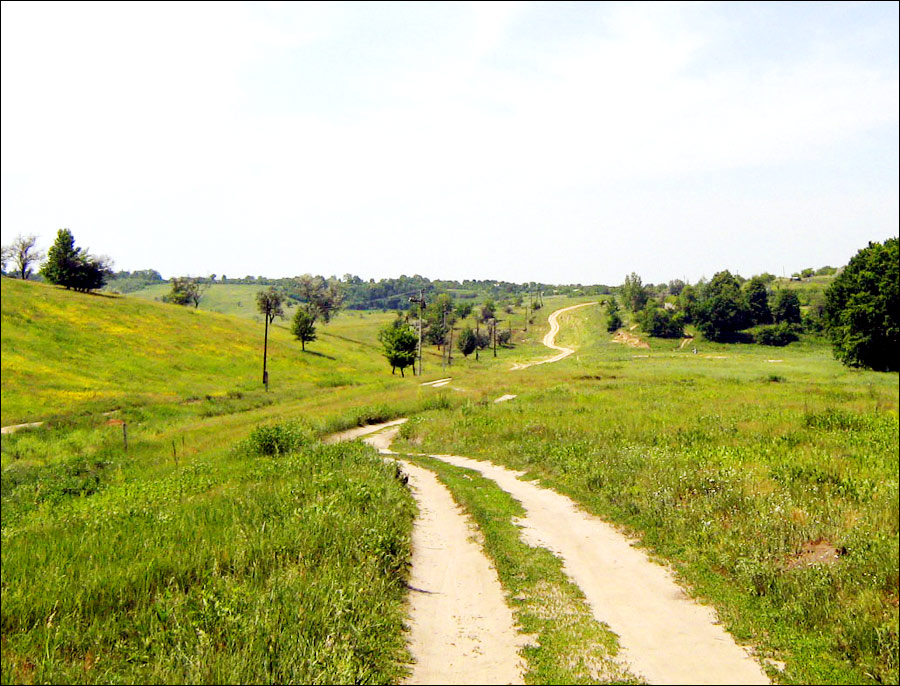
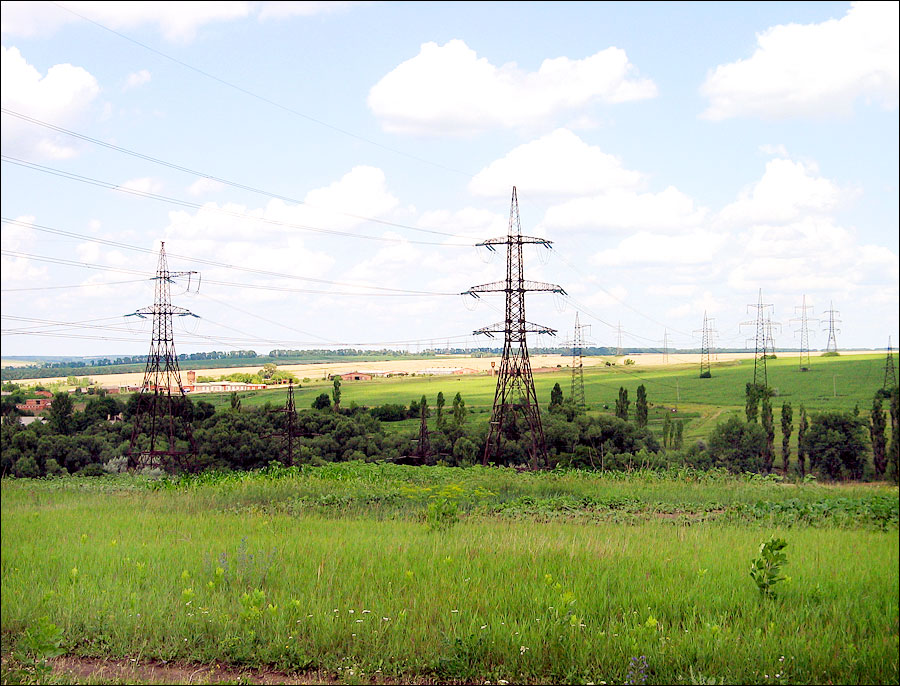
Hilly terrain of the Kharkiv region
Author: Bondarev Pavel
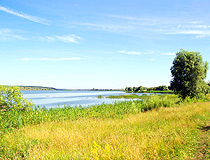
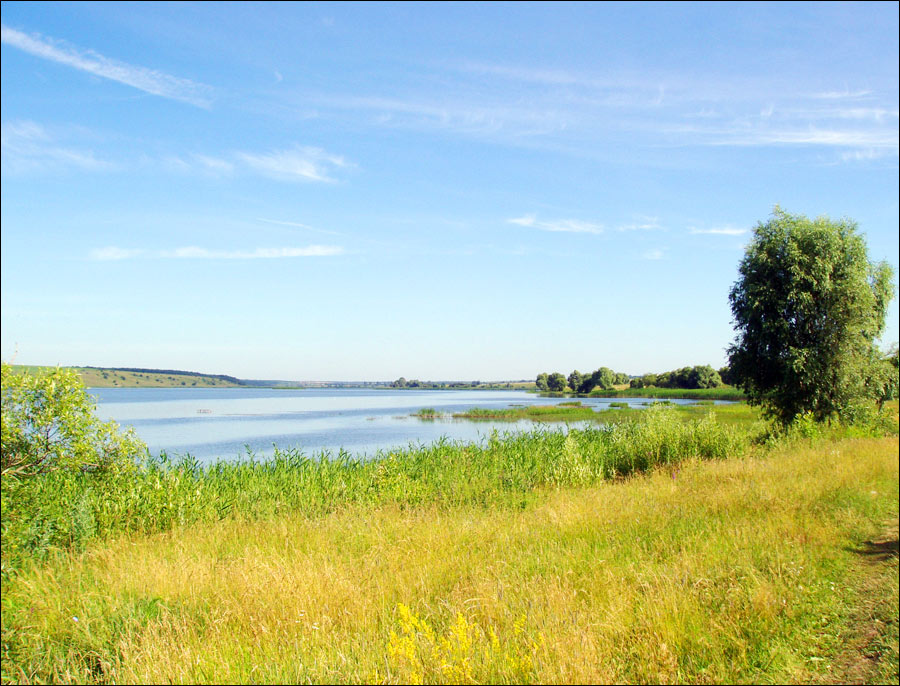
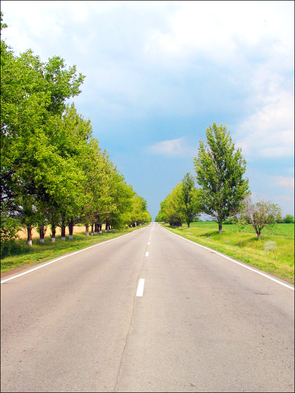
By the river in Kharkiv Oblast
Author: Alexander Golovko
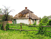
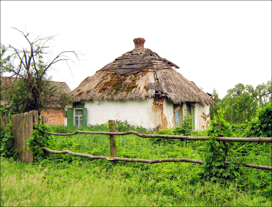
Old hut in the Kharkiv region
Author: Bondarev Pavel
Kharkiv Oblast - Features
Kharkiv Oblast is located in the north-east of Ukraine on the border of the forest-steppe and steppe geographical zones and occupies the south-western outskirts of the Central Russian Upland. The length of the region from north to south is 210 km, from east to west - 220 km. The climate is temperate continental. The average temperature in January is minus 7 degrees Celsius, in July - plus 21 degrees Celsius.
About 75% of local water resources are in the basin of the Don River. The main waterway - the Seversky Donets River (the Siverskyi Donets or simply the Donets) - is the right tributary of the Don. The banks of the Donets are very picturesque. The basin of this river is an important recreational and tourist area of the Kharkiv region.
Forests and bushes occupy only about 11% of the territory of Kharkiv Oblast (mainly in riverbeds on the high right banks). The steppe occupies most of the region and is completely plowed up (wheat, corn, sunflower, sugar beets, etc.).
Fertile black soil (chernozem) of the Kharkiv region was formed, in particular, in the 13th-18th centuries when this territory was depopulated because of to the invasion of the Mongols and was known as “The Wild Fields”. For every 100 years being unplowed, an average of 25 cm of fertile soil was formed.
Kharkiv Oblast is one of the most urbanized in Ukraine. It has a high level of economic development. This is due to both a favorable economic and geographical location (the proximity of the coal and metallurgical deposits of the Donbass and Dnieper regions stimulated the development of mechanical engineering and metalworking, the proximity of developed regions of Russia determined the development of agricultural enterprises), as well as fairly rich deposits of own raw materials (especially natural gas).
Enterprises for the production of power equipment, agricultural machinery, aircraft, fuel and energy complex, chemical, pharmaceutical, food, and light industries are the basis of the industrial potential of this region.
The Kharkiv region has an extensive transport network. Kharkiv railway junction serves about 10 million passengers a year. Several important highways pass through this region of Ukraine: Kharkiv - Moscow, Kharkiv - Simferopol, Kharkiv - Rostov-on-Don, Kharkiv - Kyiv.
Main Attractions of the Kharkiv Region
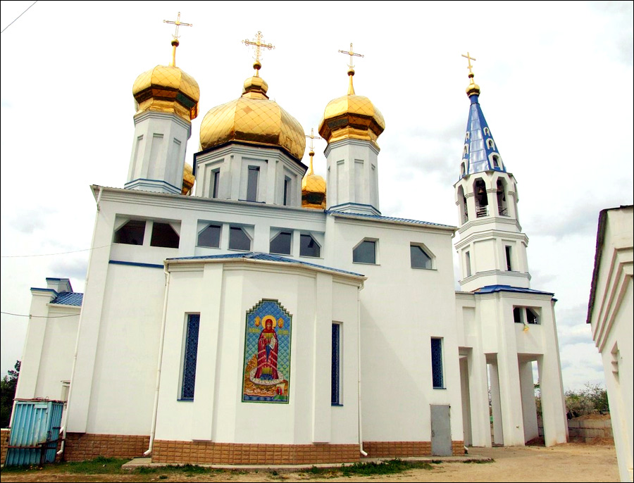
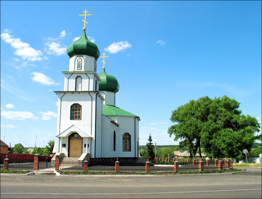
On the territory of Kharkiv Oblast there are more than 700 monuments of urban planning and architecture, of which more than 500 are located in the city of Kharkiv. 75 monuments are of national importance. Let’s look at the most interesting sights located outside the capital of the region.
Nataliyivskyy Park in Volodymyrivka - a masterpiece of landscape gardening of the 19th century, the former estate of the industrialist and philanthropist I. Kharitonenko, who named it in honor of his youngest granddaughter Natalia.
The main attraction of the park is the Transfiguration Church (1913) built by the architect A. Schusev, who also designed the Lenin Mausoleum and the Kazan Railway Station in Moscow. The church was constructed in the style of old Pskov-Novgorod Orthodox architecture and is one of the most unusual churches in Ukraine.
Singing Terraces in Horodnje - an unusual fruit garden in the form of a huge amphitheater located about 10 km from the Nataliyivskyy Park. It belonged to the same owner as the estate. He wanted to have his own garden with unique plants. Since the soil and climate did not allow this to be done, special terraces were designed. This amphitheater garden has another feature - unique acoustics.
Parkhomivka Art Museum - one of the best rural museums in Ukraine, which has a unique collection of art (about three thousand exhibits - unique paintings, drawings, sculptures, arts and crafts, valuable materials of archeology and ethnography).
The museum exposition is housed in 12 halls and includes the departments of icon painting, Russian art of the 18th-20th centuries, contemporary Russian art, foreign art, decorative and applied art, archeology and the history of the Kharkiv region. Parkhomivka, Kontorska Street, 2.
Literary and Memorial Museum of Hryhorii Skovoroda - a famous philosopher, poet and teacher of Cossack origin (1722-1794). The museum exhibits publications of his works, books of ancient, medieval and other philosophers and poets, ethnographic objects, paintings and graphic works related to him, some personal belongings.
The adjacent old park is also of historical importance, it has not changed much since the time of Skovoroda. The portrait of Hryhorii Skovoroda is depicted on a banknote of 500 hryvnias of present Ukraine. Skovorodynivka village.
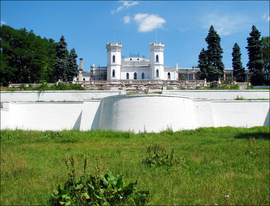
Koenig Palace in Sharivka (Sharivka Castle, 1831-1911) - one of the most magnificent palace and park complexes of Sloboda Ukraine, a cultural monument of national importance. Two stylized defense towers give the building a resemblance to a medieval castle.
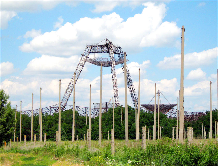
Ionospheric Observatory in Zmiiv - a scientific object recognized as a national treasure of Ukraine. The main sights of the complex are two picturesque radar complexes (30 and 100 meters in diameter), which are currently not used for their intended purpose and only attract tourists.
Mount Kremyanets in Izyum - a geological monument of nature, the highest point of Kharkiv Oblast (218 meters above sea level). On the slope of the mountain, you can see old stone statues of the mid-12th century. There are also monuments dedicated to the Civil War and World War II.
Feldman Ecopark in Lisne - a regional landscape park, which is a good place for families with a variety of entertainment and a zoo.
Flooded Quarry in Novoselivka - one of the most picturesque places in the Kharkiv region. This sandy quartz quarry is an incredibly beautiful natural object created by human hands.
Arboretum in Krasnokutsk - one of the oldest arboretums in Ukraine, with a history of more than 200 years, a monument of landscape gardening art of national importance with more than 300 species of rare plants.
Chalk Mountains of Dvorichansky National Park. This park, located in the northeastern part of the Kharkiv region in the Dvorichna District, was created to preserve unique natural chalk complexes located along the right bank of the Oskil River. The most interesting part of them is located between the villages of Novomlynsk and Kamyanka. Here you can find ledges, rocks and cliffs of bizarre shapes.