History of Poltava Oblast
Early History of Poltava Oblast
People began to settle in the territory of the present Poltava region in the Late Paleolithic era (about 13-37 thousand years ago). About 5-6 thousand years ago, this territory was relatively densely populated. This is evidenced by the remains of more than 30 settlements of that time.
About 50 monuments of the Scythian-Sarmatian time were discovered in this region dating back to the 7th-6th and 5th-3rd centuries BC. At the beginning of our era, early East Slavic tribes began to settle in this territory.
In the 8th-9th centuries, mainly the tribes of the Severians lived in the territory of the Poltava region. During the time of Kievan Rus, it was part of the Pereyaslav land, which later became a principality. By order of Prince Vladimir Svyatoslavovich (980-1015), construction of a number of fortified settlements began here.
In the old Russian chronicles of the 11th-13th centuries, the following towns were mentioned in the territory of the present Poltava region: Khorol (1084), Govtva (1095), Goroshin (1096), Ksnyatin (1069), Lubny (1107), Pesochin (1092), Piryatin (1155) , Lukomie (1179), Lokhvitsa (1320). Poltava was first mentioned under the name Ltava in 1173.
More historical facts…
This region was part of the southern border of Kievan Rus, which protected it from the Pechenegs, and then from Polovtsy, as well as other nomadic tribes. From the middle of the 11th century, the territory of present Poltava Oblast was the site of an ongoing struggle against nomads.
In the middle of the 13th century, the economic and cultural development of this region was interrupted by the Mongol invasion. A lot of fortified settlements were destroyed including Ltava (Poltava). For a long time after this, no mention of this settlement is found in historical documents.
Poltava Region in the 14th-19th centuries
During the 14th-16th centuries, the territory of the Poltava region was under the rule of the Grand Duchy of Lithuania. After the Union of Lublin of 1569, this land came under Polish control. On the map of the second half of the 16th century, there were more than 300 settlements within the limits of the present Poltava region.
The Khmelnytsky Uprising (the Cossack-Polish War) of 1648-1654 seriously affected the further colonization of this region. The successes and failures of the Cossack war, the repression after defeats led to population migration from the Right-Bank to the Left-Bank Ukraine, in particular to the Poltava region.
The battles of the Russian-Polish war of 1654-1667, in which the local population took part, ended with the Truce of Andrusovo of 1667, according to which the Left-Bank Ukraine remained in the Tsardom of Russia. Despite the destruction and devastation caused by the war, the second half of the 17th century, became a period of rapid development of agriculture, crafts, and industry.
During the Great Northern War of 1700-1721, the territory of this region became an arena of battles between Sweden and Russia. In 1709, the historic Poltava battle took place here.
In 1802, the Poltava Governorate was created with a population of about 1.3 million people. By 1859, the population of the province grew to 1.7 million. The bulk of the population were peasants and Cossacks, who were mainly engaged in agriculture and cattle breeding.
By the middle of the 19th century, its own style of home icon painting was formed here. A large collection of Poltava icons is exhibited in the Museum of the Ukrainian home icons of the historical and cultural complex “Radomysl Castle” in Radomyshl, Zhytomyr Oblast.
The economic development of the Poltava Governorate was greatly facilitated by the construction of railways. In 1869, one of the largest towns in the province - Kremenchug - was connected to Odessa. In 1870, the Kharkov-Poltava-Kremenchug Railway connected the eastern and southeastern parts of the Poltava region with the central industrial region of the Russian Empire. Industrial growth contributed to a more intensive development of agriculture.
According to the All-Russian census of 1897, the population of the Poltava Governorate was 2,778,151 people (urban population - 274,294). In 1900, there were 77.5 thousand artisans in the local villages. By the number of artisans, this province occupied one of the first places in the Russian Empire.
Poltava Oblast in the 20th century
The First World War and the ensuing Civil War in the territory of the former Russian Empire greatly influenced the economy of the region. In 1920, the local industry produced only 13.8% of the pre-war output. Gross grain harvest was halved, and the cultivation of industrial crops, in particular sugar beets, came to naught. The number of horses decreased by 38%, cattle - by 29%.
On September 22, 1937, Poltava Oblast was created. According to the All-Union Census of 1939, there were 2,263,159 people living in this region. New industries were developed in the region, especially machine-building and light industries. Local agriculture specialized in growing crops, mainly wheat, as well as sugar beets and sunflowers.
On September 18, 1941, during the Second World War, German troops captured Poltava, and by October 13 they occupied the entire region. During the two years of occupation, 355 settlements were destroyed, more than 200 thousand people were killed, more than 156 thousand people were moved for forced labor to Germany.
Almost all of the working and productive livestock, tractors and agricultural machinery were destroyed or transported to Germany. The number of horses in the Poltava region decreased by 4 times, cattle - by 8 times, pigs - by 20 times, and sheep and goats - by 50 times.
As of 1950, industrial production in the Poltava region reached 82% of the pre-war level. In the 1950s, large oil and natural gas fields were discovered in the region. The current borders of the Poltava region were established in 1954.
In the 1980s, the oil and natural gas production, oil refining, chemical, mining, automotive, electrical, and textile industries developed rapidly. According to the All-Union Census of 1989, the population Poltava Oblast was 1,753,030 people, including men - 789,285, women - 963,745.
Poltava Oblast of independent Ukraine is an industrial and agricultural region specializing in oil and natural gas production, iron ore, oil refining, production of trucks and railway cars.
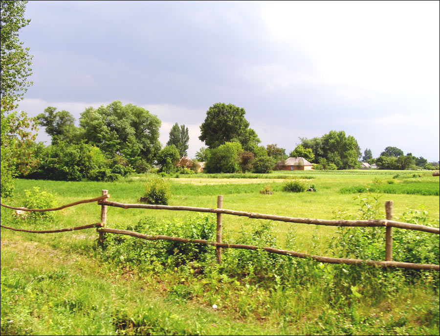
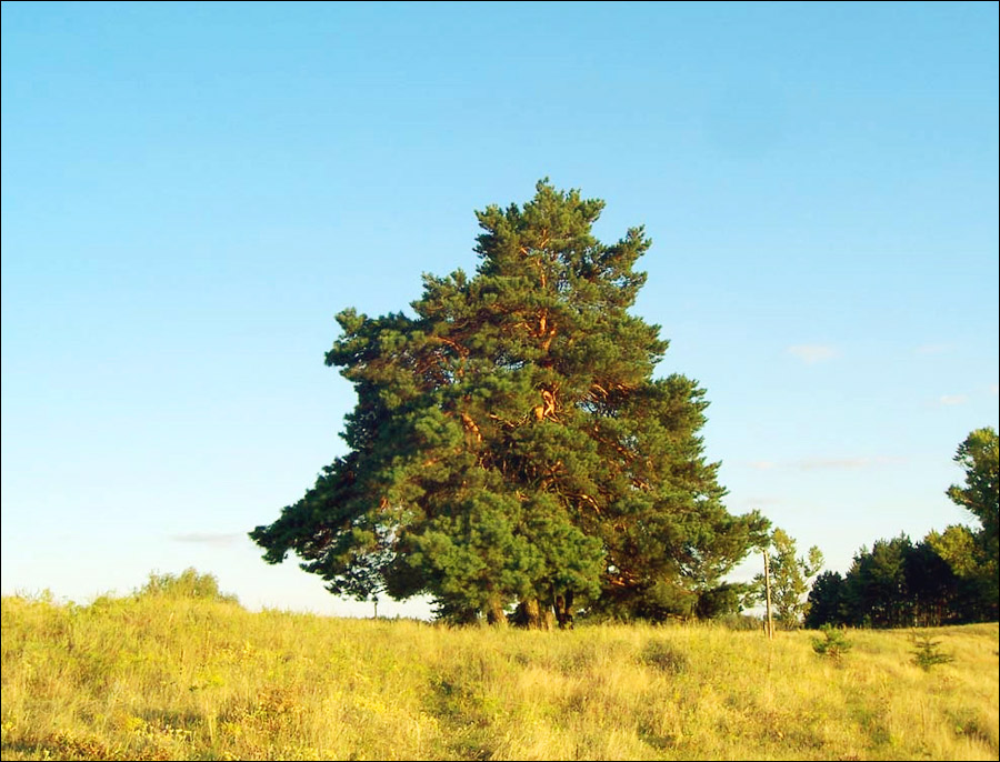
Beautiful landscapes of Poltava Oblast
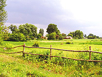
Summer in the village in the Poltava region
Author: Serg Schevchenko
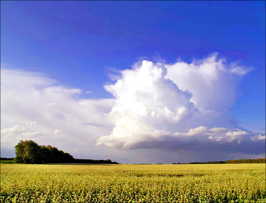
Sunny day in Poltava Oblast
Author: Vladymyr Bysov
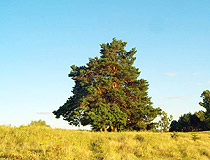
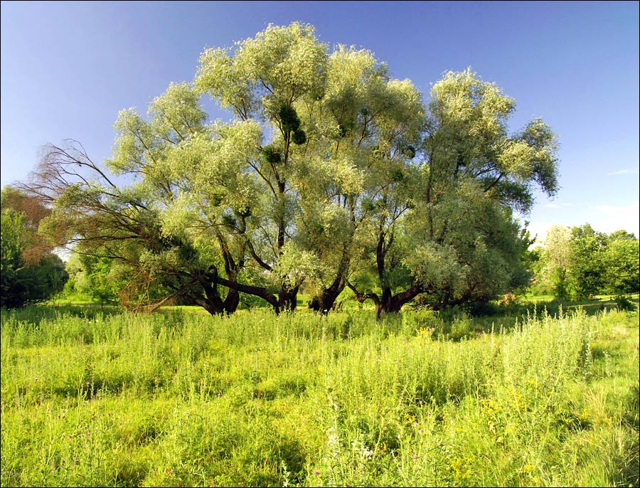
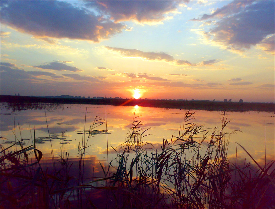
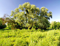
Nature of the Poltava region
Author: Vitaliy Semenov
Poltava Oblast - Features
The length of the territory of the Poltava region from north to south is 213.5 km, from west to east - 245 km. The total area of Poltava Oblast (28.7 thousand sq. km.) is comparable with the areas of such countries as Albania (28.7), Armenia (29.7), Belgium (30.5).
There are 146 rivers (waterways more than 10 km long) with a total length of about 5,100 km. The largest rivers (more than 500 km long) are the Dnieper and Psel. In the south and south-west, the Poltava region is washed by the waters of the Kremenchug and Kamensky reservoirs.
The climate is temperate continental with cool winters and warm summers. The average temperature in January is about minus 5 degrees Celsius, in July - plus 21 degrees Celsius.
More than 92% of the territory is within the natural zone of the forest-steppe, and only 8% (extreme south-eastern part) is within the steppe natural zone. However, the region belongs to the forest deficiency regions of Ukraine. As of early 21st century, the forest cover of the Poltava region together with shrubs and forest belts is about 9.5%. The average forest cover in Ukraine is more than 15%.
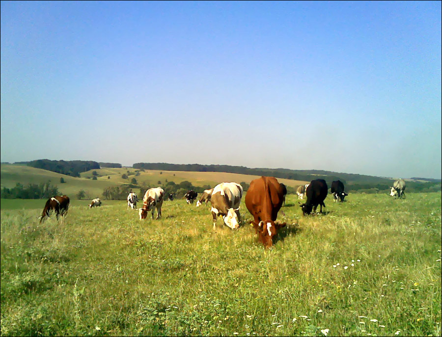
In the structure of industrial production in the Poltava region, the fuel and food industries, mechanical engineering, and ferrous metallurgy have the largest shares. Crop production occupies a leading position in local agriculture with such leading crops as cereals (mainly winter wheat), sugar beets, sunflowers. The main livestock industries are cattle breeding, pig breeding, and poultry farming. In addition, rabbit breeding, horse breeding, beekeeping, fur farming, pond fish farming are widespread in this region.
The leading place in freight turnover in the region belongs to the pipeline and railway transport. The main artery for river transport is the Dnieper River. Air transport is poorly developed. The international airport “Poltava”, the only airport in the region, accepts only charter and special flights. Two European highways pass through the Poltava region: E40, which includes the M03 Kyiv - Kharkiv - Rostov-on-Don (Russia) highway, and E584, which includes the M22 Poltava-Kremenchuk-Oleksandriya highway.
Poltava Oblast is the base for a number of higher educational institutions including the Ukrainian Medical Dental Academy, Poltava National Pedagogical University named after V. G. Korolenko, Poltava National Technical University named after Y. Kondratyuk, Kremenchuk College of Railway Transport, and Kremenchuk National University named after Mikhail Ostrogradsky.
Main Attractions of Poltava Oblast
A large number of the most famous sights of Poltava Oblast are located in its capital - the city of Poltava, as well as in the town of Myrhorod (check our pages devoted to these places). Here we will take a look at the most interesting attractions located in other parts of this region.
National Museum of Ukrainian Pottery in Opishnya. This old village located about 45 km north of Poltava has long been famous as the largest center of masters of ceramics, the pottery capital of Ukraine.
In its open-air exposition you can see unique works of local potters, as well as craftsmen from other Ukrainian regions. The exhibition hall features especially valuable exhibits, a large collection of books on pottery. There is a souvenir shop.
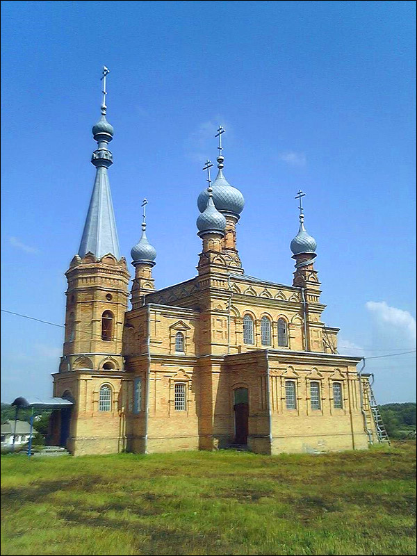
Mgarskyi Transfiguration Monastery (1619) in Mhar - one of the most revered Orthodox shrines in Ukraine, located about 142 km northwest of Poltava, near Myrhorod. The monastery was supported by Ukrainian Hetmans and Russian Tsars, it was visited by Ivan Mazepa, Peter I, Taras Shevchenko, Alexander Pushkin, and others. The monastery was returned to believers in 1993, restoration was carried out. Monks conduct excursions.
National Museum of Nikolai Gogol in Hoholeve. In this village, about 100 km northwest of Poltava, the future great Ukrainian and Russian writer spent his childhood and youth. The estate was restored from photographs, drawings, plans, letters, and memoirs of contemporaries, as the original buildings burned down during the Second World War.
The parental house and the outbuilding with Gogol’s office were restored. Ponds, a romantic grotto, and a garden have been preserved. In the recreated interiors of the living room, dining room, and bedrooms there is an exposition that gives an idea of the Gogol era, his life and work.
In particular, the first editions of Gogol’s books, original portraits, some interior items, personal belongings of the writer and his family are exhibited. In the garden opposite the museum, there is the grave of Gogol’s parents. In the warm season, starting in May, night theatrical performances are held.
Dykanka Village, located about 30 km north of Poltava, became famous thanks to the book of Nikolai Gogol “Evenings on a Farm Near Dikanka”. In the past there was a family estate of the noble family Kochubey here.
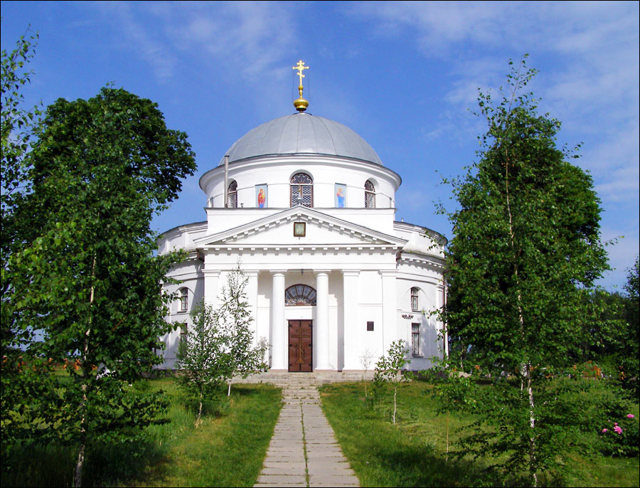
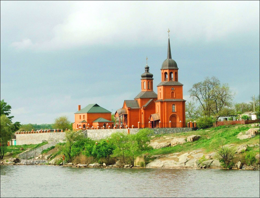
Several interesting architectural and natural monuments have been preserved: the Arc de Triomphe (1820) - the historical symbol of Dykanka built as the main entrance to the Kochubey estate in memory of the arrival of Emperor Alexander I to Dykanka; St. Nicholas Church (1794) with the tomb of the Kochubey family; Trinity Church (1780) - the only architectural monument closely connected with Gogol, who often visited it.
The natural monuments of Dykanka: Dykanka National Natural Park; four “Kochubey’s” oaks 600-800 years old, 20-22 meters high, 150-185 cm in diameter mentioned by Pushkin in his poem “Poltava”; Lilac grove created by Victor Kochubey for his sick daughter Anna - about 40 species of lilac from around the world were collected here.
Velyki Sorochyntsi Village. The main architectural attraction of this village located about 86 km northwest of Poltava is the Transfiguration Church (1732) built in the Ukrainian Baroque style. In 1809, Nikolai Gogol was baptized in it.
Every year, on the last Saturday and Sunday of August, the Sorochyntsi Fair, one of the most famous fairs in Ukraine, takes place in this village. In 1999, this fair received the status of a nationwide event.
Mount Pyvykha near Hradyzk, about 141 km southwest of Poltava - a picturesque historical and geological monument, the highest point on the left bank of the Dnieper River (169 m) and one of the highest places in the entire left-bank Ukraine. In 2008, Pyvykha was presented at the All-Ukrainian competition “7 Natural Wonders of Ukraine”.
Stud Farm in Dibrivka, about 25 km northwest of Myrhorod. Founded in 1888, it occupies one of the leading places among stud farms that breed horses of trotting breeds. The complex of residential and working premises of the 19th century has been preserved. There is a wide space for horseback riding, it is also possible to learn horseback riding in an indoor arena. Guided tours are available.