Yalta - Overview
Yalta is a famous resort and port city located on the southern coast of the Crimean peninsula. Since 1961, the intercity trolleybus line Simferopol-Alushta-Yalta, unique for the countries of the former USSR, has been operating.
Since 2014, Yalta is controlled by Russia.
The population of Yalta is about 74,600 (2021), the area - 15 sq. km.
The current status of Yalta and Crimea
The current status of Yalta is disputed between Ukraine and Russia. De facto, it is controlled by Russia as the entire Crimea.
On March 16, 2014, a referendum was held and the results showed that the majority of Crimeans voted for independence of Crimea and joining Russia. However, the legitimacy of the referendum is questionable.
It was not recognized internationally. This event is widely regarded as the annexation of Crimea by Russia. Ukraine considers Crimea as its territory temporarily occupied by Russia.
History of Yalta
Yalta was founded by the Greeks approximately in the 1st century. The legend says that Greek sailors lost their way because of the storm. They searched the shore for a long time and, when finally they saw the shore (“yalos”), they decided to give the founded settlement this name.
In antique times, the settlement was the part of the Roman Empire, in the Middle Ages - of the Byzantine Empire, Feodoro principality and Genoa colonies. It was known as Yalita and Jalita. From 1475 to 1774, the south shore of Crimea was the part of the Ottoman state.
In 1778, the Christian population of Crimea was removed to Azov area according to the Russian government order. Crimea became the part of the Russian Empire which caused Crimean Tatars’ massive migration. Yalta was almost uninhabited. By the end of the 18th century, it was a small fishermen village.
In the mid 19th century, the town gradually turned into a popular resort and rapidly grew. It started developing as a health resort in the 1860s.
Favorable climate with mild winters and its scenic location between the sea and the mountain made Yalta a popular resort. There were a lot of hotels and sanatoriums in the town.
By the early 20th century, a lot of representatives of the Russian elite, including some members of the emperor’s family and monarchs themselves had dachas and palaces in Yalta or near it.
During the World War II, the city suffered German occupation and deportation of the Crimean Tatars in 1944.
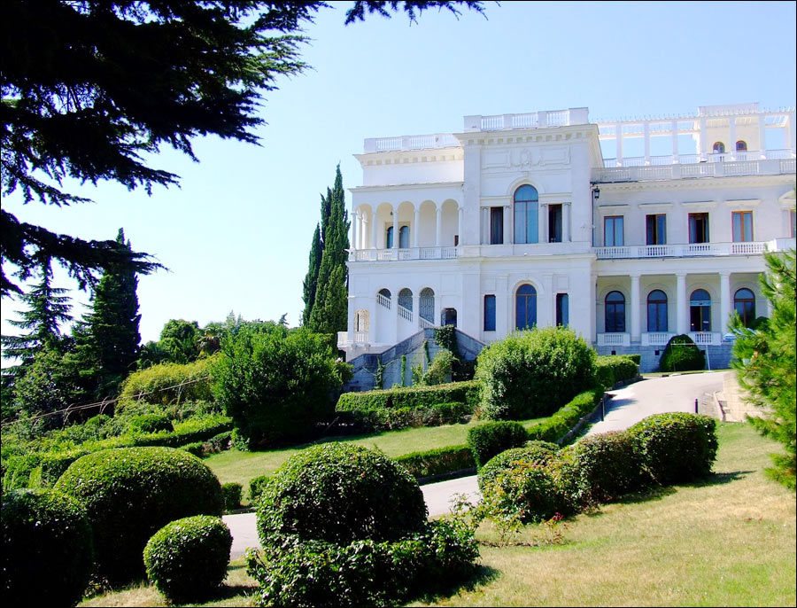
From February 4 to 11, 1945, Yalta conference took place in the city. In February 1945, the three chief Allied leaders met during the conference in Livadiya Palace to plan the final defeat and occupation of Nazi Germany.
After the war, Yalta grew and developed as the resort. In 1961, the trolley-bus line connected it with Simferopol.
The city has wine-making, fruit-canning and tobacco-processing industries.
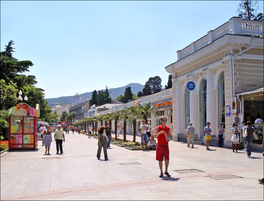
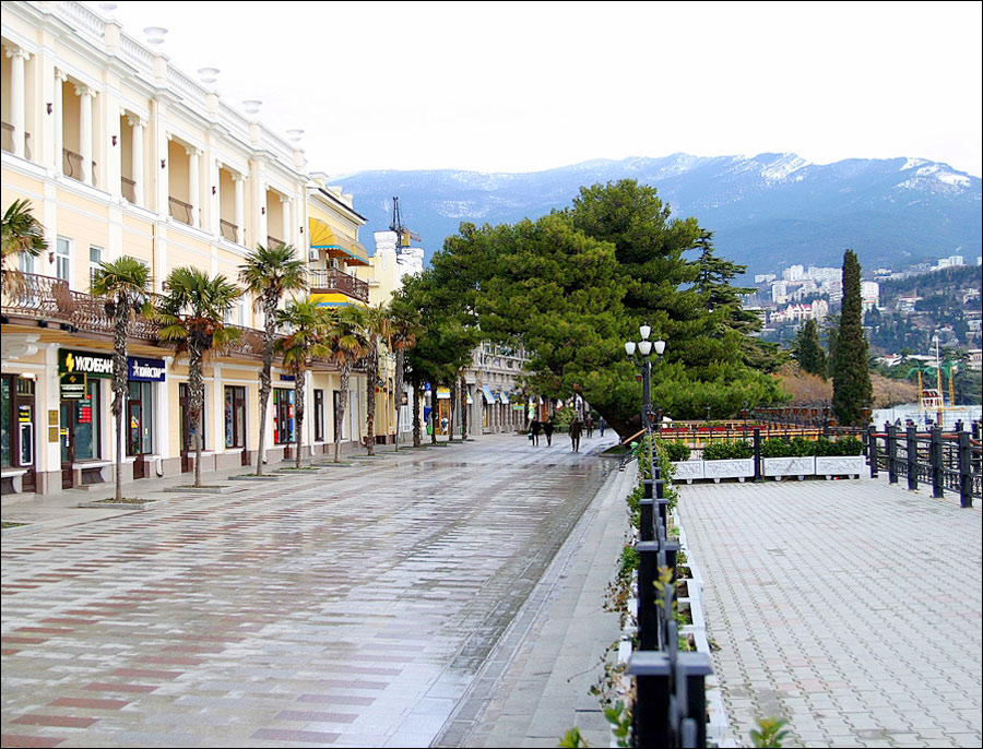
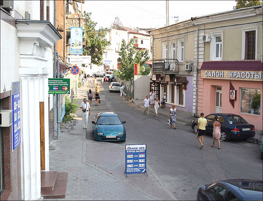
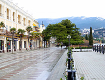
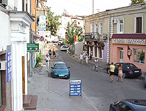
Yalta streets
Yalta city street
Author: Sotnikov
Yalta street view
Author: Yury Lebenkov
Yalta street
Author: Yury Lebenkov
Yalta - Features
Yalta is characterized by an abundance of greenery. The old town looks like a large park with some houses. It is the capital of the Crimean resorts.
It is the center of the large territory of the south Crimea shore known as Bolshaya (“big”) Yalta, which stretches for over 70 km.
The climate is of sub-tropical type. It is characterized by mild and rainy winters, cool springs, hot and long summers and long and warm autumns.
The average temperature in July is 24 degrees Celsius above zero, the average temperature in January - 4 degrees C above zero.
Local reserves and parks are important curing climatic factors. The beaches of Bolshaya Yalta stretch for 59 km.
Attractions of Yalta
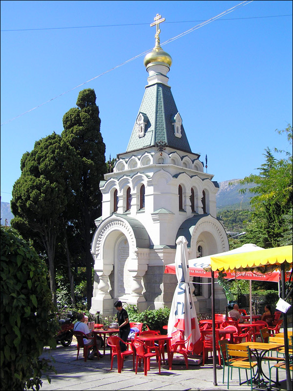
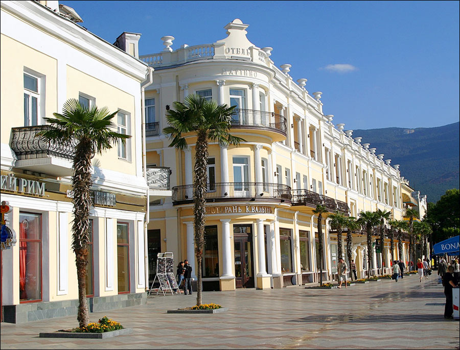
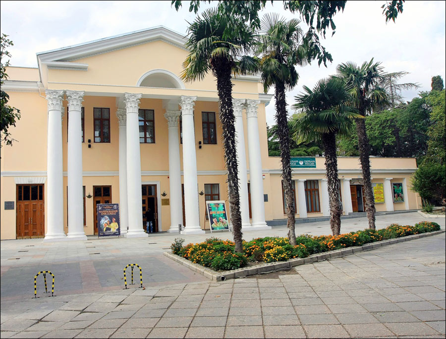
Yalta itself is interesting due to its unique combination of architectural monuments surrounded by mountainous landscape. There are a lot of beautiful (although, not all of them are in good condition) buildings constructed in the late 19th - early 20th centuries.
The most interesting places in Yalta:
- Roffe swimming-pools;
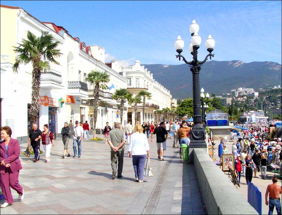
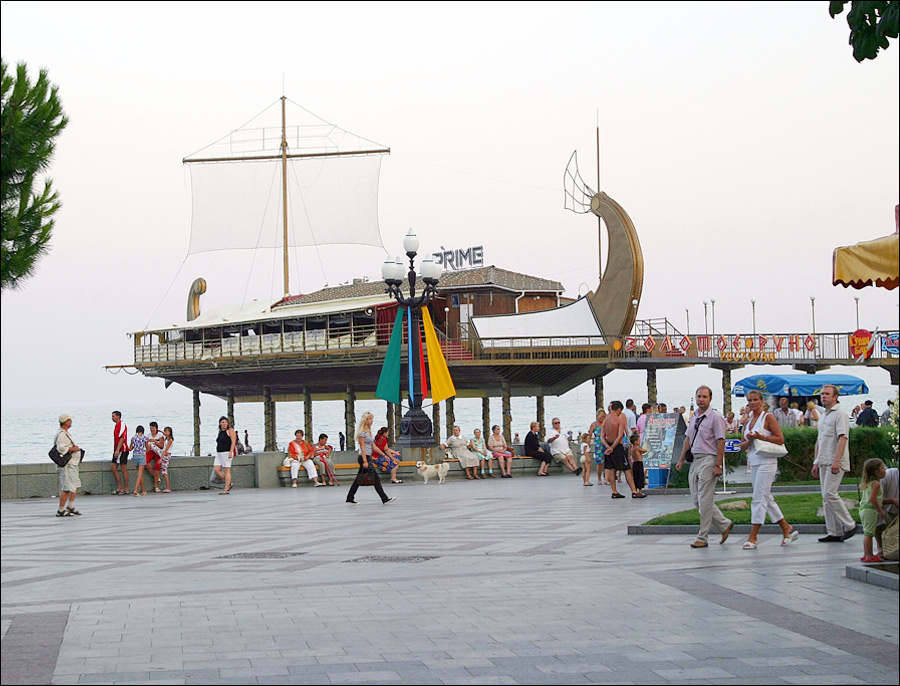
- Yalta embankment;
- The Armenian Church (Zagorodnaya Street);
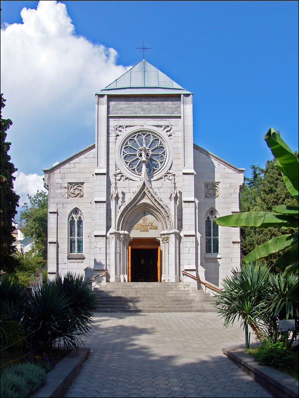
- The Roman-Catholic Church on Pushkin Street;
- Yalta rope way, the lowest station is located close to “Tavrida” hotel, the way goes up to the dome-shaped hill Darsan (140 meters), where you can enjoy a panoramic view of Yalta;
- The restored hotel “Tavrida” - the first hotel in the Russian Empire with escalators;
- James Zlatoust Cathedral (Tolstoy Street);
- Alexander Nevsky Cathedral (Sadovaya Street);
- The building of the former sanatorium of the Ministry of Defense, constructed in the Gothic style (Sverdlov Street);
- Emir Bukharsky palace (Kommunary Street);
- “Skazka” Zoo (Kirov Street).
Nowadays, a lot of old dachas and estates are inhabited by locals. Also, they are used as sanatoriums.
Fortunately, most of them preserved their unique design. In Yalta, there is a wonderful Massandra park (near “Yalta” hotel).
Museums
- The state museum of history and literature (Pushkin Street, 5);
- The department of pre-revolutionary culture of Yalta (Ekaterininskaya Street, 8);
- Livadiya palace-museum;
- Alexander III palace (Massandra);
- The museum “Fairy-tale Glade” (Kirov Street);
- Chekhov’s house-museum (Kirov Street, 112);
- Lesya Ukrainka’s house-museum (Katerininska Street, 8).