Kirovohrad Oblast - Overview
Kirovohrad Oblast or Kirovohradska Oblast is an administrative region located in the central part of Ukraine. The capital of the region is the city of Kropyvnytskyi, renamed from Kirovohrad during decommunization in 2016.
The region itself still retains its Soviet name, since it requires amendments to the Constitution of Ukraine to change it. In the coming years, the name of the region will most likely change and it will become known as Kropyvnytskyi Oblast.
The population of Kirovohrad Oblast (2021) is about 904,000 (2.2% of the total population of Ukraine).
The area of Kirovohrad Oblast is 24,588 sq. km. (4.1% of the total area of Ukraine).
Brief History of Kirovohrad Oblast
People began to settle in the territory of the present Kirovohrad region during the Paleolithic. About 10 monuments of that time were found here including three sites of primitive hunters that existed about 20 thousand years ago.
For centuries, different peoples lived on this territory replacing each other: Cimmerians, Scythians, Sarmatians, Goths, Huns, Avars. In the 1st millennium AD, tribes of Eastern Slavs settled on this territory.
The lands of the present Kirovohrad Oblast were part of Kievan Rus. It was here that the southern line of fortifications against the nomads passed - against the Pechenegs, and then the Cumans. In 1242, the entire territory of the region became part of the Mongol Empire.
In 1362, one of the largest Lithuanian-Mongol battles, the Battle of Blue Waters, took place in the Kirovograd region. As a result, Podolia was annexed to the Grand Duchy of Lithuania and Kiev was recaptured.
More historical facts…
In the second half of the 15th century, these territories became part of the lands on which the Zaporizhzhya Cossacks arose. In 1556, the Zaporizhzhya Sich was founded, which included almost the entire territory of the Kirovo?rad region. In the middle of the 17th century, a significant part of the region was controlled by Zaporizhzhya Cossacks.
In the middle of the 18th century, this frontier region of the Russian Empire began to be actively settled by immigrants from Russia, Serbia, and Bulgaria. For several years, it was known as New Serbia and then New Russia. In 1754, the fortress of St. Elizabeth was founded, which later became Elisavetgrad (today known as the city of Kropyvnytskyi).
In the late 1840-1850s, the first sugar factories were opened in the territory of the present region. In the second half of the 19th - early 20th centuries, Elisavetgrad was one of the most culturally developed district towns of the south of present Ukraine.
In 1868-1869, the railway connected Elisavetgrad with Odessa and Kremenchug, three years later - with Kharkov and Nikolaev. Processing and food enterprises began to actively develop. In 1882, the first permanent professional Ukrainian theater was created in Elisavetgrad.
During the civil war in 1917-1920, power in the region changed several times. In Soviet times, in 1924, Elisavetgrad was renamed to Zinovievsk (in honor of the Soviet politician G. E. Zinoviev). In December 1934, the town was renamed to Kirovo (in honor of the Soviet politician S. M. Kirov killed on December 1, 1934). The territory of the region was alternately part of the Nikolaev, Kherson, and Odessa regions.
In 1939, a separate administrative region was formed - Kirovohrad Oblast. The capital of the region (Kirovo) was renamed to Kirovohrad to distinguish it from the city of Kirov (the capital of Kirov Oblast) in Russia.
Kirovohrad Oblast occupied one of the leading places in terms of agricultural production. Its enterprises produced construction materials, furniture, shoes, lignite (brown coal). In 1941, during the Second World War, the territory of the region was captured by German troops. In early 1944, it was liberated by the Red Army.
Since 1991, Kirovohrad Oblast is part of independent Ukraine. July 14, 2016, the city of Kirovohrad was renamed Kropyvnytskyi in honor of the Ukrainian writer and dramaturge Marko Kropyvnytskyi. In the coming years, Kirovohrad Oblast itself will most likely also be renamed (this requires changes in the Constitution of Ukraine) and will be called Kropyvnytskyi Oblast.
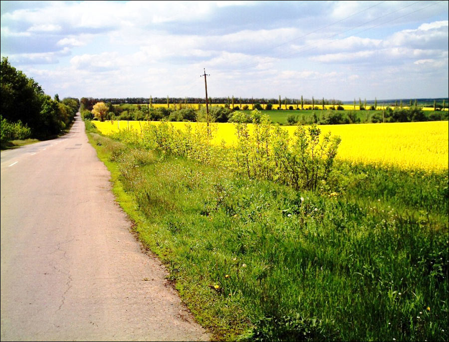
Landscapes of Kirovohrad Oblast
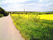
Yellow fields of Kirovohrad Oblast
Author: Sergiy Pogribniy
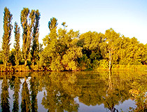
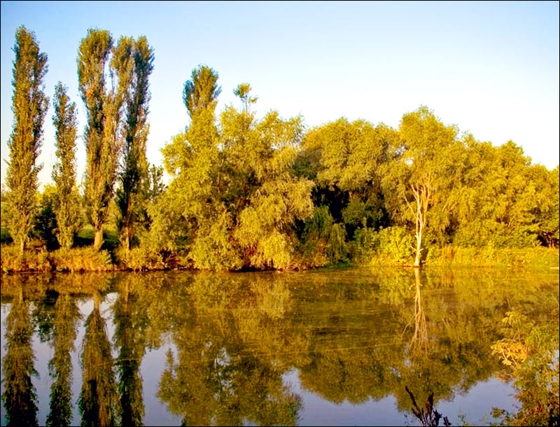
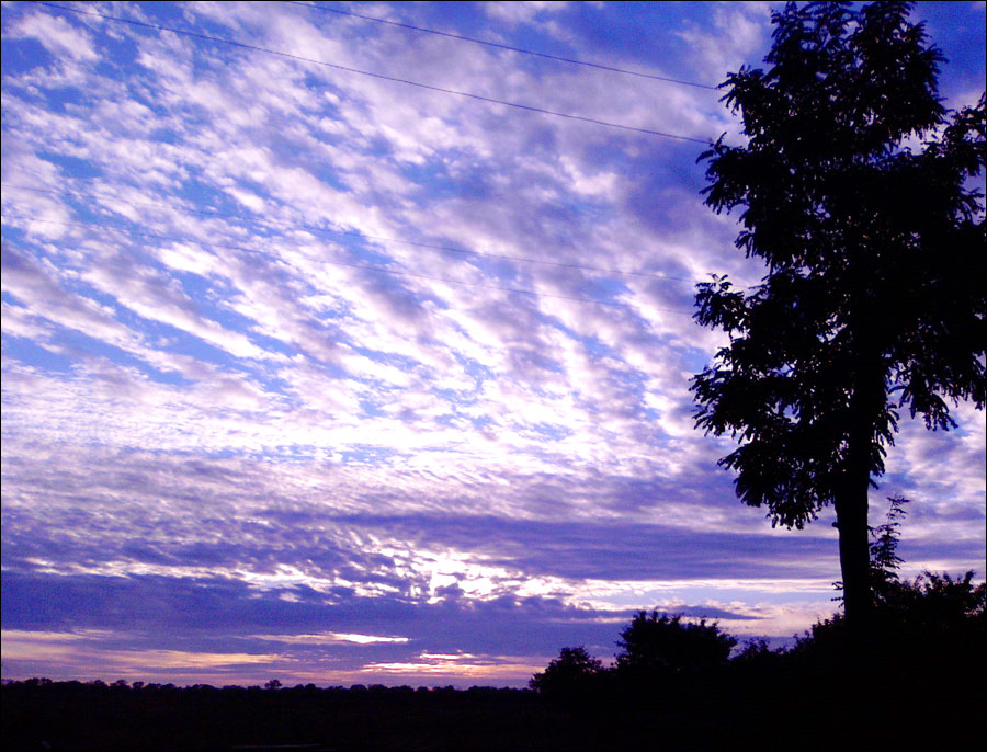
Nature of the Kirovohrad Region
Author: Krivenko
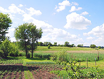
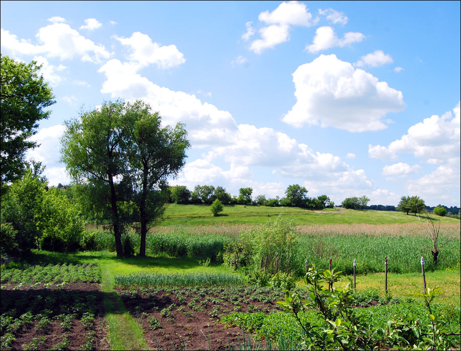
Summer in Kirovohrad Oblast
Author: Shashkov A.
Kirovohrad Oblast - Features
Kirovohrad Oblast is located in the center of Ukraine, between the Dnieper and Southern Buh rivers in the southern part of the Dnieper Upland. Almost the entire territory of the region is located on the right bank of the Dnieper. The length of the region from north to south is almost 148 km, from west to east - 335 km.
The climate of the Kirovohrad region is temperate continental. Winters are mild with frequent thaws. Summers are dry, quite hot, often arid. The average temperature in July is plus 21 degrees Celsius, in January - minus 5.5 degrees Celsius.
This region has relatively large reserves of brown coal in the area of the city of Oleksandriya, deposits of uranium, iron, nickel ores. In recent decades, gold deposits have been discovered. There is also a high probability of discovering platinum, diamonds, chromium, and other rare metals.
The Kirovohrad region has an agrarian-industrial economy. The largest industries are the food industry, machine building and metalworking, electric power, and the building materials industry. Among the branches of the food industry, the leading role belongs to sugar production. There are 11 sugar factories in this region.
The main crops grown in the region are winter wheat, barley, soybeans, corn, legumes, buckwheat and millet. The most important industrial crops are sunflower (about 10% of Ukrainian production) and sugar beets (5%).
Attractions of Kirovohrad Oblast
Tourism in the Kirovohrad region is still poorly developed. But due to its convenient geographical location (in the center of Ukraine), a favorable climate, significant recreational potential, a number of unique places of interest, there is a potential for its development.
A significant part of architectural and historical monuments are located in the capital of the region - Kropyvnytskyi. And here are the most interesting natural and artificial sights located in other districts of the region.
Museum of Strategic Missile Forces. This unique museum is located near the village of Pobuzke in the former secret missile base. Here you can see various military equipment, missiles, engines. The most interesting thing is the opportunity to go down to the real command post along the 150-meter underground corridor, from where the launch of nuclear missiles was controlled.
Former Geographical Center of Ukraine. The point of the geographical center of Ukraine was first calculated in 1989. This place was marked with a memorable sign in the village of Dobrovelychkivka of Kirovohrad Oblast, about 108 km west of Kropyvnytskyi. After numerous scientific discussions and disputes, on August 24, 2002 a granite stela was installed here.
However, in 2005, new studies moved the geographical center of Ukraine to Cherkasy Oblast. Dobrovelychkivka was given the status of “The Geometric Center of Ukraine”, although the sign remained unchanged.
Canyon of the Syniukha River near Ternivka is a picturesque place formed by granite rocks. The Syniukha is considered one of the cleanest rivers in Ukraine. Its length is about 100 kilometers, but only in this place you can see such beautiful landscapes. A granite rock stands above the river, rising 20 meters above the water. Near the canyon, upstream, there is a hydroelectric power station.
Another local attraction is the building of the old water mill of the 19th century. At the confluence of the Syniukha and Yatran rivers, the Kohutovka landscape reserve is located. There you will see granite rocks of different heights and magical landscapes.
Morozovsky Coal Quarry - one of the most unusual tourist attractions located near the city of Oleksandriya. This flooded quarry, where brown coal was previously mined, is not used for this purpose now. However, several huge coal-mining machines were left here creating unique “post-apocalyptic” landscapes.
Zavallya Graphite Quarry - the second largest graphite deposit in the world and the largest in Europe located near the town of Zavallya.
Chornyi Les (Black Forest) - one of the largest oak massifs of the forest-steppe zone of Ukraine, which is located in the center of the Kirovohrad region. This forest is famous for its deep lake. The main historical value of this forest is made up of mounds of the Bronze Age, hillforts and earthen ramparts of the tribes of the Chernoles archeological culture, which existed here as early as the 8th century BC. The most convenient way to get here is from the town of Znamyanka.
Arboretum “Veseli Bokovenky” - one of the most beautiful parks in Ukraine, located near the village of Ivanivka. This park, existing since 1893, covers an area of 110 hectares. Five main landscapes have been created here with almost one thousand species of trees and shrubs.
Karpenko-Karyi State Museum-Reserve “Khutir Nadia” near the village of Mykolaivka, about 20 km southwest of Kropyvnytskyi - one of the most prominent historical and cultural attractions of Ukraine. The estate was founded by the father of the founder of the Ukrainian theater in 1871, who named it after his wife. Later, the playwright turned it into a creative oasis in the middle of the Ukrainian hinterland.