Brief History of Sumy Oblast
From the first inhabitants to the times of Kievan Rus
People began to settle in the territory of present Sumy Oblast during the Late Paleolithic, about 15 thousand years ago. About 5-7 thousand years ago, the territory of the region was inhabited by hunting and fishing tribes. From the end of the 3rd millennium BC, various tribes of farmers and pastoralists began to live here. In the 8th century BC, this territory became part of Scythia - a large state formation of the Scythian tribes.
At the beginning of our era, the entire territory of this region was part of the lands on which the early Slavic tribes lived. In the 7th-10th centuries, it was inhabited by a Slavic tribe of the Severians (“men of the north”). In the late 9th century, the long process of socio-economic development of the Eastern Slavs led to the formation of Kievan Rus - a loose federation of East Slavic and Finnic peoples.
In the 9th century, the region was part of the Pereyaslavl and Chernihiv principalities of Kievan Rus, and from the 12th century - Novgorod-Seversky principality. In this period, a lot of settlements and towns were built, including such historically important ones as Romny, Glukhov, and Putivl. The last of them is associated with an old Russian literary monument - “The Tale of Igor’s Campaign”.
But fierce internecine wars weakened the principality, which led to frequent attacks of the nomadic Cumans. “The Tale of Igor’s Campaign” describes the events of these times when Prince Igor Svyatoslavovich was defeated by nomads and captured. Today, there are still some preserved historical and cultural monuments of the times of Kievan Rus in Sumy Oblast.
More historical facts…
This region located on the border with the steppe, despite the constant attacks of nomads, was relatively densely populated. More than 80 old Russian settlements and burial grounds have been discovered here. In addition to small settlements, there were several relatively large towns.
In the first half of the 13th century, this territory was invaded by the Mongols, a lot of towns and settlements were completely destroyed. After that, for a long time the region remained sparsely populated.
The fight between Lithuania, Poland, and Russia
In the 1360s, the southwestern part of the present Sumy region became part of the Grand Duchy of Lithuania, and then of the Commonwealth. The local population, as well as inhabitants of other neighboring regions, entered into confrontation with the Polish feudal lords, uprisings were quite frequent.
According to the truce of 1503, which ended the Russo-Lithuanian war of 1500-1503, almost all of the nearby Chernigov and Seversky lands became part of the Tsardom of Russia. During the 17th century, the Sumy region was the subject of wars between Russia and Poland. The border between the Ukrainian Cossack state and Sloboda Ukraine passed through this region.
The main town of the present region, Sumy, was founded in 1652. In 1658, Sumy became part of the Belgorod fortification line, which protected the southern borders of Russia from the attacks of the Crimean Tatars. It became the center of the Sumy Sloboda Cossack Regiment. In 1687 and 1689, Sumy was a gathering place of Russian troops for the Crimean campaigns.
In 1708-1709, the population of the Sumy region was in the center of the Great Northern War (1700-1721) between the armies of Charles XII (the King of Sweden) and Peter I (the Tsar of Russia). In 1708, Sumy was assigned to the Kiev Governorate, in 1732 - to the Belgorod Governorate.
Sumy region in the Russian Empire
In 1765, the administrative-territorial division of the Russian Empire was extended to this territory. In the second half of the 18th century, there were about 500 settlements with a total population of more than 350 thousand people here.
In the 18th-19th centuries, since its territory was favorably located at the junction of Ukraine and Russia, it became one of the areas of intensive economic growth. However, by the beginning of the 20th century, it continued to remain mainly an agricultural land. Industrial enterprises processed mainly agricultural products - sugar beets, hemp, mint. Sumy was called the sugar capital.
In the 19th century, the lands of present Sumy Oblast were divided between the Chernigov, Poltava, Kharkov, and Kursk Governorates, in the Soviet years - between the oblasts of the same names.
Sumy Oblast in the 20th century
A separate Sumy Oblast with a population of about 1,707 thousand people was created only on January 10, 1939.
Sumy Oblast suffered significantly during the Second World War. During the years of occupation, 43,730 civilians and 66,993 prisoners of war were executed, about 100,000 people were taken to Germany for forced labor.
In 1959, the population of Sumy Oblast was about 1,508 thousand people; in 1979 - 1,462 thousand people; in 1989 - 1,432 thousand people; in 1999 - 1,354 thousand people. The population of the region continues to decline until today.
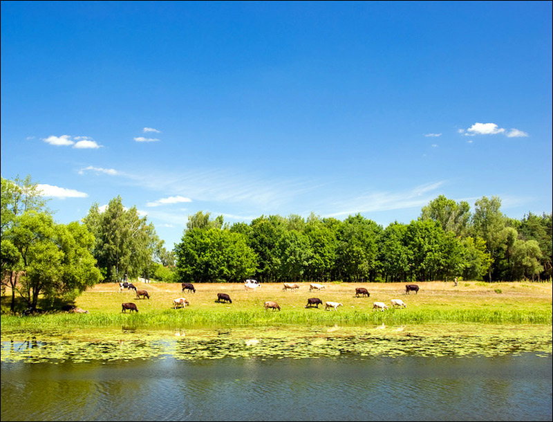
Nature of Sumy Oblast
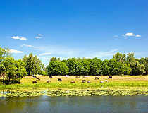
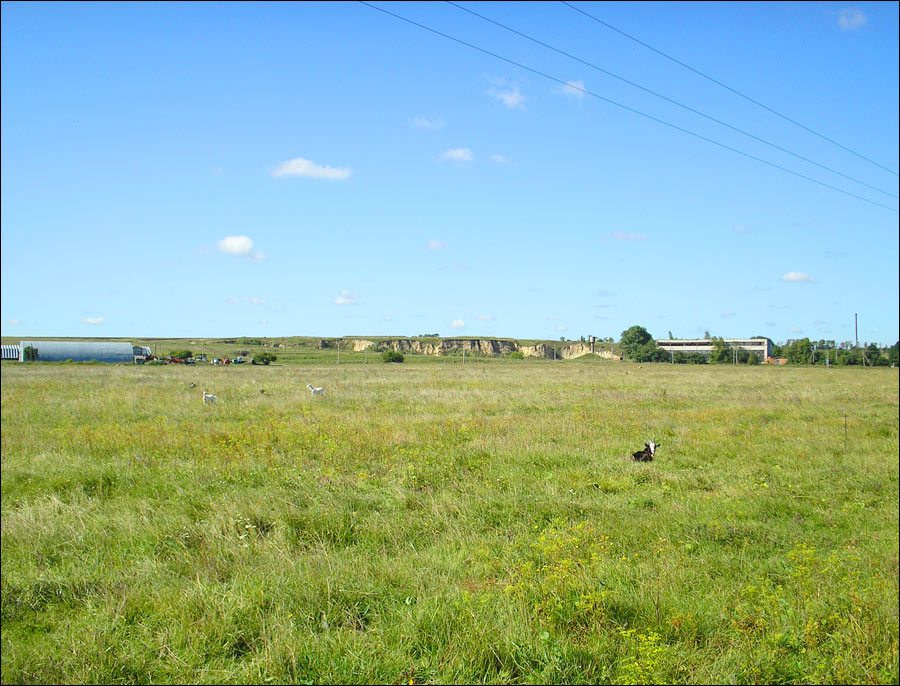
Grazing cows in the Sumy region
Author: Anton Gvozdikov
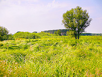
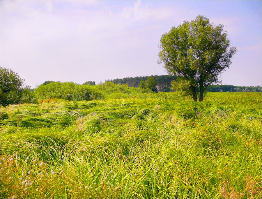
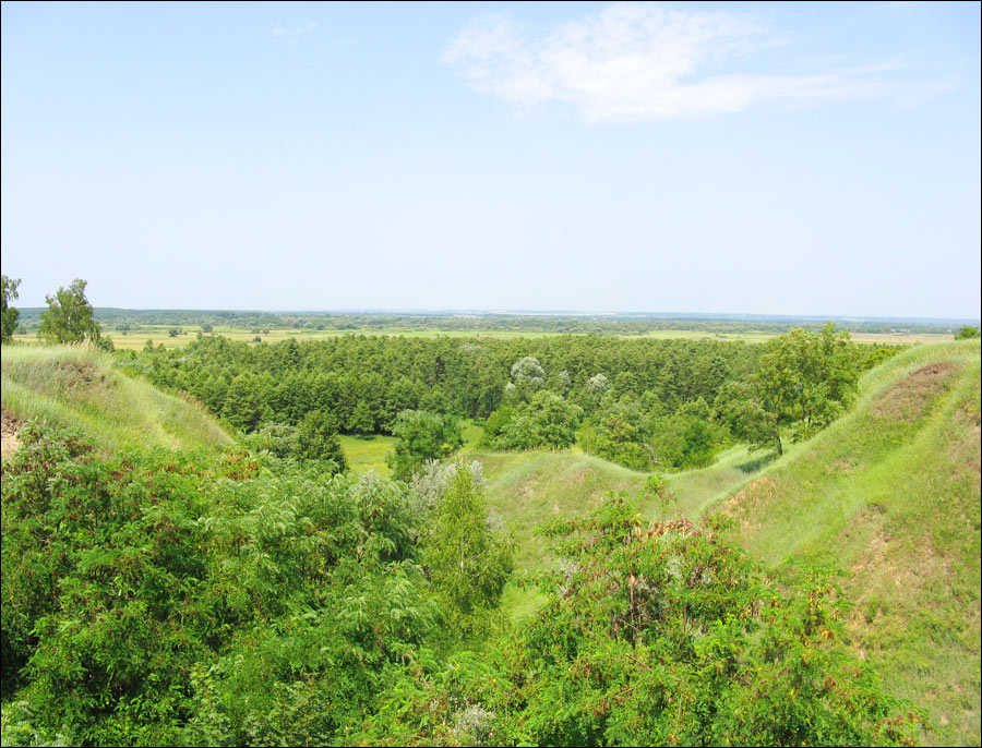
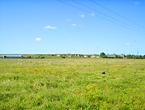
Summer in Sumy Oblast
Author: Ivolin
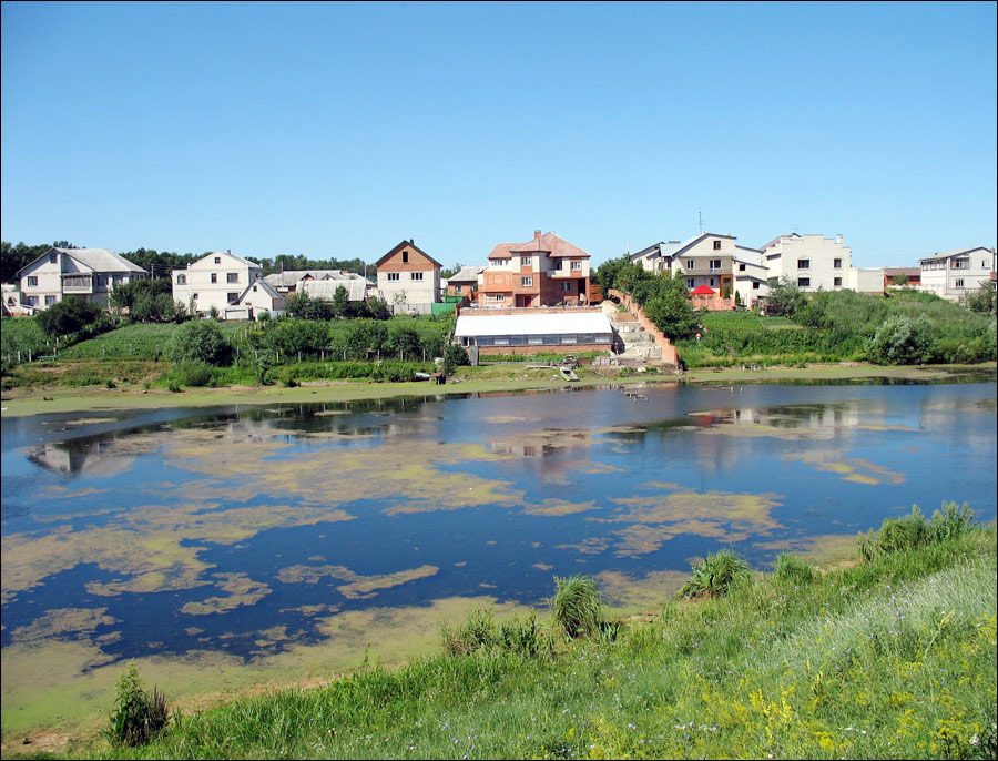
One sunny day in the Sumy region
Author: Oleg Kotok
Sumy Oblast - Features
Sumy Oblast is located in the north-eastern part of Left-Bank Ukraine (on the left bank of the Dnieper River). From west to east, the region stretches for 170 km, from north to south - for 200 km. In the north and east, this region borders on the Bryansk, Kursk, and Belgorod regions of Russia - the length of the state border is 298 km. There are three railway and five automobile checkpoints.
The climate is temperate continental. Winters are mild, summers are moderately hot. The average temperature in July is plus 19 degrees Celsius, in January - minus 7.5 degrees Celsius. The rivers of the Sumy region belong to the Dnieper basin and are mainly its left tributaries. The Desna flowing on the border with Chernihiv Oblast is the main river of the region.
About 17% of the territory is occupied by forests located mainly in the north. Sumy Oblast is one of the most environmentally friendly regions of Left-Bank Ukraine. The region has a lot of lakes, swamps, reservoirs, as well as fairly large forests and a vast stretch of pristine virgin steppe.
Combustible minerals are of the greatest industrial importance: oil (one third of the reserves of Ukraine) and natural gas, peat (floodplains of large rivers in the north). There are non-metallic minerals: phosphorites, rock and potassium salts, limestones, marl, mineral paints, gypsum, chalk, refractory clays, building and glass sands.
The leading industries of the Sumy region are machine building and metalworking, fuel, food, and chemical industries. Several gas pipelines and oil pipelines pass through its territory. Agriculture specializes in growing wheat, rye, legumes, buckwheat, sugar beets, hemp, and sunflower.
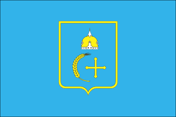
The coat of arms of Sumy Oblast has three main elements. The golden helmet is a symbol of the origin of this region formed during the times of Kievan Rus. The golden ear symbolizes agriculture - the main occupation of the inhabitants of this region since ancient times. The golden cross symbolizes spirituality that is passed down from generation to generation. The dominance of blue and yellow colors (the colors of the Ukrainian flag) shows that the region is an integral part of Ukraine.
A large number of historical and cultural monuments of various eras have been preserved in the Sumy region. There are about 1,500 historical sights, 700 - archaeological sites, over 100 monuments of monumental art, and 373 architectural monuments. Putyvl, Romny, and Hlukhiv are included in the list of the most important historical towns of Ukraine.
Main Attractions of the Sumy Oblast
A lot of attractions of Sumy Oblast are located in the city of Sumy, as well as in the historic town of Hlukhiv. You can find more info about them on our pages dedicated to these places. The following sights can be found in other parts of the region.
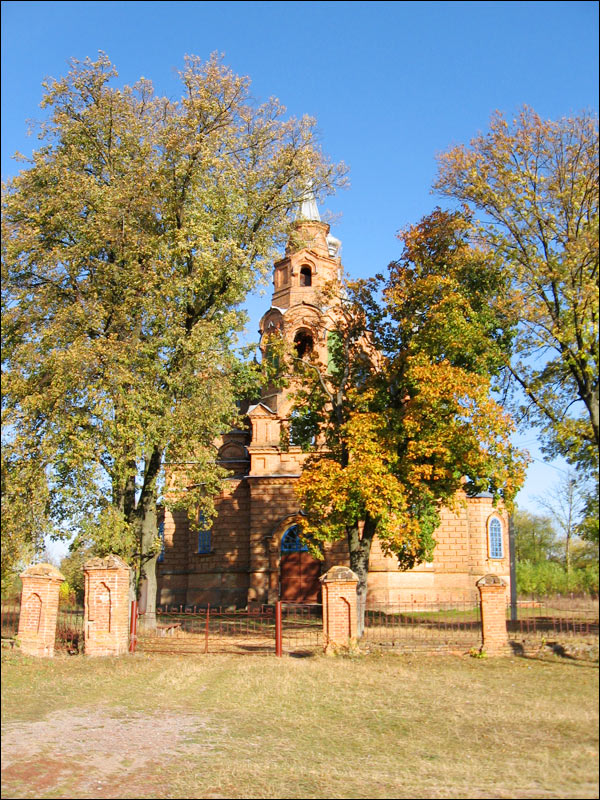
Sofroniyivskyy Monastery (1630-1653), about 2 km from the village of Nova Sloboda and 111 km northwest of Sumy. It was one of the largest monasteries in the Russian Empire. At the beginning of the 20th century, there were 60 different buildings here. In 1930, the monastery was closed and most of the buildings were destroyed.
Today, the architectural complex of the monastery consists of several preserved and restored buildings: the Gate Church of the Intercession constructed in the Cossack Baroque style in the middle of the 18th century, the refectory of the late 17th century, and the abbot corps (1911).
The Apple-Tree Colony in Krolevets (Andriyivska Street, 51), about 148 km northwest of Sumy - one of the natural wonders of Ukraine. Planted as a single tree over 220 years ago, it transformed into a colony of 15 interconnected apple trees occupying an area of about 1,000 square meters.
Over the years, this place has become very popular. Tourists from different parts of Ukraine, as well as from Belarus, Russia, Finland, Turkey, Holland, and other countries come here during the flowering period of this unique apple tree in the beginning of May.
The Manor House “The Round Courtyard” (1749) in Trostyanets (Myru Street, 16), about 56 km south of Sumy - a unique architectural monument that has no analogues in Ukrainian architecture of the mid-18th century.
The building was constructed in the form of an oval fortress over 60 meters in length and 40 meters in width and was originally designed as a structure with some defensive functions. In the mid-19th century, the building was turned into a summer theater and a circus. Today, it has been restored, various cultural events are held here.
In its immediate vicinity you can find another attraction - The Golitsyn Palace (1762). It is a neoclassical manor house with baroque elements decorated with rich stucco on the facade and sculptures in niches. The palace is surrounded by a magnificent park with a lake, a gazebo, and park sculptures.
In 2007-2009, restoration was carried out. Today, in the ballroom and other central halls of the palace there is an art gallery, on the second floor there is a room-museum of Tchaikovsky. The Trostyanets Museum of Local Lore is open in the right wing. In 2012, a chocolate museum was opened in the left wing.
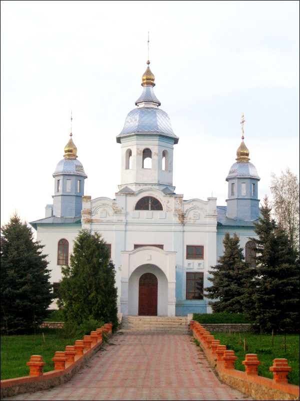
Molchenskyy Convent in Putyvl, about 100 km northwest of Sumy. This fortified monastery was built on the bank of the Seym River on the basis of the fortress of Lithuanian times at the turn of the 16th-17th centuries. In 1604, the tsar-impostor False Dmitry I was hiding behind its walls and left from here to Moscow after the death of Boris Godunov.
The complex is dominated by the Cathedral of the Nativity of the Virgin built in 1575-1585 and repeatedly rebuilt in the 17th-18th centuries. The bell tower is the gate tower of the fortress; a fragment of the wall with the corner tower is also preserved. The complex also includes the Church of St. John the Baptist, built in the 19th century, an abbot and cells buildings, a refectory, and outbuildings.
Spadshchanskyy Forest, about 6 km northwest of Putyvl near Kardashi - a historical and cultural reserve. In 1941, during the Second World War, a partisan detachment of S. Kovpak was organized here. By 1942, as a result of its actions, an extensive partisan network of about 18,000 people was created. In this forest, you can see a reconstructed partisan fortified area with 9 dugouts, a museum, as well as an open-air exhibition of military equipment.
Mykhailivska Tsilyna Nature Reserve near Katerynivka, about 47 km southwest of Sumy - a unique never-plowed plot of virgin meadow steppe with an area of ??202 hectares. Since 1741, these lands belonged to the Counts Kapnist, who bred Oryol trotters at their stud farm in Mykhailivka. Large areas of the steppe were allocated for pasture, and therefore were never plowed.
In 1928, “Mykhailivska Virgin Land” received the status of a reserve. The territory of the reserve is surrounded by forest shelterbelts. More than 500 species of herbs grow here, 38 of which are protected (11 are listed in the Red Book of Ukraine). During the summer, since they bloom at different times, the steppe changes its color 10-12 times. The reserve is inhabited by hares, foxes, and small rodents. Guided tours of this reserve are organized by the Lebedyn Regional Museum of Local Lore.
Lake Shelehivske located north of Mezhyrich, about 39 km southwest of Sumy - a picturesque body of water which is a hydrological monument of nature of national importance. This lake of glacial origin is fed from sources. It is not very easy to get here, so its pristine beauty has been preserved.