The Lugansk People’s Republic
In 2014, during the protests that took place in the Lugansk region, governmental buildings were seized and the Lugansk People’s Republic was proclaimed. May 11, 2014, the referendum about the republic’s independence was held. Its legitimacy was not recognized by Ukraine, the EU and US consider it illegal.
The territory of the Lugansk region became a place of armed conflict between the armed forces of Ukraine and the people protecting the self-proclaimed republic.
Today, the conflict is not resolved and the future of this region remains unclear. It is not recommended to visit Lugansk because it is very unsafe, especially for foreigners.
Citizens of Ukraine who remain in this territory have to leave the conflict zone to obtain official documents. To leave/enter the conflict zone, a special pass is required, it is issued free of charge.
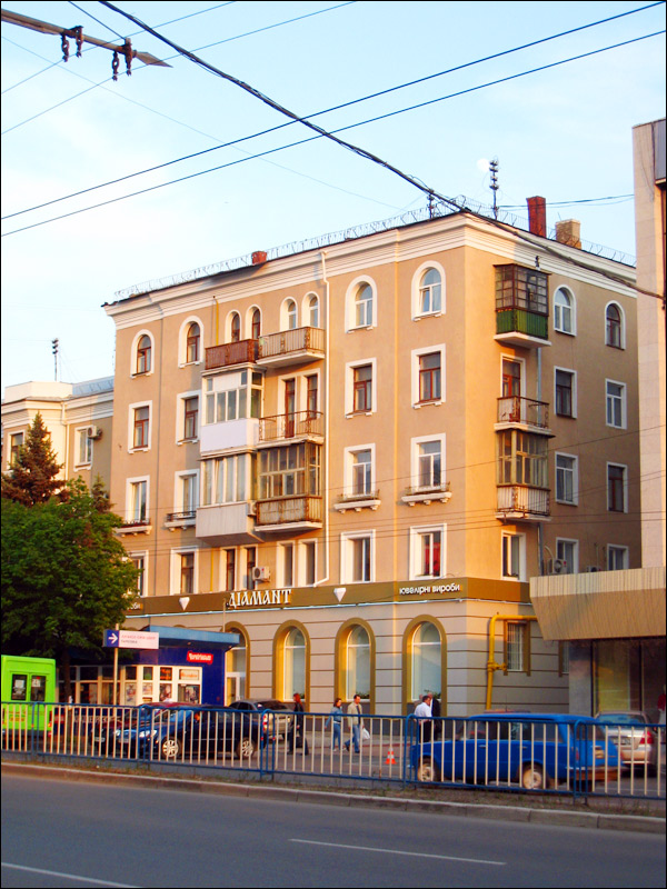
Lugansk streets
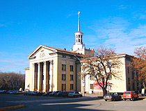
Lugansk street view
Author: Alexander Byelkin
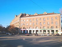
Lugansk city street
Author: Alexander Byelkin
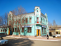
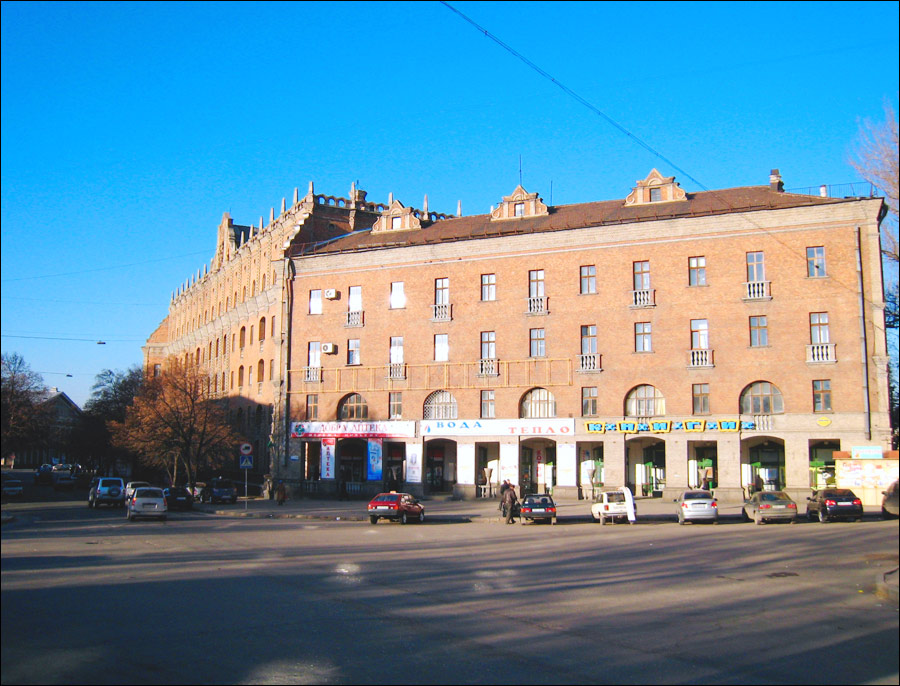
Drugstore in Lugansk
Author: Alexander Byelkin
History of Lugansk
In 1795, Catherine II signed a decree on founding a cast iron mill - the first in the south of the Russian Empire. It was constructed in the Lugan River valley and a settlement was founded nearby.
In 1797, the settlement was called Lugansky plant. Specialists and workers were recruited from the inner Russian regions and partly from abroad. In 1800, the first blast-furnace of Lugansky canon foundry produced cast iron.
In 1812, during the war against Napoleon, the plant became one of the main suppliers of canons and ammunition for the Russian army. In the early 19th century, its favorable location promoted the development of trade.
In the mid 70s of the 19th century, the railway was constructed. In 1882, the town of Lugansk was founded on the basis of Lugansky settlement. In 1896, the German businessman Gustav Hartman began the construction of a large plant to produce steam engines. The equipment was brought from Germany. In 1900, the first steam engine left the town.
In the early 20th century, it was a large industrial center. There were 16 plants and factories, 6 Orthodox churches, a synagogue, a Polish Rome-Catholic church, and a Lutheran church in the town. The first church was built in Kamennye Brody in 1761 - a wooden Petropavlovskaya church. In 1792-1795, it was replaced by a stone church. This is the only church preserved until today.
In 1926, the population of Lugansk was about 77,000. In 1931, the first in the USSR heavy cargo steam engine of “Felix Dzherdzhinsky” series was produced in Lugansk. In 1935, the city was renamed Voroshilovgrad, in honor of Kliment Yefremovich Voroshilov - a prominent Soviet military officer and politician during the Stalin era.
In 1956, the population was over 250,000. In 1958, the historical name “Lugansk” was returned to the city. In 1970, it was again renamed into Voroshilovgrad after the Voroshilov’s death (1969). In 1972, the football team “Zarya” (Voroshilovgrad) became the champion of the USSR for the first and the last time. It was the first USSR champion from the city, which was not the capital of the Soviet republic.
In 1990, the original name was returned to the city again.
Lugansk - Features and Attractions
Heavy engineering dominated by huge diesel-locomotive works is a major branch of local industry. Steel tubes, coal-mining equipment, spare parts for motor vehicles, and precision instruments are also produced in Lugansk.
The city has a teacher-training, medical, agricultural, and machine-building universities.
Lugansk is the most eastern regional center of Ukraine. The lowest (-41.9 degrees Celsius) and highest (+42.0 degrees Celsius) temperatures observed in Ukraine were recorded in this city.
The city is characterized by a steppe climate. Summers are often hot. The average temperature in July is plus 23.3 degrees Celsius. The average temperature in January is minus 3.7 degrees Celsius.
Museums
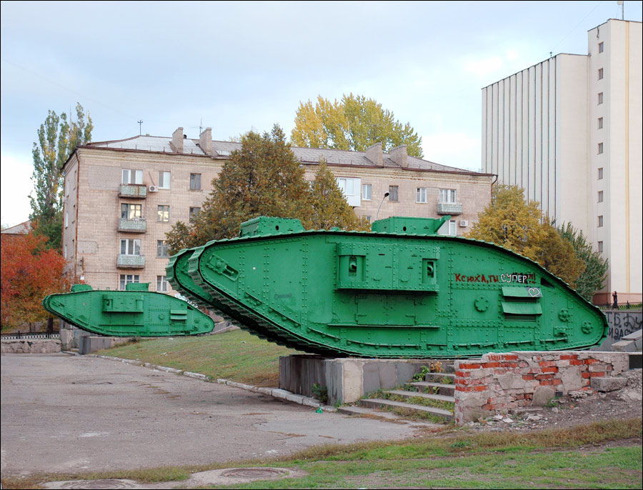
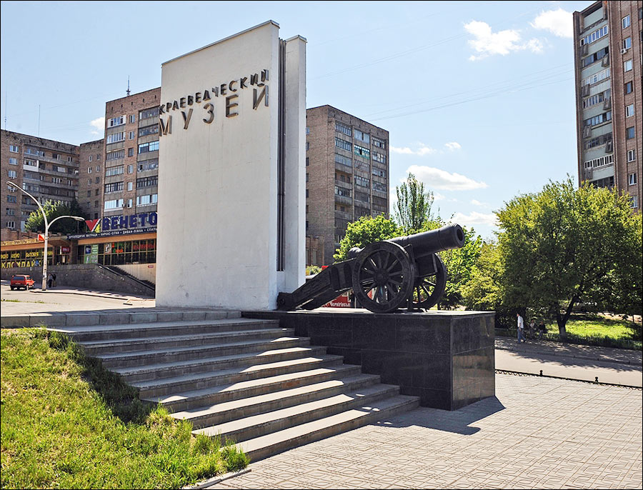
Local History Museum - one of the oldest museums in Donbass. Seven exhibits are devoted to the history of the region from ancient times to the present day. Nearby, you can see two British tanks Mark-5 “Ricardo” of the World War I time and an old gun. Shevchenko Street, 2. Opening hours: 9:00-17:00. Days off: Monday, Tuesday.
Tanks Mark-5. Two unique British tanks Mark-5 (Mark V) “Ricardo” - part of the memorial complex “The Monument to Revolutionary Fighters”. Both tanks were produced in the UK in 1917-1918. During the Russian Civil War, the tanks were used by Denikin’s troops. They were captured by the Red Army and became the basis of its first tank brigade.
In 1938, on the initiative of the Defense Commissar Voroshilov, the tanks were transferred to several cities of the USSR, in particular to Lugansk. The tanks were used as historical monuments of the Civil War. Also, there is one preserved tank in Kharkiv. In 2009, they were renovated and returned to their places. Shevchenko Street, 2.
Museum of the History of Lugansk. The museum was founded in 1980 as a museum of Kliment Voroshilov, after whom the city was named in Soviet times. The main exhibition is devoted to the development of the city in the 19th century. At the entrance, there is an exhibition of old cannons made at Lugansk foundry. Karl Marx Street, 30. Opening hours: 9:00-16:30. Days off: Saturday, Sunday.
Museum of Art. The museum, opened in 1920, is located in the former house of industrialists Venderovich (1876), on one of the oldest streets in the city. There are about 8 thousand exhibits of domestic and foreign art of the 16th-20th centuries: paintings, sculptures, decorative and applied arts. Paintings of Italian, French, Flemish, and Dutch artists of the 16th-18th centuries are especially valuable. Pochtovaya Street, 3. Opening hours: 9:00-17:00. Days off: Monday, Tuesday.
House-Museum of Vladimir Dal - a small one-story house, where the outstanding writer and lexicographer V. Dal was born in 1801. In 1986, the house became a museum. The exhibits presented in five rooms of the museum are devoted to life and work of the author of “Explanatory Dictionary of the Russian Language”. Nearby, you can find a monument to Dal (1981). Dal Street, 12. Opening hours: 9:00-16:00. Days off: Sunday, Monday.
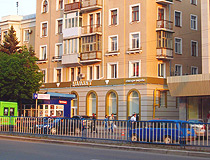
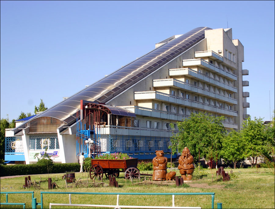
Lugansk pictures
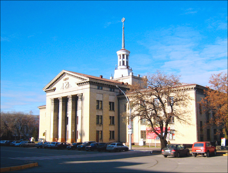
Lugansk architecture
Author: Alexander Byelkin

Lugansk scenery
Author: Alexander Byelkin
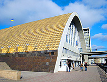
Lugansk Railway Station
Author: Alexander Byelkin
Churches
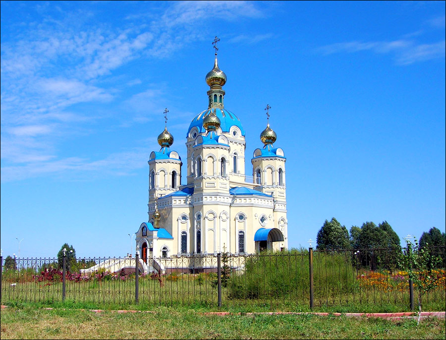
St. Vladimir Cathedral. The cathedral was founded in 1993 and consecrated in 2006. Today, it is the largest cult construction of south-eastern Ukraine. The cathedral can accommodate up to 3 thousand believers. Built on a high open area, this majestic building can be seen from afar. Plekhanov Street, 44.
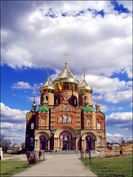
St. Peter and St. Paul Cathedral - the oldest building in Lugansk constructed in 1792-1796. 2nd Kooperativniy Street, 12.
St. Alexander Nevsky Church. The church was built on the territory of University Park in 2000-2003. Budenniy Street.
Other places of interest
Park of Stone Statues. This park-museum has one of the largest collections of stone statues of the 11th-12th centuries in Ukraine. The museum is located on the territory of the Lugansk National University. The statues are the sculptures of 1-4 meters height, depicting warriors (sometimes women).
The statues were originally placed on the mounds of ancient peoples: Scythians, Polovtsians, etc. These are the only remains of monumental art of long-extinct nomadic peoples lived in what is now known as the Lugansk region. Oboronnaya Street, 2.
Monument to Prince Igor. The monument is located in the village of Stanichno-Luganskoye (north-eastern suburb of the city). It was opened for the 65th anniversary of the formation of the region.
14-meter statue of the prince was placed on a high hill above the highway Lugansk - Shirokiy. It is planned to create a historical and cultural complex in this area.
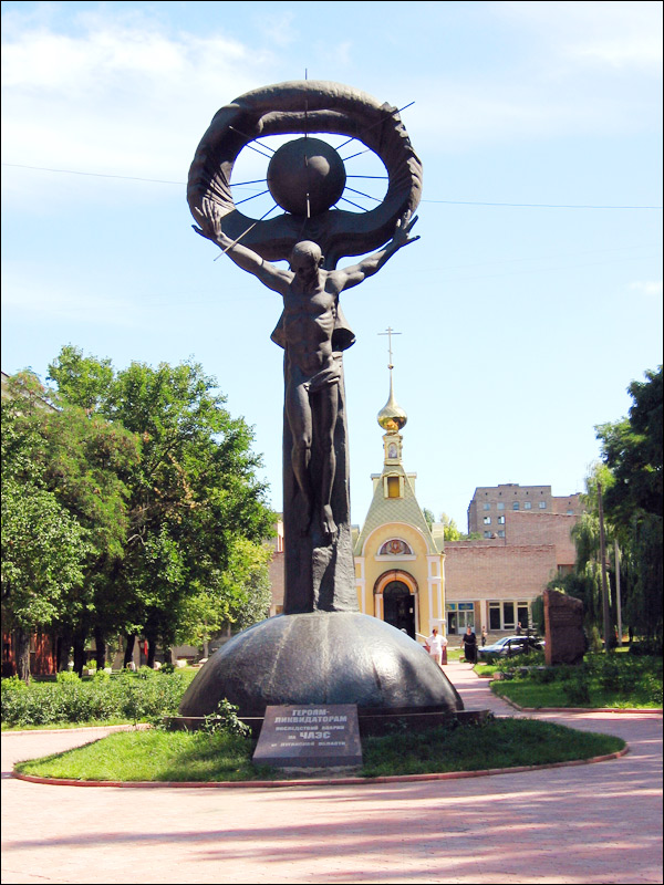
Ostraya Mogila. This memorial is dedicated to the Civil War (1919) and the Second World War.


The comments of our visitors