
CAT | Nature
6
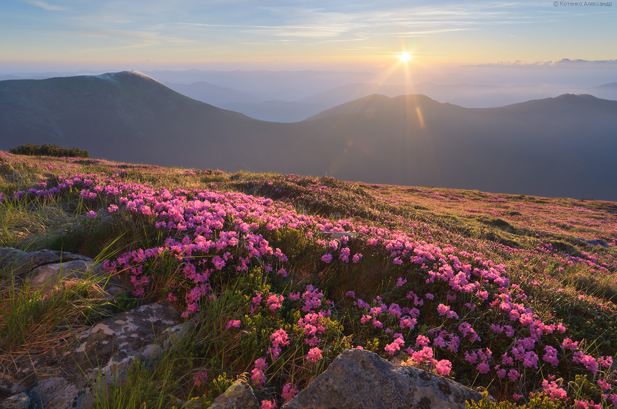
Blooming Carpathians – Chornohora Mountain Range
No comments · Posted by Sergei Rzhevsky in Nature, Photos, Regions
Chornohora is the highest mountain range in the Ukrainian Carpathians located on the border of Zakarpattia Oblast and Ivano-Frankivsk Oblast.
It is especially beautiful here when the slopes of the mountain range are covered with blooming rhododendrons. Chornohora on Google Maps. Photos by: Alexander Kotenko.
beautiful flowering mountain landscapes

Tags: Ivano-Frankivsk oblast · landscapes · Zakarpattia oblast
4
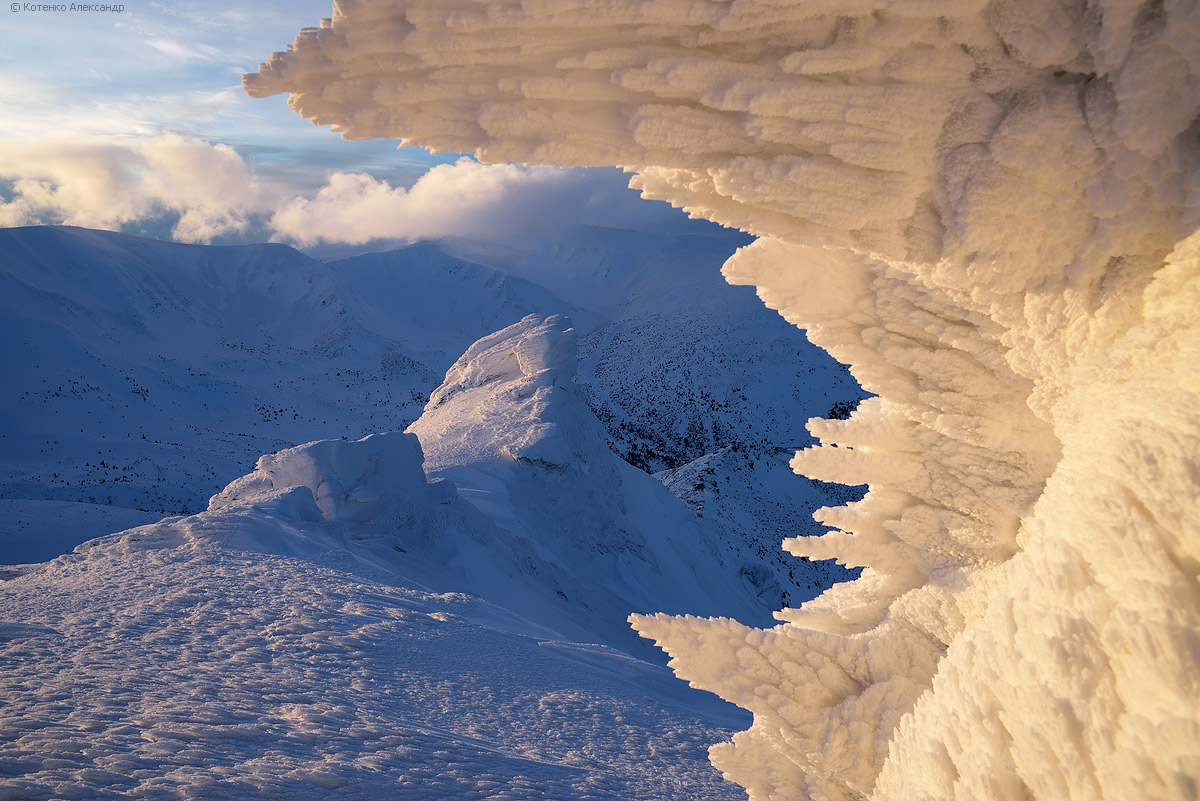
Snowy Winter on Mount Pip Ivan Chornohora
No comments · Posted by Sergei Rzhevsky in Nature, Regions, Travel
In the Ukrainian Carpathians, there are two peaks named Pip Ivan. One of them is located in Ukraine’s highest and most popular mountain range, Chornohora, hence the peak’s name, Pip Ivan Chornohora (2,028 m), or Pipivan, or Black Mountain. It is the third-highest peak in the Carpathians and the easternmost of the six two-thousanders. Its significantly lower namesake, Pip Ivan Marmaroshsky (1,936 m), is located in the Marmarosy mountain range.
The mountain is located in the southeastern part of the mountain range, on the border of Ivano-Frankivsk Oblast and Zakarpattia Oblast. Mount Pip Ivan Chornohora on Google Maps. Photos by: Alexander Kotenko.
the main sight of the mountain
Tags: Ivano-Frankivsk oblast · Zakarpattia oblast
12
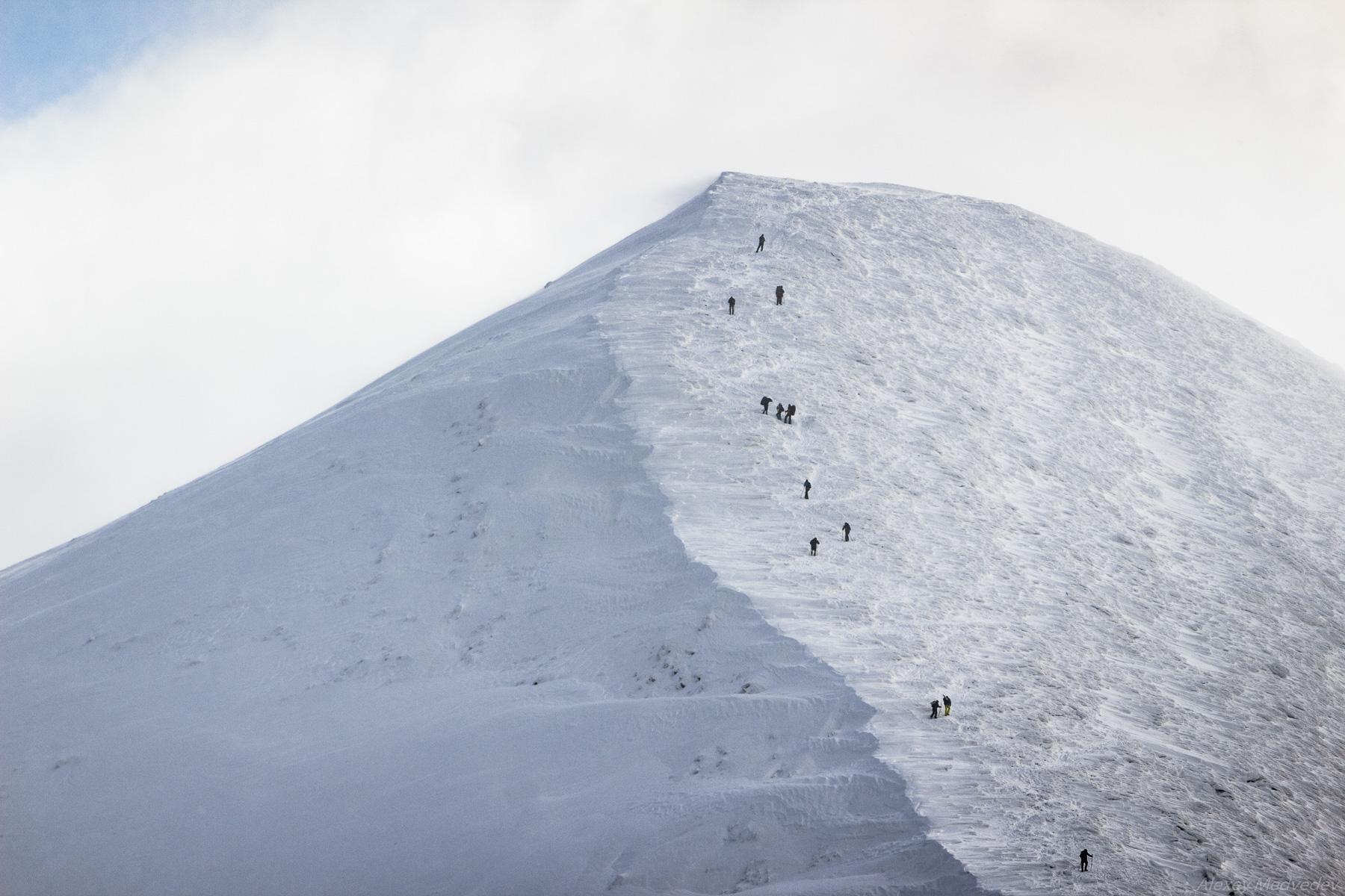
Climbing Mount Hoverla in Winter
No comments · Posted by Sergei Rzhevsky in Nature, Regions, Travel
Hoverla (in Romanian, “Howarla” means “insurmountable height”) is the highest mountain and the highest point in Ukraine (2,061 m above sea level). It is located on the border of Zakarpattia Oblast and Ivano-Frankivsk Oblast, approximately 17 km from the Ukrainian border with Romania.
It’s a popular destination for summer and winter tourism. The first hiking route up the mountain was opened in 1880. In the north, you can see the cities of Ivano-Frankivsk Oblast: Ivano-Frankivsk, Kolomyia, and Snyatin. Mount Hoverla on Google Maps. Photos by: Alexey Medvedev.
Tags: Ivano-Frankivsk oblast · Zakarpattia oblast
27
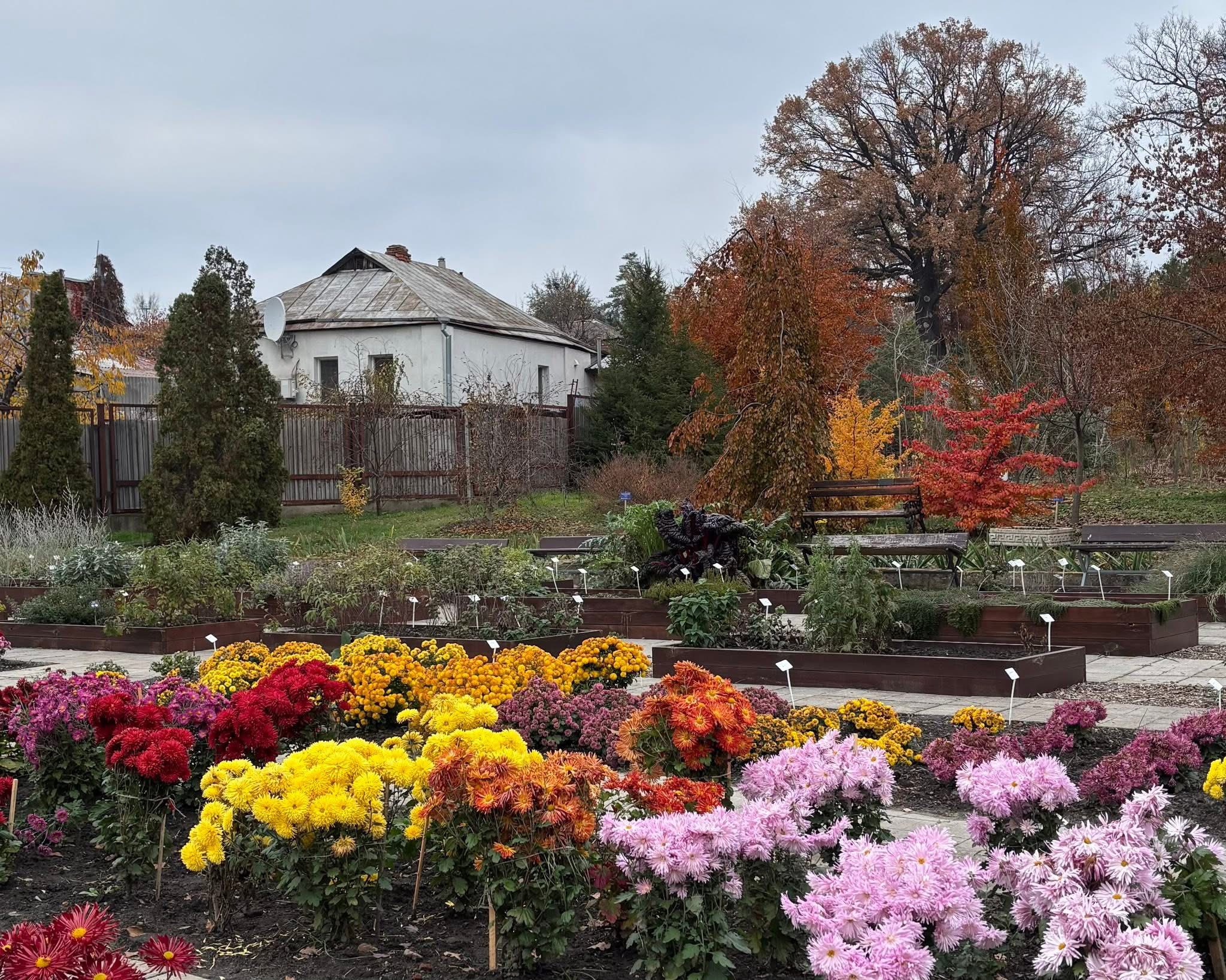
Colorful Autumn in the Kharkiv Botanical Garden
No comments · Posted by Sergei Rzhevsky in Cities, Nature
The Botanical Garden of the V. N. Karazin Kharkiv National University is a nationally significant natural reserve in Kharkiv. It was founded simultaneously with Kharkiv University in 1804, making it the oldest botanical garden in Ukraine.
The total area of the botanical garden is 41.9 hectares. The “old site,” located at Klochkivska St, 52 (shown in these photos), covers 5.5 hectares; the new site, on the slope of Sarzhyn Yar (Otakara Yarosha St, 24), covers 36.4 hectares.
The collection includes over 7,000 species of local and global flora. Admission to the Kharkiv Botanical Garden is free. However, visiting is strictly limited to hours from 10:00 AM to 3:00 PM. Photos by: Olena Ilchenko.
vivid colors of autumn in Kharkiv
Tags: Kharkov city
30
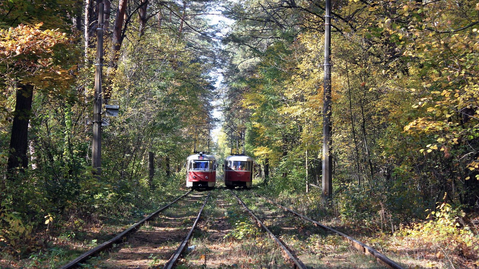
Pushcha-Vodytsya – the Most Scenic Tram Line in Ukraine
No comments · Posted by Sergei Rzhevsky in Nature, Travel
Pushcha-Vodytsya is a historical place and a climatic resort located mainly in pine forests in the north-western part of Kyiv. This locality got its name from the word “pushcha” (a dense, impenetrable forest) and the Vodytsya River, which no longer exists.
Today, it is one of the most popular holiday destinations in the capital of Ukraine. You can find a cascade of lakes with sandy beaches, boat and catamaran rental stations, as well as shops and ATMs here. Pushcha-Vodytsya is connected to Kyiv by a unique historical tram line running through the forest, which makes it probably the most scenic tram line in Ukraine. Pushcha-Vodytsya on Google Maps. Photos by: Igor Golovach.
Tags: Kiev city
3
The Most Beautiful Parts of Natural Ukraine
No comments · Posted by Sergei Rzhevsky in Nature, Travel
Unlike Caribbean beaches, Swiss Alps, and Michigan casinos, Ukraine isn’t usually a bucket list destination for everyday travelers. Despite the country being plagued with stereotypes of Cold War-era notions, harsh and freezing winters, and an overall gray landscape, these ideas couldn’t be further from the truth in most cases. In reality, Ukraine is packed with cultural heritage, historical meaning, and magnificent natural beauty that warrants a visit – once the unfortunate military invasion eases up.
Amid all the tragedy and catastrophe affecting the country, let’s take a moment to appreciate the most beautiful parts of natural Ukraine. These picturesque sights are fully accessible to tourists, offering call reception and browsing opportunities for all, while appearing as if they’re untouched.
Tags: No tags
7
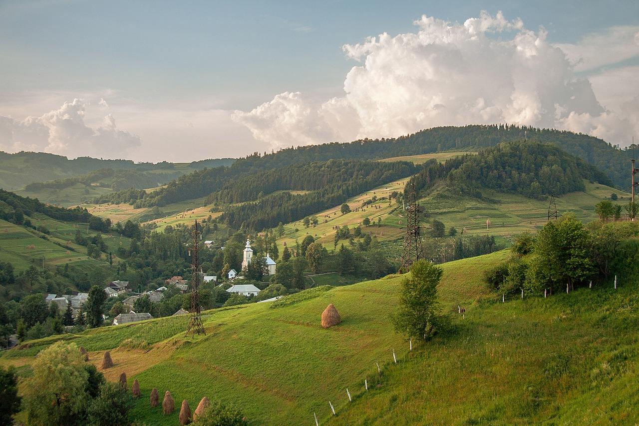
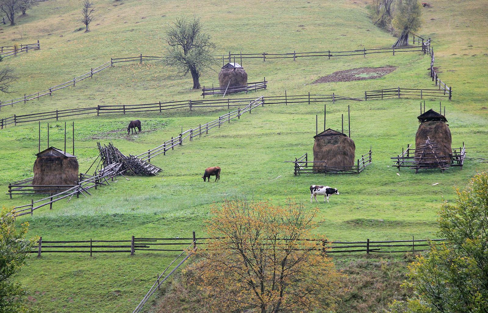
Early autumn in the pastures of the Ukrainian Carpathians
No comments · Posted by Sergei Rzhevsky in Nature, Travel
Polonina is a treeless area of the upper belt of the Eastern Carpathians, which is used as pasture and for haymaking. The flora is similar to the flora of the lower tier of alpine meadows. The local population refers to the pasture above the upper edge of the forest as polonina, in contrast to pastures within the forest zone.
The following photos were taken on the pastures of Chortka and Stanimir located in the southwestern part of Ivano-Frankivsk Oblast in early October 2023. Photos by: Sergej Palko.
beautiful autumn in the Carpathians
Tags: Ivano-Frankivsk oblast
The great outdoors is an exciting place to be. Most people who are stuck indoors have found ways to stay entertained. One example is exploring Gclub, an e-gaming platform where visitors can play games and win cash.
While outdoor options are limited, let’s take a look at tourist spots so you can plan your next trip. Among the best destinations is Ukraine, a European country with some of the most scenic spots in the world. It offers a multitude of breathtaking views and spectacular landscapes.
beautiful Ukrainian landscapes
Tags: No tags
11
Amazing Scenery in the Area of the Flooded Village of Bakota
No comments · Posted by Alex Smirnov in Nature, Travel, Video
Bakota, located about 50 kilometers from Kamianets-Podilskyi in the territory of the Podilski Tovtry National Park, in the very south of Khmelnytskyi Oblast, was once a village, but its story ended in 1981, when it was flooded due to the construction of the Dniester hydroelectric complex.
Today, Bakota is a place with amazing nature and beautiful views. Here, from the rocky high bank of the river, you can spend hours watching the water surface and picturesque cliffs. There are also boat excursions available. On the territory of Bakota, you can spend the night in a tent, fish.
Tags: Kamenets Podolskiy city · Khmelnitsky oblast
22
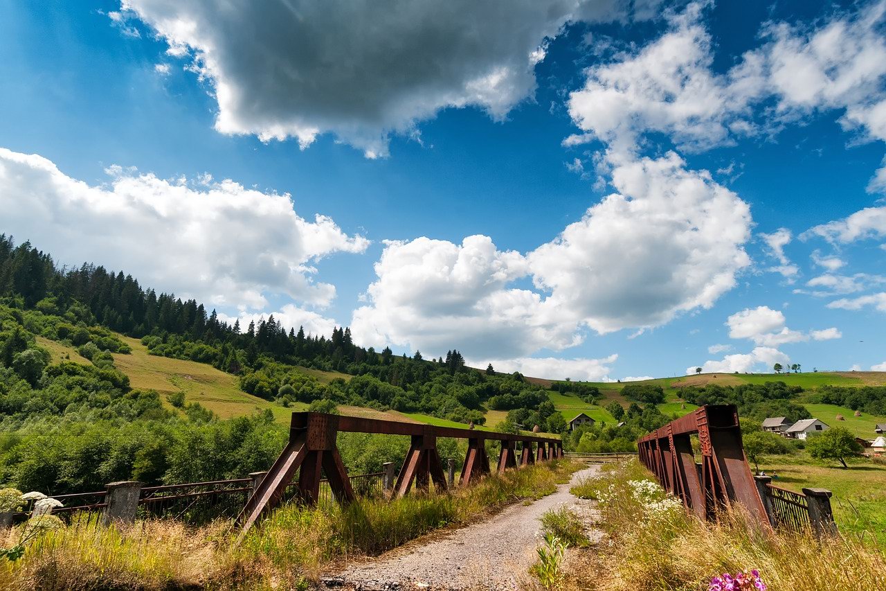
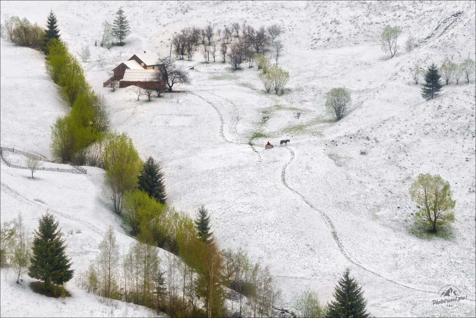
Unpredictable spring weather of the Carpathians
No comments · Posted by Sergei Rzhevsky in Nature, Photos
In early May, the weather in the Ukrainian Carpathians can be very changeable. It would seem that winter has long ended, snow has completely melted, green grass and flowering trees are everywhere.
And one night it suddenly snows and winter comes back, even if only for one day. Thanks to this relatively unusual natural phenomenon, you can see very picturesque views of the Carpathians, when snow clearly shows the smallest folds of the relief. Photos by: Vlad Sokolovsky.
Tags: Zakarpattia oblast