
TAG | Crimea Republic
11
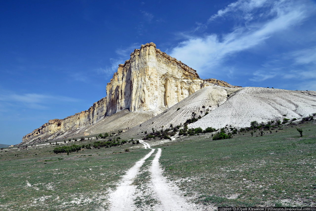
Belaya Skala – a wonderful natural monument in Crimea
No comments · Posted by Sergei Rzhevsky in Nature, Photos
Belaya Skala (White Rock) or Aq-Qaya is a vertical white rocky wall in Crimea, located near the village of Belaya Skala. The height of the cliff is 100 meters. This natural monument was created by erosion and weathering of the limestones and sandstones.
Almost all the inhabitants of the former USSR, as well as many people in the former socialist countries saw this beautiful landscape at least once because most movies about Indians and the American Wild West, shot in the Soviet era, included scenes filmed near this rock. Photos by: Yuri Yuhanson.

Tags: Crimea Republic
12
Fairy-tale forest on Demerdzhi in the Crimea
No comments · Posted by Sergei Rzhevsky in Nature, Photos
Demerdzhi-Yayla or just Demerdzhi is a mountain range located in the Alushta region of the Crimea.
In the fall, on a foggy day, the beech forest growing on the slopes of the mountain range is transformed into an amazing fairy-tale scenery. Photos by: Denis Belitsky.
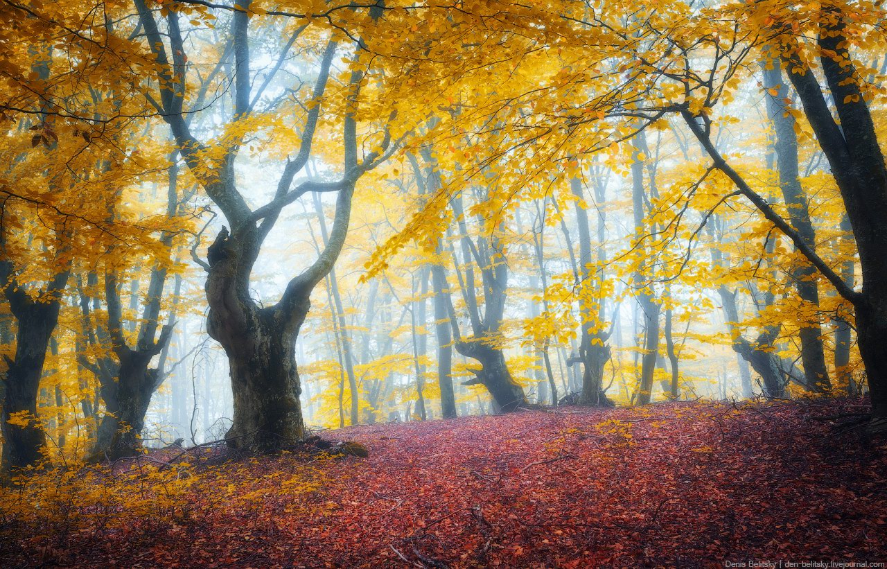
a wonderful forest straight from fairy tales
Tags: Crimea Republic
Baydar Valley is an intermountain hollow (16 km long and 8 km wide) located in the southwestern part of the Crimean Peninsula.
The valley is located at an altitude of 300-400 meters, surrounded by 600-800 meters mountains. Sometimes, when the fog descends on the valley, it becomes a truly fantastic place. Photos by: Denis Belitsky.

walk through the mystical forest
Tags: Crimea Republic
8
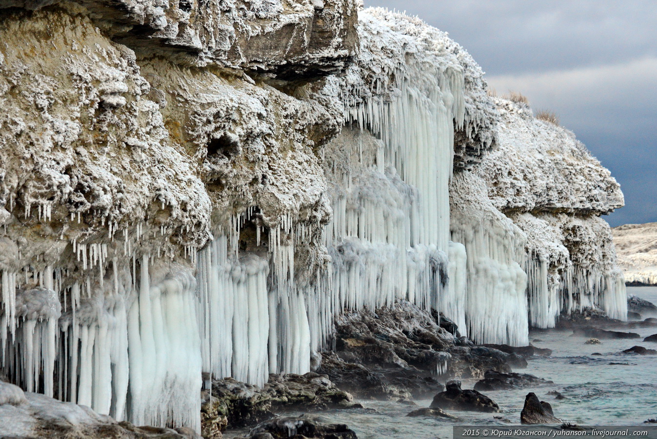
Ice age in Crimea – ice-bound Chersonese
No comments · Posted by Sergei Rzhevsky in Nature, Photos
Tauric Chersonese or simply Chersonese is a city founded by the ancient Greeks located in the south-west coast of Crimea. For two thousand years, it was a major political, economic and cultural center of the northern Black Sea area.
Today, you can see the remains of Chersonese in the Gagarin district of Sevastopol, it is a historical and archaeological reserve. In 2013, Chersonese was included in the list of UNESCO World Heritage Sites. The photos were taken by Yuri Yuhanson.
Tags: Crimea Republic · landscapes · Sevastopol city
27
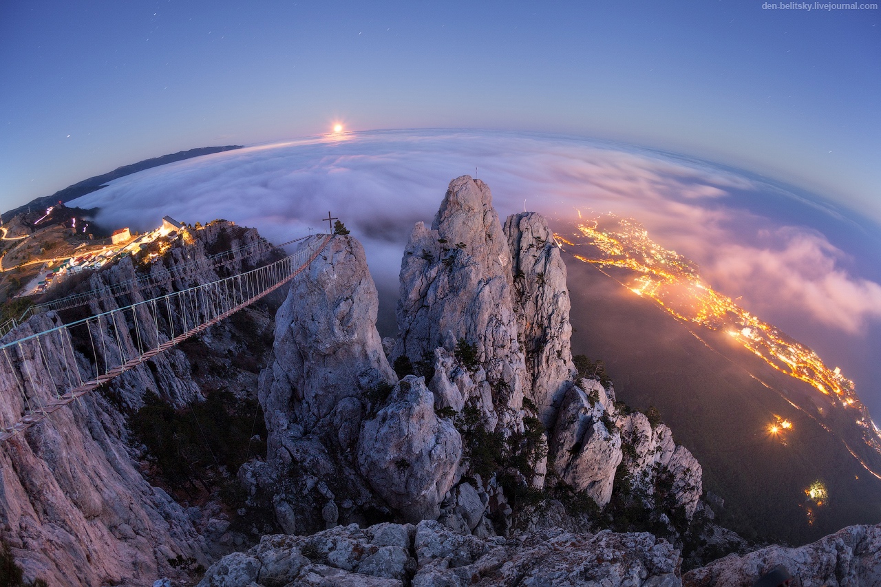
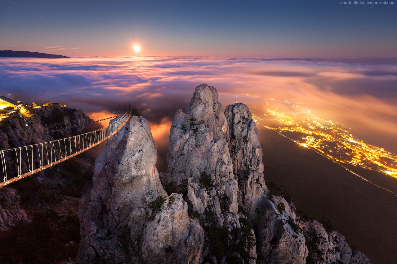
Moonrise over Mount Ai-Petri in Crimea
No comments · Posted by Sergei Rzhevsky in Nature, Photos
Ai-Petri is a mountain of 1,234 meters height located in the Yalta region of Crimea. The name “Ai-Petri” is of Greek origin and means “Saint Peter”.
It is the place with the maximum number of foggy days in Crimea (215 days in 1970). The photo was taken by Denis Belitsky.
Tags: Crimea Republic · landscapes
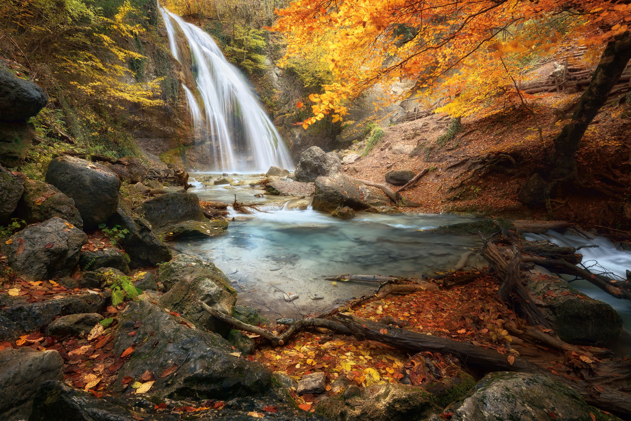
Djur-Djur (meaning “water-water” on Armenian language) is the most full-flowing waterfall in the Crimea located in Alushta region near Generalskoye village at an altitude of 468 meters above sea level.
This waterfall doesn’t dry out even in the dry season. Photo by Ilya Melikhov
Tags: Crimea Republic
19
Moonrise over Yalta – Ai-Petri Peak in Crimea
No comments · Posted by Sergei Rzhevsky in Cities, Photos
It took some effort to shoot this beautiful picture of night Yalta from Ai-Petri Peak but the result is worth it. Photo by Denis Belitsky
Tags: Crimea Republic · Yalta city
9
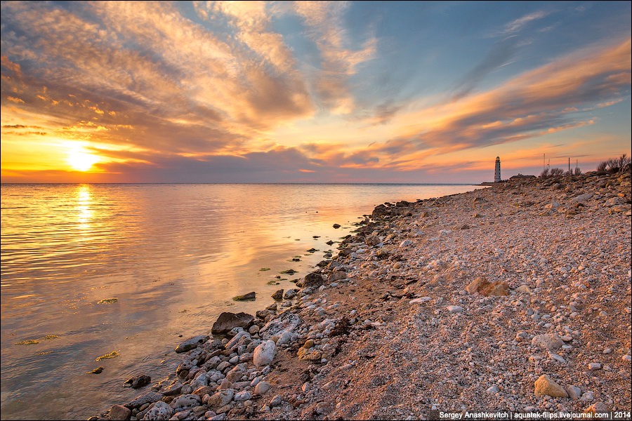
Chersonese lighthouse in Sevastopol
No comments · Posted by Sergei Rzhevsky in Photos, Travel
Chersonese lighthouse is located at the entrance to Sevastopol bay, in its southwestern part, at Cape Chersonese. The lighthouse was built in 1816 and throughout its long life played an important role in the history of the Black Sea Fleet.
During the Second World War, the lighthouse tower was destroyed, but it was rebuilt in 1950-1951. Up to this day, it provides safe navigation on the sea way to Sevastopol. Photos by Sergey Anashkevitch
Tags: Crimea Republic · Sevastopol city
What a beautiful view! Morning on Mount North Demerji (1356 meters) in the Crimea. Photo by Vladimir Metzger
Tags: Crimea Republic · landscapes
17
Let’s walk around Cape Tarkhankut in the Crimea
No comments · Posted by Sergei Rzhevsky in Nature, Photos, Regions
Tarhankut is a cape located in the most western point of the Crimea, on the peninsula bearing the same name. It is a popular place for diving, windsurfing, kiteboarding.
From April to October, the sun shines brightly, and the water in July and August warms up to +28 ° C. There are no rivers nearby, so the water is crystal clear. Tarhankut is interesting for its steep banks and beautiful cliffs. Cape Tarhankut location on Google Maps. Photos by Sergey Stepanenko

wonderful views of the Crimean nature
Tags: Crimea Republic · landscapes