
TAG | Zakarpattia oblast
24
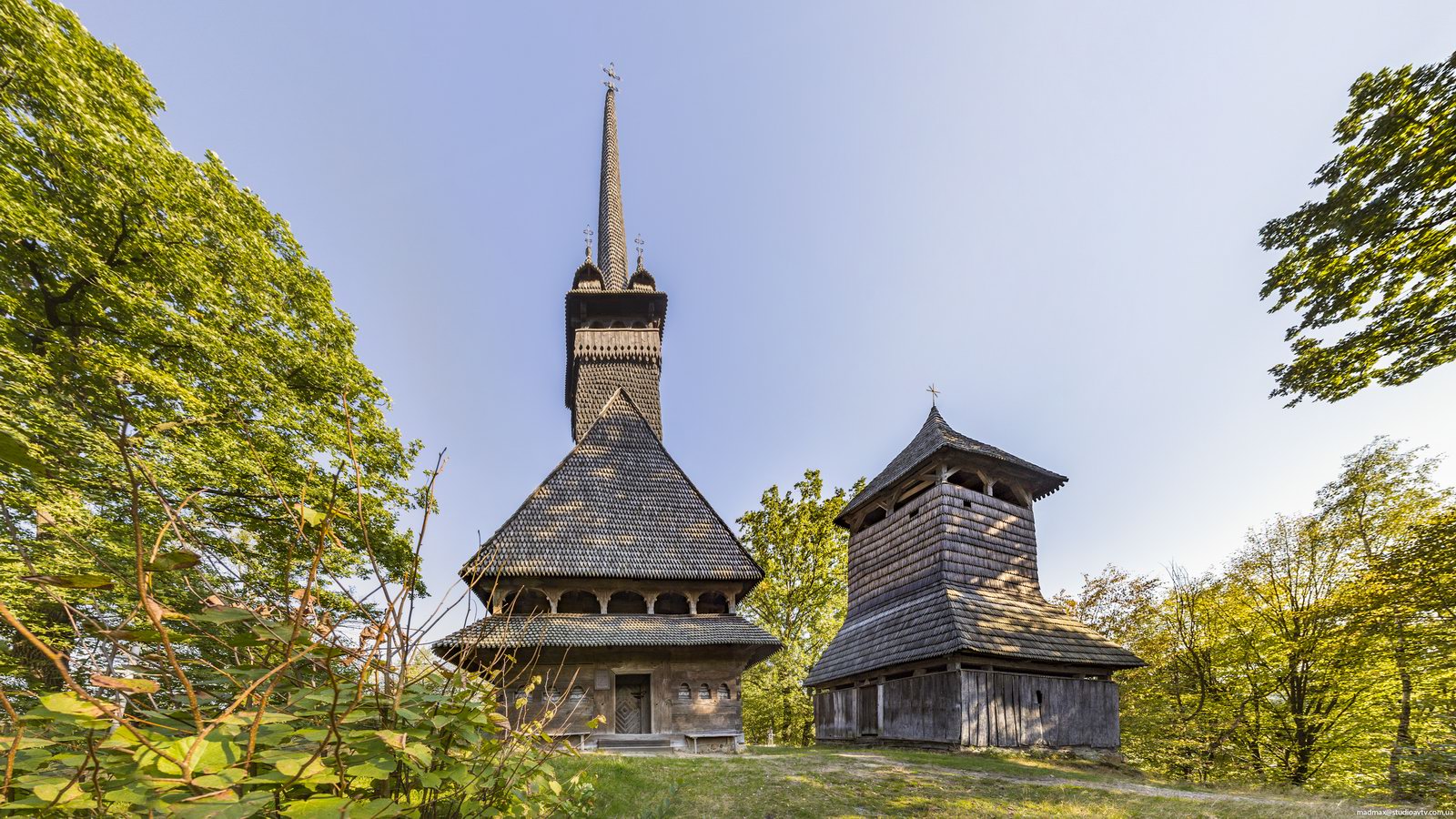
Stunning Wooden Church in Danylovo
No comments · Posted by Sergei Rzhevsky in Regions, Religion, Travel
One of the main attractions of Danylovo, a village located on the territory of the Khust district of Zakarpattia Oblast, is a very picturesque wooden Church of St. Nicholas built in 1779.
This is undoubtedly one of the most beautiful churches in Transcarpathia. Today, following restoration in 1968, it is one of the finest examples of 18th-century Carpathian wooden churches. Danylovo on Google Maps. Photos by: Maxim Ritus.

Tags: church · Zakarpattia oblast
6
Blooming Carpathians – Chornohora Mountain Range
No comments · Posted by Sergei Rzhevsky in Nature, Photos, Regions
Chornohora is the highest mountain range in the Ukrainian Carpathians located on the border of Zakarpattia Oblast and Ivano-Frankivsk Oblast.
It is especially beautiful here when the slopes of the mountain range are covered with blooming rhododendrons. Chornohora on Google Maps. Photos by: Alexander Kotenko.
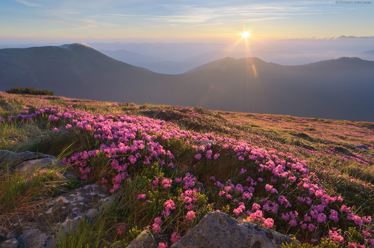
beautiful flowering mountain landscapes
Tags: Ivano-Frankivsk oblast · landscapes · Zakarpattia oblast
9
Sakura Blossom in Uzhhorod
No comments · Posted by Sergei Rzhevsky in Cities, Photos, Travel
If you visit Uzhhorod, the capital of Zakarpattia Oblast, between mid-April and early May, you will see streets adorned with blooming cherry trees.
The cherry blossoms in Uzhhorod are a truly stunning and astonishing spectacle, transforming the city into a veritable Japanese garden. Photos by: Taras Kashchak.

Tags: Uzhgorod city · Zakarpattia oblast
22
The Museum of Folk Architecture and Rural Life in Uzhhorod
No comments · Posted by Sergei Rzhevsky in Culture, History, Travel
The Transcarpathian Museum of Folk Architecture and Rural Life is an open-air museum located in the city of Uzhhorod, the capital of Zakarpattia Oblast of Ukraine.
It features architectural monuments from old Transcarpathian villages and examples of the oldest and widespread forms of folk applied art. The Museum of Folk Architecture in Uzhhorod on Google Maps. Photos by: Taras Kashchak.
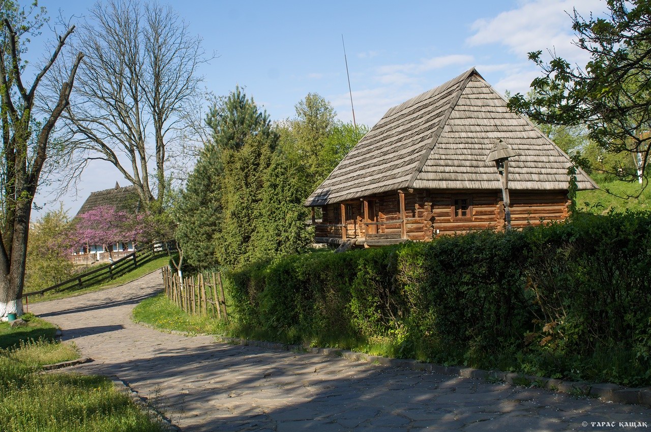
scenic museum in the center of Uzhhorod
Tags: museum · Uzhgorod city · Zakarpattia oblast
4
Snowy Winter on Mount Pip Ivan Chornohora
No comments · Posted by Sergei Rzhevsky in Nature, Regions, Travel
In the Ukrainian Carpathians, there are two peaks named Pip Ivan. One of them is located in Ukraine’s highest and most popular mountain range, Chornohora, hence the peak’s name, Pip Ivan Chornohora (2,028 m), or Pipivan, or Black Mountain. It is the third-highest peak in the Carpathians and the easternmost of the six two-thousanders. Its significantly lower namesake, Pip Ivan Marmaroshsky (1,936 m), is located in the Marmarosy mountain range.
The mountain is located in the southeastern part of the mountain range, on the border of Ivano-Frankivsk Oblast and Zakarpattia Oblast. Mount Pip Ivan Chornohora on Google Maps. Photos by: Alexander Kotenko.
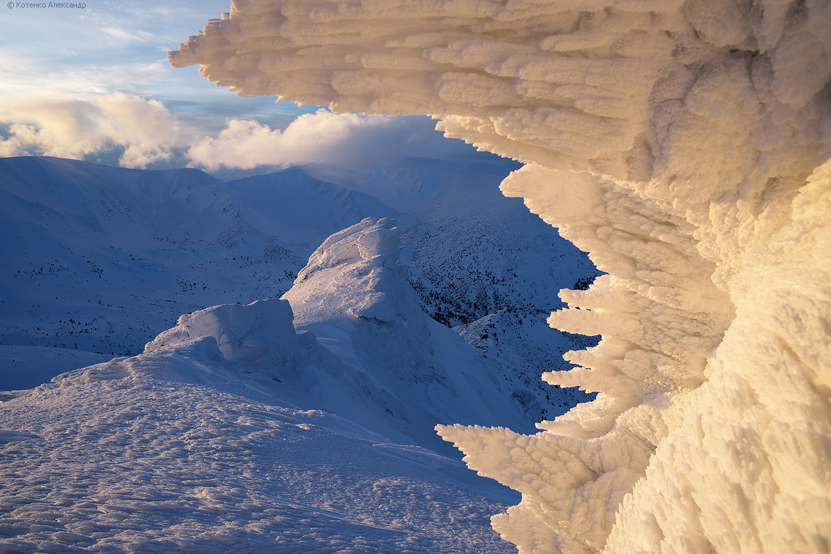
the main sight of the mountain
Tags: Ivano-Frankivsk oblast · Zakarpattia oblast
18
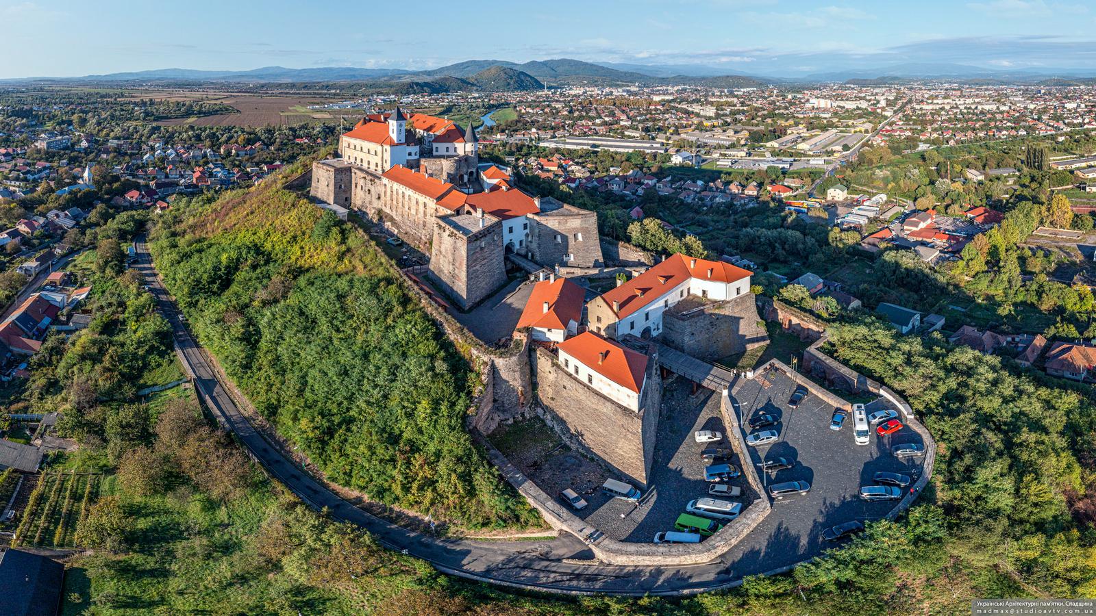
Palanok – One of the Most Beautiful Castles in Ukraine
No comments · Posted by Sergei Rzhevsky in Architecture, History, Video
Palanok Castle, also known as Mukachevo Castle, is a picturesque castle in the city of Mukachevo in Zakarpattia Oblast of Ukraine. Situated on a 68-meter-high volcanic mountain, it covers an area of 13,930 square meters. This castle is an outstanding historical, architectural, military-fortification and historical monument of Transcarpathia of the 14th-18th centuries.
The castle’s exact founding date is unknown; it is first mentioned in documents dating back to the 11th century. Its name derives from its construction. A moat was originally dug around the mountain and filled with water. Its inner bank was surrounded by an oak palisade, called a “palanok.” The castle houses a historical museum, an art gallery with an exhibition of contemporary paintings, and an art salon.
Tags: Mukachevo city · Zakarpattia oblast
12
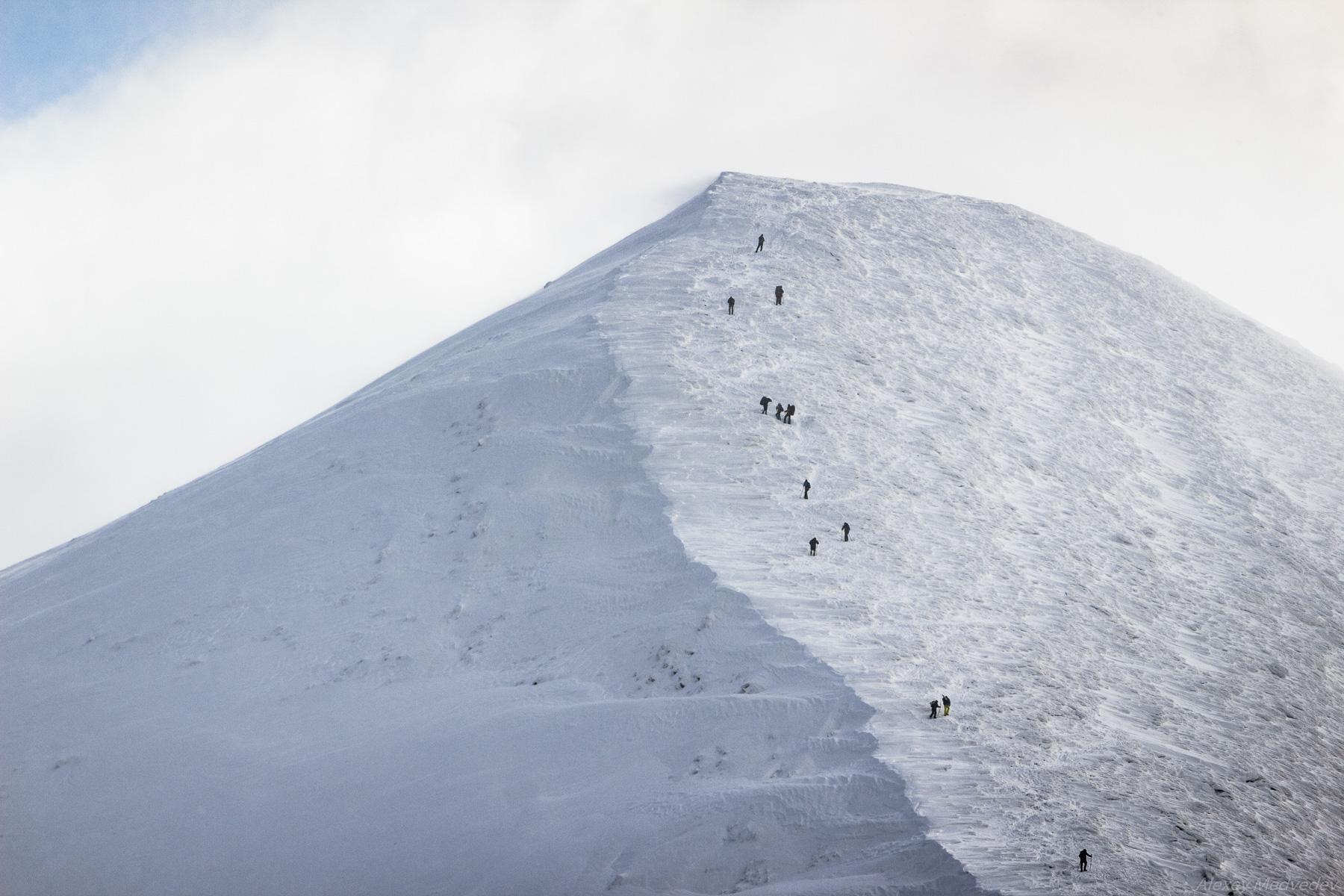
Climbing Mount Hoverla in Winter
No comments · Posted by Sergei Rzhevsky in Nature, Regions, Travel
Hoverla (in Romanian, “Howarla” means “insurmountable height”) is the highest mountain and the highest point in Ukraine (2,061 m above sea level). It is located on the border of Zakarpattia Oblast and Ivano-Frankivsk Oblast, approximately 17 km from the Ukrainian border with Romania.
It’s a popular destination for summer and winter tourism. The first hiking route up the mountain was opened in 1880. In the north, you can see the cities of Ivano-Frankivsk Oblast: Ivano-Frankivsk, Kolomyia, and Snyatin. Mount Hoverla on Google Maps. Photos by: Alexey Medvedev.
Tags: Ivano-Frankivsk oblast · Zakarpattia oblast
22
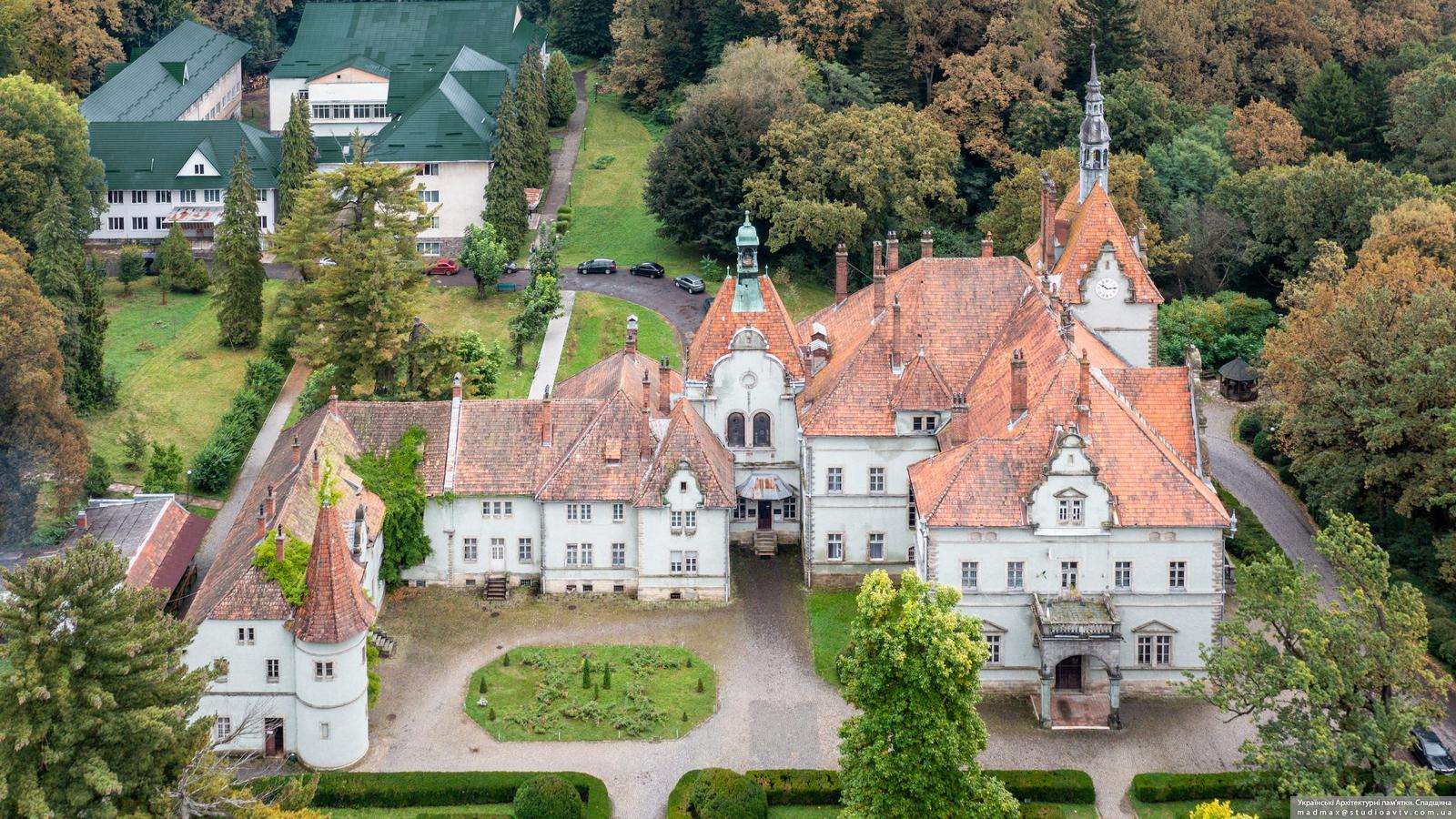
The Palace of the Counts of Shenborn in Zakarpattia Oblast
No comments · Posted by Sergei Rzhevsky in Architecture, Regions
The Schenborn (Schönborn) Palace, also known as the Beregvar Hunting Lodge, is the former residence and hunting lodge of the prominent Austro-Hungarian aristocratic dynasty of Schönborn, which included several high-ranking members of the Roman Catholic clergy. Representatives of this family were the largest landowners in Transcarpathia.
This architectural monument of national importance, which currently houses the sanatorium “Karpaty” (“Carpathians”), is located in the village of Karpaty, about 17 km north-east of Mukachevo in Zakarpattia Oblast. The Schenborn Palace on Google Maps. Photos by: Maxim Ritus.
Tags: Mukachevo city · Uzhgorod city · Zakarpattia oblast
11
The Palanok Castle in Mukachevo
No comments · Posted by Sergei Rzhevsky in Architecture, Travel
The Palanok Castle or Mukachevo Castle is a very picturesque castle located in the city of Mukachevo in Zakarpattia Oblast of Ukraine.
It is a unique example of medieval fortification architecture with a combination of different styles, an architectural monument of national importance. Today, the Mukachevo Castle houses a historical museum. Photos by: Maxim Ritus.
Tags: fortress · Mukachevo city · Zakarpattia oblast
22
Vynohradiv – One of the Oldest Towns of Transcarpathia
No comments · Posted by Sergei Rzhevsky in Cities, Photos, Travel
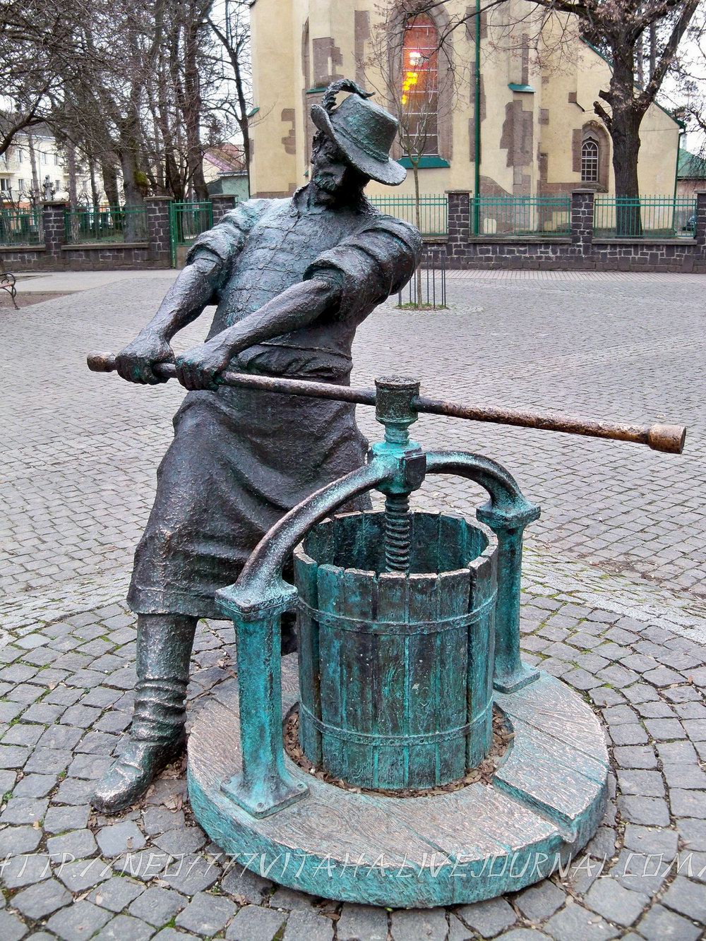
Vynohradiv (until 1946 – Sevlush) is a small town with a population of about 25,000 people located in the southern part of Zakarpattia Oblast, about 94 km southeast of Uzhhorod. The distance to the border with Hungary is 16 km, Romania – 10 km, Slovakia – 80 km, Poland – 110 km. Vynohradiv is one of the oldest settlements in Transcarpathia. There was a Slavic settlement here already in the 9th century AD. Photos by: neo7777vitaha.
The monument to the winemaker in Vynohradiv. It was installed in the central square of the town, not far from the complex of buildings of the Franciscan monastery, in 2011. According to one legend, it was the Franciscans who were the first in the region to master winemaking. The monument depicts a man dressed in national Hungarian clothing and working at a wine press.
walk the streets of Vynohradiv
Tags: Zakarpattia oblast