
TAG | Ivano-Frankivsk oblast
14
Church of St. Panteleymon in Shevchenkove
No comments · Posted by Sergei Rzhevsky in Architecture, Photos, Regions
Shevchenkove is a very small village with a population of about 150 people located in the Halych district of the Ivano-Frankivsk region, 28 km north of Ivano-Frankivsk.
Here you can find remains of old defensive ramparts and a unique architectural monument of national importance – Church of St. Panteleymon (1194), the oldest church in Western Ukraine.
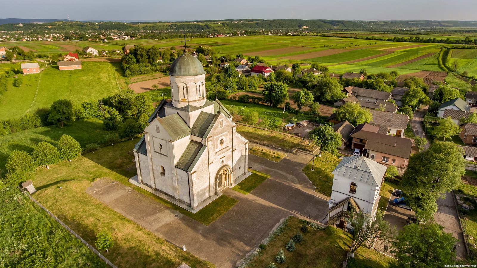

Tags: church · Ivano-Frankivsk oblast
10
In the center of Old Halych, the capital of Galicia, in Krylos
2 Comments · Posted by Sergei Rzhevsky in History, Regions
When it comes to Old Halych, the capital of Galicia, and later the Principality of Galicia-Volhynia, we mean not the present town of Halych, but the village of Krylos located southwest of it, in the Halych district of the Ivano-Frankivsk region.
Most of the monuments of archeology, architecture and history of the old capital are found here, which together with the historical center of Halych and several other nearby historical places form the national reserve “Old Halych”. Krylos on Google Maps. Photos by: Maxim Ritus.
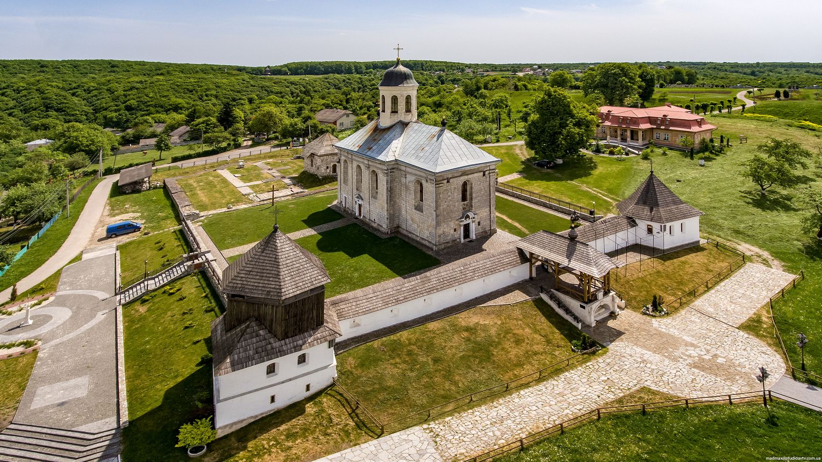
fly over the very center of Galicia
Tags: church · Ivano-Frankivsk oblast
28
Attractions of the Ukrainian Carpathians
No comments · Posted by Alex Smirnov in Regions, Travel, Video
The Ukrainian Carpathians are part of the Carpathian mountain system located in western Ukraine, mainly on the territory of the Lviv, Ivano-Frankivsk, Zakarpattia, and Chernivtsi regions, with a total area of about 24 thousand square kilometers.
The absolute heights of this picturesque mountain system range from 120-400 meters at the foot of the mountains to 500-800 meters in intermontane depressions and 1,500-2,000 meters along the main ridges.
Tags: Chernovtsy oblast · Ivano-Frankivsk oblast · Lviv oblast · Zakarpattia oblast
7
Hoverla – the Highest Mountain in Ukraine
No comments · Posted by Alex Smirnov in Nature, Travel, Video
Hoverla (in Romanian meaning “an impassable height”) is the highest mountain on the territory of Ukraine (2,061 meters).
This popular tourist destination is located on the border of the Zakarpattia and Ivano-Frankivsk regions, about 17 km from the border with Romania. Hoverla on Google Maps.
Tags: Ivano-Frankivsk oblast · Zakarpattia oblast
12
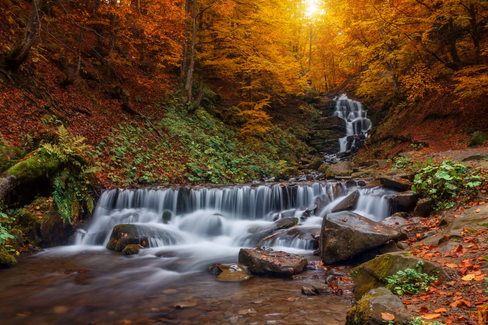
Top 10 photos of Ukrainian nature in 2016
No comments · Posted by Sergei Rzhevsky in Nature, Photos, Regions
Wiki Loves Earth is an annual international photo contest of the natural monuments and here are the best photos of the natural attractions of Ukraine taken in 2016.
Shypit waterfall – a hydrological natural monument located in the Ukrainian Carpathians, about 6 km from Pylypets village in Mizhhiria district of Zakarpattia oblast. Author: Yekaterina Krasnickaja.
Tags: Chernovtsy oblast · Dnepropetrovsk oblast · Ivano-Frankivsk oblast · Nikolaev oblast · Zakarpattia oblast
6
Golden Autumn on Sokilsky Ridge in the Carpathians
No comments · Posted by Sergei Rzhevsky in Nature, Regions, Travel
Sokilsky Ridge is located in Pokutsko-Bukovina Carpathians (part of the Ukrainian Carpathians), south of Kolomyya, in the Kosovsky district of the Ivano-Frankivsk region.
The length of the ridge is about 15 km, the maximum height – 940 m. It stretches from the northwest to the southeast between the rivers Ribnitsa and Cheremosh, from Sokolivka village to Velykyi Rozhyn village. Sokilsky Ridge on Google Maps. Photos by: Oleksandr Kotenko.
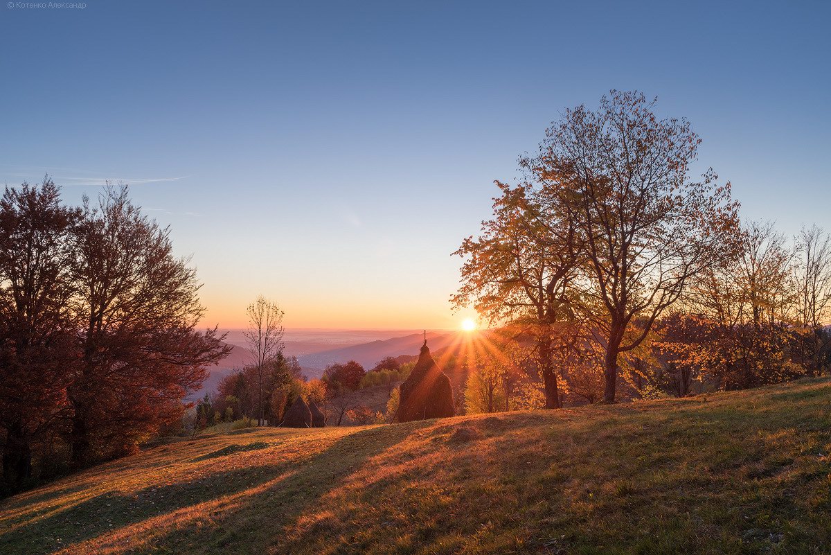
golden autumn in all its glory
Tags: Ivano-Frankivsk oblast
28
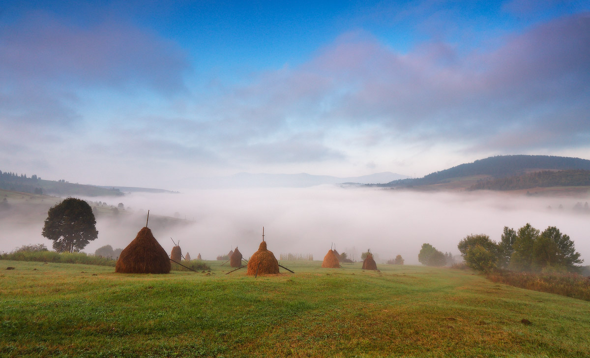
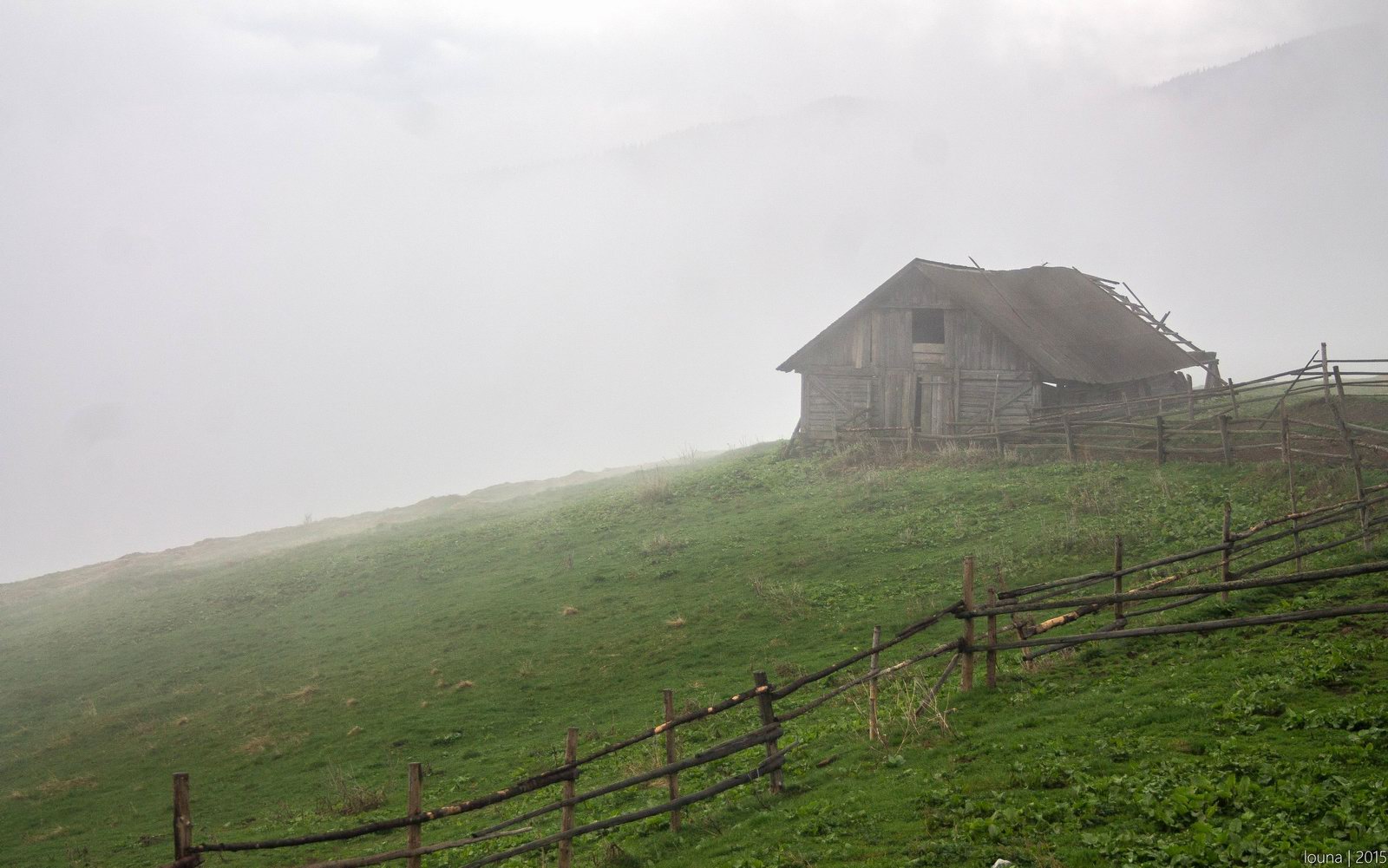
One foggy autumn morning in the Carpathians
No comments · Posted by Sergei Rzhevsky in Nature, Regions
The Ukrainian Carpathians, located in the west of Ukraine mainly in the Lviv, Ivano-Frankivsk, Zakarpattia, and Chernivtsi regions, are beautiful at any time of the year! One foggy morning in September. Photos by: Maxim Weise.
Tags: Chernovtsy oblast · Ivano-Frankivsk oblast · Lviv oblast · Zakarpattia oblast
8
Let’s go hiking on Chornohora range
No comments · Posted by Sergei Rzhevsky in Nature, Regions, Travel
Chornohora mountain range is one of the most beautiful places in Ukraine stretching for 40 kilometers from north-west to south-east. It is a border between Zakarpattia and Ivano-Frankivsk oblasts.
Chornohora is the highest mountain system in Ukraine. Only here you can find mountain peaks about 2 km high. This mountain range is known for its preserved mountain ecosystems and virgin forests. The area is part of the Carpathian reserve and Carpathian national park. Photos by: levk_777.
Tags: Ivano-Frankivsk oblast · Zakarpattia oblast
3
One fine day in the Ukrainian Carpathians
No comments · Posted by Alex Smirnov in Nature, Video
This beautiful video was filmed on Pip Ivan Mountain (2,020 meters) – one of the highest peaks of Chornohora mountain range of the Ukrainian Carpathians, located in the south-eastern end of the mountain range, on the border of the Ivano-Frankivsk region and Zakarpattia region regions.
Tags: Ivano-Frankivsk oblast · Zakarpattia oblast
25
One sunny April day in the Ukrainian Carpathians
No comments · Posted by Sergei Rzhevsky in Nature, Photos
The Ukrainian Carpathians are part of the Carpathian mountain system located in the west of Ukraine, mainly in the Lviv, Ivano-Frankivsk, Zakarpattia, and Chernivtsi regions.
As spring is just around the corner, let’s take a look at the Ukrainian Carpathians in April, when all the snow melted and the hillsides are covered with the first greenery. Photos by: Maxim Weise.
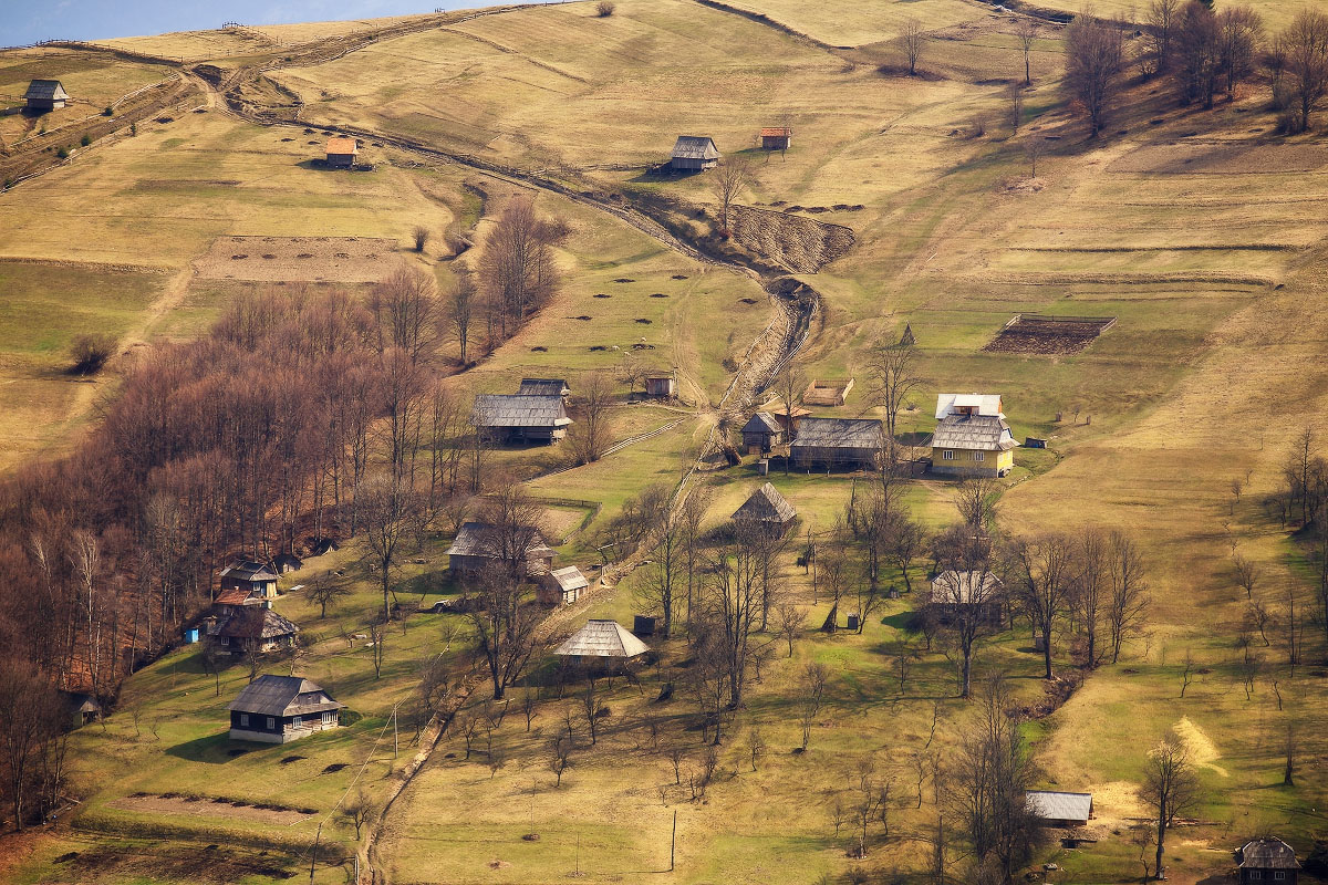
sunny spring day in the mountains
Tags: Chernovtsy oblast · Ivano-Frankivsk oblast · Lviv oblast · Zakarpattia oblast