
TAG | Zakarpattia oblast
21
Church of the Archangel Michael in Vyshka
No comments · Posted by Sergei Rzhevsky in Architecture, Regions, Travel
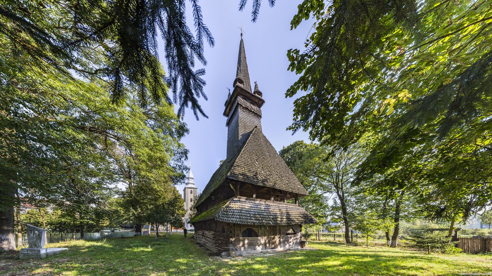
The main attraction of Vyshka village, located in Velykyi Bereznyi district of the Zakarpattia region, is an old wooden church of the Archangel Michael.
This church, an architectural monument of national importance, was built approximately in 1700. At the end of the 20th century, the roof of the church was covered with iron plates, which greatly changed its original appearance. Vyshka village on Google Maps. Photos by: Maxim Ritus.
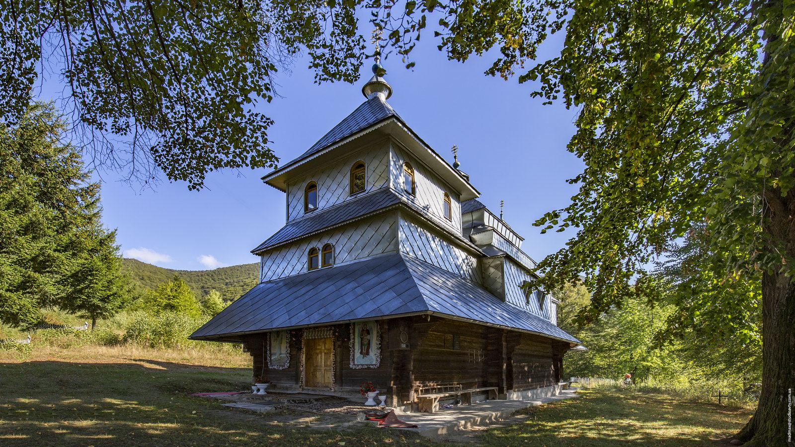
the church that looks like an ironclad

Tags: church · Zakarpattia oblast
15
Church of the Archangel Michael in Krainykovo
No comments · Posted by Sergei Rzhevsky in Architecture, Photos, Regions
Krainykovo is a village with a population of about 1,500 people located in Khust district of the Zakarpattia region, 126 km southeast of Uzhhorod.
The main attraction of the village is the wooden Gothic Church of the Archangel Michael built in 1668. This is one of the oldest churches in the area and one of the most original places of worship in the region.

Tags: church · Zakarpattia oblast
26
St. Michael Church in Svalyava
No comments · Posted by Sergei Rzhevsky in Architecture, Photos, Travel
Svalyava is a small town with a population of about 17 thousand people located in the center of the Zakarpattia region, in a picturesque valley surrounded by mountains.
One of the main attractions of the town is St. Michael Church (1759), situated on the southern outskirts. This is one of the most perfect churches of Transcarpathia and a beautiful example of Lemko folk architecture.
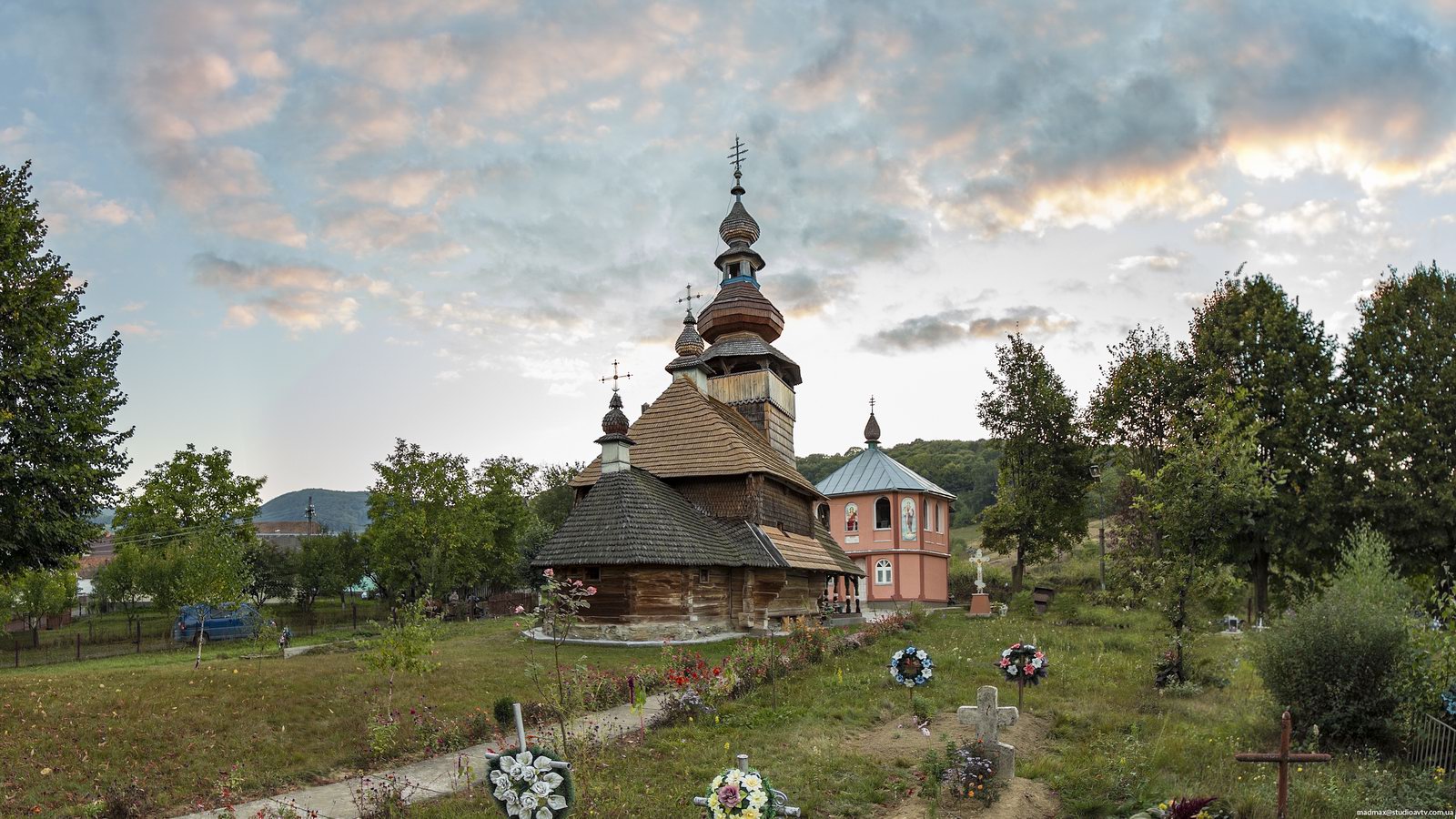
wonderful monument of wooden architecture
Tags: church · Zakarpattia oblast
17
Church of the Dormition in Novoselytsya
No comments · Posted by Sergei Rzhevsky in Architecture, Photos, Religion
Novoselytsya, a village founded in 1600, is located in the Vynohradiv district of the Zakarpattia region. It is famous for its wooden church, Church of the Dormition, built in 1669.
The uniqueness of the church is that it is the smallest wooden Gothic church in Transcarpathia. Its proportions are considered ideal. The church is made of oak without a single nail.
Tags: church · Zakarpattia oblast
18
Explore the ruins of Nevytsky Castle
No comments · Posted by Sergei Rzhevsky in History, Regions, Travel
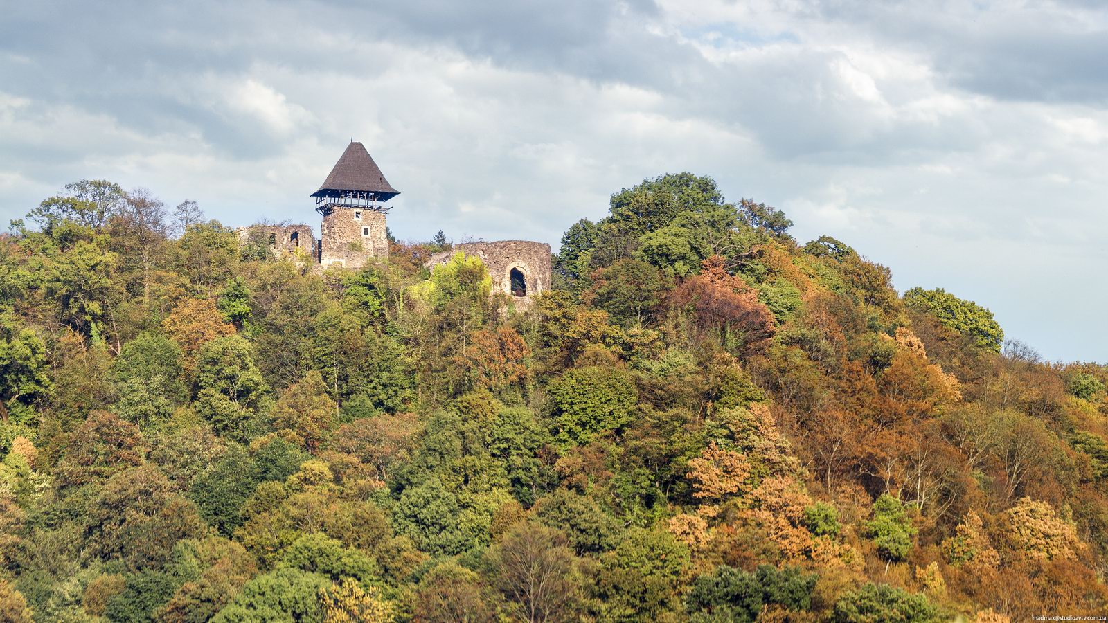
Nevytsky Castle can be found near the village of Kamyanytsya in the Zakarpattia region, about 12 kilometers northeast of Uzhgorod, the capital city of the region.
The castle was built on a hill above the Uzh River in the 13th century, on the site of an earlier wooden fortifications. In 1241, it was destroyed during the Mongol invasion, but, in the second half of the 13th century, it was restored.
Tags: Uzhgorod city · Zakarpattia oblast
10
Church of St. Nicholas in Sokyrnytsya
No comments · Posted by Sergei Rzhevsky in Architecture, Religion, Travel
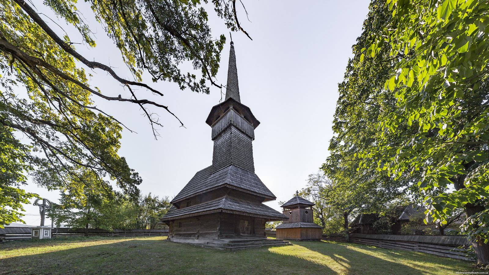
Church of St. Nicholas in Sokyrnytsya, a village in the Khust district of the Zakarpattia region, is one of the oldest wooden churches of Transcarpathia, a nice example of wooden Gothic.
The church was originally built in the village of Shashvar (present Trosnik in the Vynohradiv district) in 1709. In 1770, the rebuilt church was moved to Sokyrnytsya. Near the church you can see a tall bell tower of the same year of construction.
Tags: church · Zakarpattia oblast
3
One fine day in the Ukrainian Carpathians
No comments · Posted by Alex Smirnov in Nature, Video
This beautiful video was filmed on Pip Ivan Mountain (2,020 meters) – one of the highest peaks of Chornohora mountain range of the Ukrainian Carpathians, located in the south-eastern end of the mountain range, on the border of the Ivano-Frankivsk region and Zakarpattia region regions.
Tags: Ivano-Frankivsk oblast · Zakarpattia oblast
25
The Hunting Palace of the Counts Schonborn
No comments · Posted by Sergei Rzhevsky in Architecture, Regions, Travel
Schonborn Palace, the former residence and hunting lodge of the Counts Schonborn and the sanatorium “Carpathians” (since 1946), is located near the city of Mukacheve in the Zakarpattia region.
The palace was built by the Count Erwin Friedrich Schonborn-Bukhgeim in neo-romantic style, combining Romanesque and Gothic motifs, in 1890-1895.

Tags: Mukachevo city · Zakarpattia oblast
25
One sunny April day in the Ukrainian Carpathians
No comments · Posted by Sergei Rzhevsky in Nature, Photos
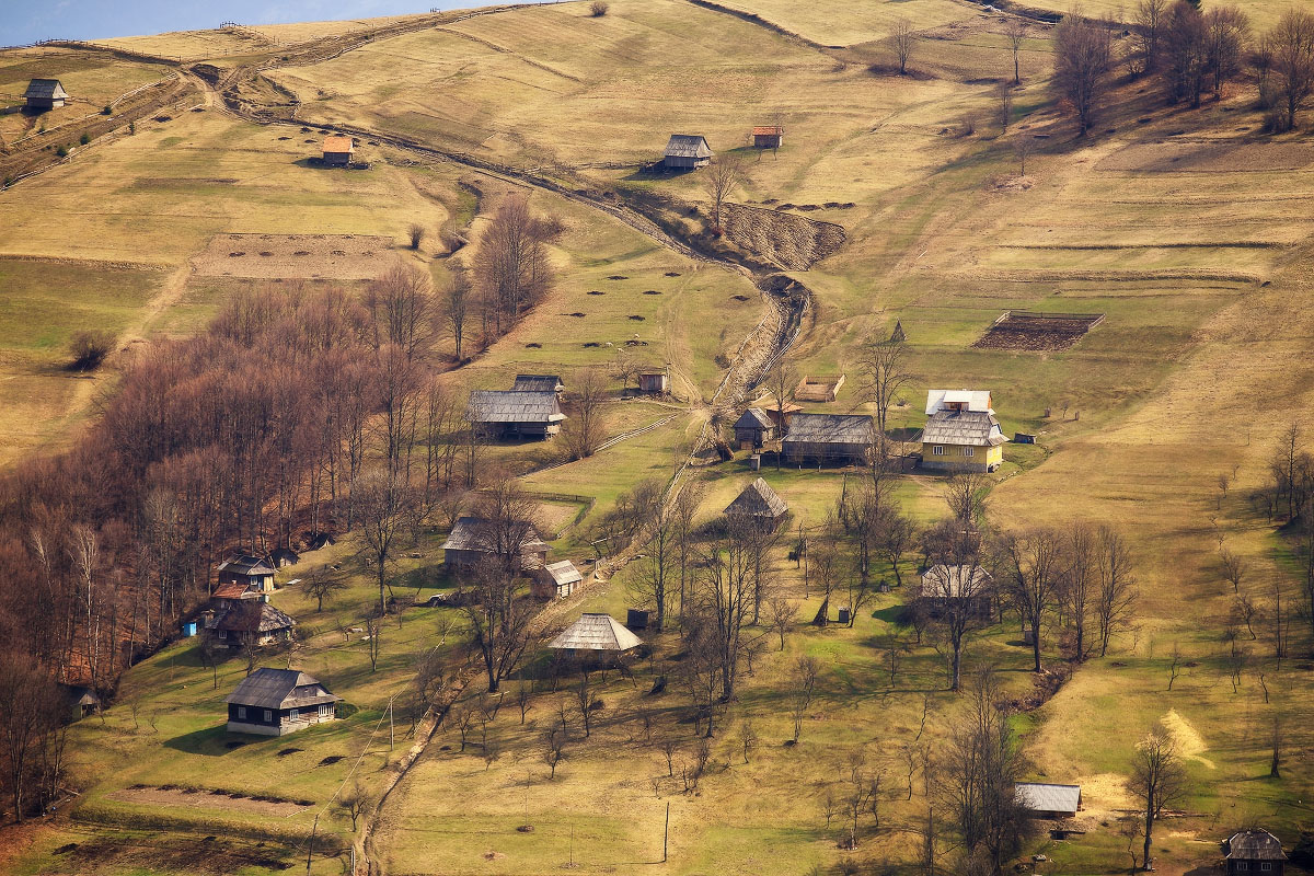
The Ukrainian Carpathians are part of the Carpathian mountain system located in the west of Ukraine, mainly in the Lviv, Ivano-Frankivsk, Zakarpattia, and Chernivtsi regions.
As spring is just around the corner, let’s take a look at the Ukrainian Carpathians in April, when all the snow melted and the hillsides are covered with the first greenery. Photos by: Maxim Weise.
sunny spring day in the mountains
Tags: Chernovtsy oblast · Ivano-Frankivsk oblast · Lviv oblast · Zakarpattia oblast
7
The mountain ranges of Gorgany in winter
No comments · Posted by Sergei Rzhevsky in Nature, Photos, Travel
Gorgany is a system of mountain ranges extending up to 75 km in the outer band of the Ukrainian Carpathians, in the Ivano-Frankivsk and Zakarpattia regions. The width from east to west is about 40 km.
The name comes from the name of rock slides called “gorgan”. The highest peak is Mount Syvulia (1836 m). This area is very popular among tourists, here you can find the most wild routes in the Carpathians.

Tags: Ivano-Frankivsk oblast · landscapes · Zakarpattia oblast