TAG | Zakarpattia oblast
25
Church of the Ascension (Strukivska) in Yasinya
No comments · Posted by Sergei Rzhevsky in Architecture, Photos, Regions
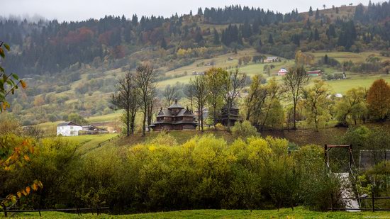
Among the attractions of Transcarpathia, the architecture of the Hutsuls, one of the indigenous peoples of the Carpathians, occupies a special place with its unique and beautiful wooden churches.
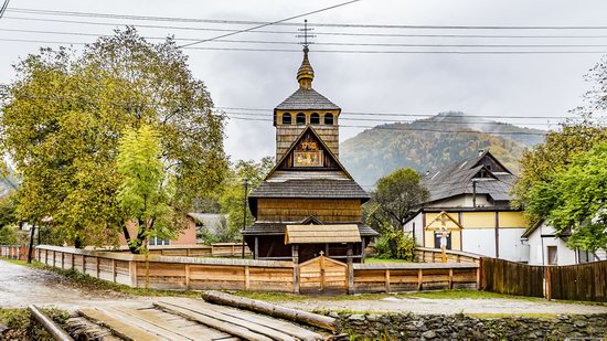
Church of the Ascension (Strukivska) in the urban village of Yasinya located in the east of the Zakarpattia region is one of these old and amazing churches. Yasinya on Google Maps. Photos by: Maxim Ritus.
picturesque monument of wooden architecture
Tags: church · Zakarpattia oblast
28
Wooden Churches St. Nicholas in Serednje Vodyane
No comments · Posted by Sergei Rzhevsky in Architecture, Photos, Regions
Serednje Vodyane is a large village with a population of about 6.5 thousand people located in the Rakhiv district of the Zakarpattia region, 162 km southeast of Uzhhorod, near the border with Romania.
In the village there are two old wooden churches dedicated to St. Nicholas – The Upper Church of St. Nicholas and The Lower Church St. Nicholas – beautiful monuments of Transcarpathian architecture. Serednje Vodyane on Google Maps. Photos by: Maxim Ritus.
The Upper Church of St. Nicholas.
Tags: church · Zakarpattia oblast
28
Attractions of the Ukrainian Carpathians
No comments · Posted by Alex Smirnov in Regions, Travel, Video
The Ukrainian Carpathians are part of the Carpathian mountain system located in western Ukraine, mainly on the territory of the Lviv, Ivano-Frankivsk, Zakarpattia, and Chernivtsi regions, with a total area of about 24 thousand square kilometers.
The absolute heights of this picturesque mountain system range from 120-400 meters at the foot of the mountains to 500-800 meters in intermontane depressions and 1,500-2,000 meters along the main ridges.
Tags: Chernovtsy oblast · Ivano-Frankivsk oblast · Lviv oblast · Zakarpattia oblast
9
Mukachevo – walk through the town center
No comments · Posted by Sergei Rzhevsky in Cities, Travel
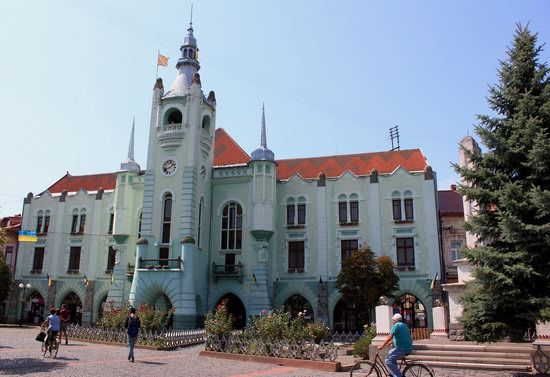
Mukachevo is a town with a population of about 86,000 people located in the central part of the Zakarpattia region, 41 km south-east of Uzhhorod.
The town has a high tourist potential for both Ukrainian tourists and foreigners. Ukrainians like to come here to visit the Palanok Castle, St. Nicholas Convent, as well as the town center with its paved streets and cozy cafes. Photos by: Igor Golovach.
explore the center of Mukachevo
Tags: Mukachevo city · Zakarpattia oblast
7
Hoverla – the Highest Mountain in Ukraine
No comments · Posted by Alex Smirnov in Nature, Travel, Video
Hoverla (in Romanian meaning “an impassable height”) is the highest mountain on the territory of Ukraine (2,061 meters).
This popular tourist destination is located on the border of the Zakarpattia and Ivano-Frankivsk regions, about 17 km from the border with Romania. Hoverla on Google Maps.
Tags: Ivano-Frankivsk oblast · Zakarpattia oblast
6
Palanok Castle in Mukacheve
No comments · Posted by Sergei Rzhevsky in Architecture, History, Travel
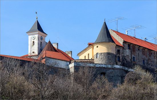
The Palanok Castle, also known as Mukacheve Castle, is the main attraction of the town of Mukacheve located in the Zakarpattia region. The castle stands on a 68-meter-high hill of volcanic origin, the total area of the castle is 13,930 square meters.
The exact date of the founding of the castle is unknown. For the first time it was mentioned in documents in the 11th century. The fortifications were built and rebuilt several times. The castle’s buildings that have survived to this day belong to the 14th-17th centuries. Today, there is a historical museum here. Photos by: Igor Salnikov.
Tags: fortress · Mukachevo city · Zakarpattia oblast
16
Church of the Nativity of the Blessed Virgin in Dilove
No comments · Posted by Sergei Rzhevsky in Culture, Photos, Regions
Dilove is a village with a population of about 2,500 people located in the Rakhiv district of the Zakarpattia region, 190 km from Uzhhorod and 140 km from Ivano-Frankivsk, 50 km from the border with Romania.
The main attraction of the village is the Church of the Nativity of the Blessed Virgin (1750) – a unique monument of folk wooden architecture and a true national cultural treasure. Photos by: Maxim Ritus.
Tags: church · Zakarpattia oblast
23
Winter on the mountain range Pishkonya
No comments · Posted by Sergei Rzhevsky in Nature, Travel
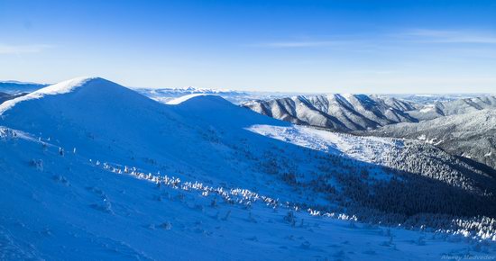
Pishkonya, a mountain range in the Ukrainian Carpathians, is located in the southeastern part of Mizhhiria district of the Zakarpattia region, within the National Park “Synevyr”.
The highest peaks are Nehrovets (1,707 m), Yasnovets (1,600 m), Darvayka (1,501 m). The most convenient ways to climb the range begin in the villages of Synevyr and Kolochava. Pishkonya on Google Maps. Photos by: Alexey Medvedev.
let’s go hiking in the mountains
Tags: Zakarpattia oblast
12
Top 10 photos of Ukrainian nature in 2016
No comments · Posted by Sergei Rzhevsky in Nature, Photos, Regions
Wiki Loves Earth is an annual international photo contest of the natural monuments and here are the best photos of the natural attractions of Ukraine taken in 2016.
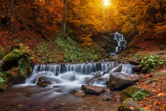
Shypit waterfall – a hydrological natural monument located in the Ukrainian Carpathians, about 6 km from Pylypets village in Mizhhiria district of Zakarpattia oblast. Author: Yekaterina Krasnickaja.
Tags: Chernovtsy oblast · Dnepropetrovsk oblast · Ivano-Frankivsk oblast · Nikolaev oblast · Zakarpattia oblast
16
Church of the Descent of the Holy Spirit in Kolochava
No comments · Posted by Sergei Rzhevsky in Architecture, Regions, Travel
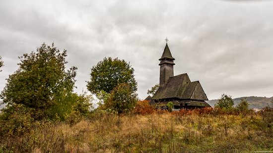
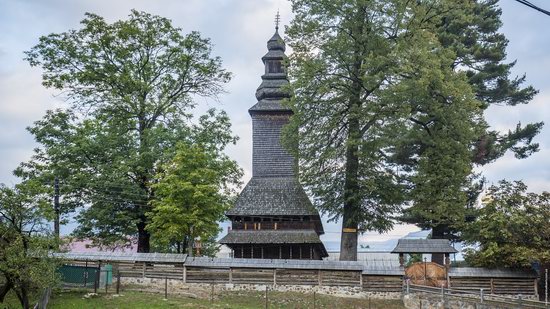
The wooden Greek-Catholic church of the Descent of the Holy Spirit is an architectural monument of the 18th century located in the village of Kolochava in Mizhgirya district of the Zakarpattia region.
The church in Baroque style was built of spruce boards by the master Ferenc Tekke in 1795. Since 1953, this beautiful building was used as a museum of atheism. Photos by: Maxim Ritus.
Tags: church · Zakarpattia oblast

