
CAT | Travel
2
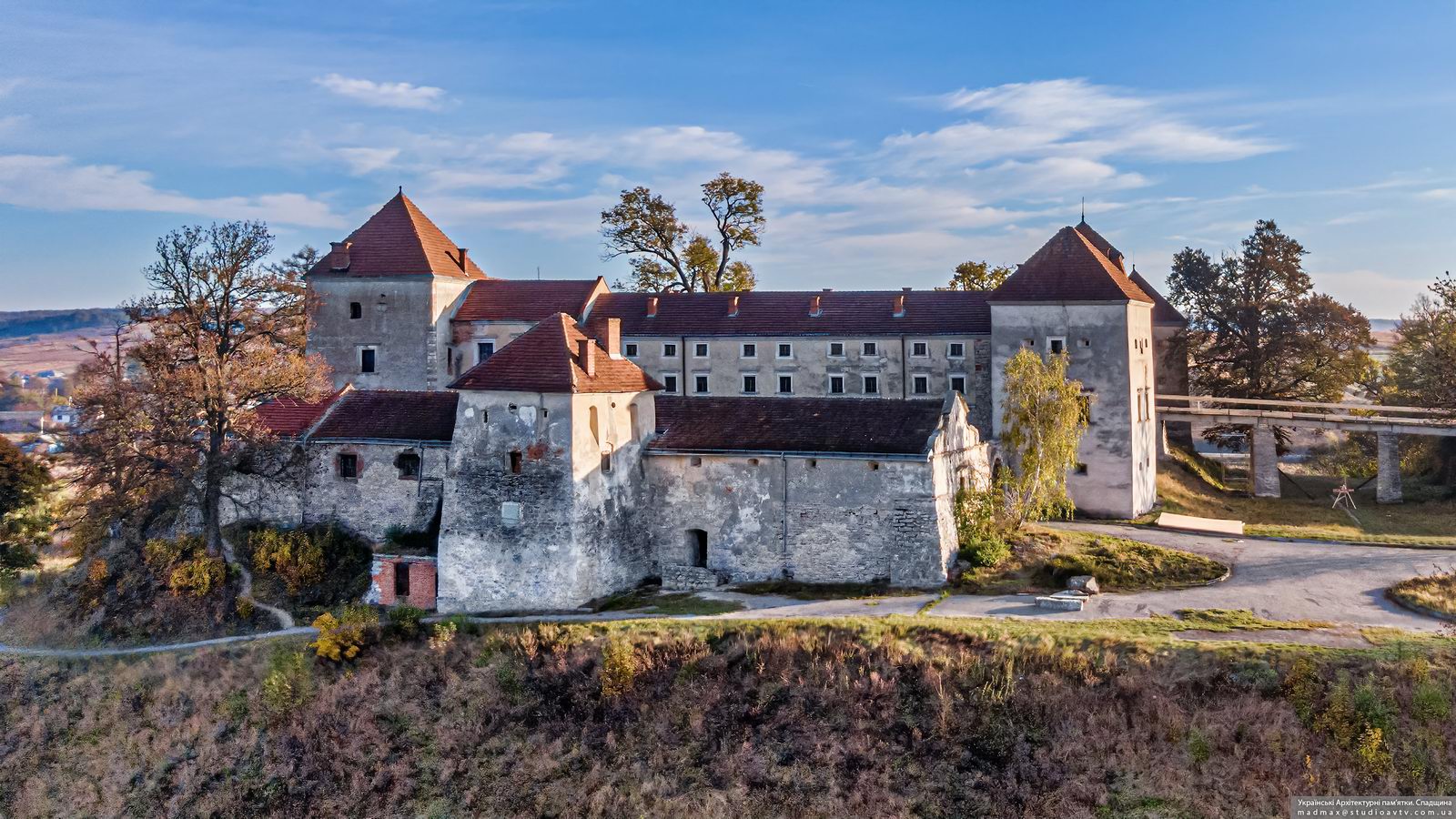
Svirzh Castle – the view from above
No comments · Posted by Sergei Rzhevsky in Architecture, Regions, Travel
Svirzh Castle, a picturesque fortified aristocratic residence, is a unique monument of defense architecture of the 15th-17th centuries located in the village of Svirzh in Lviv Oblast, about 44 km southeast of Lviv.
First mentioned in 1484, it was originally a purely defensive stone building. After numerous renovations, the castle acquired its present form in the middle of the 17th century. In Soviet times, this building was used as a school of tractor drivers. Svirzh Castle on Google Maps. Photos by: Maxim Ritus.

Tags: Lviv oblast
18
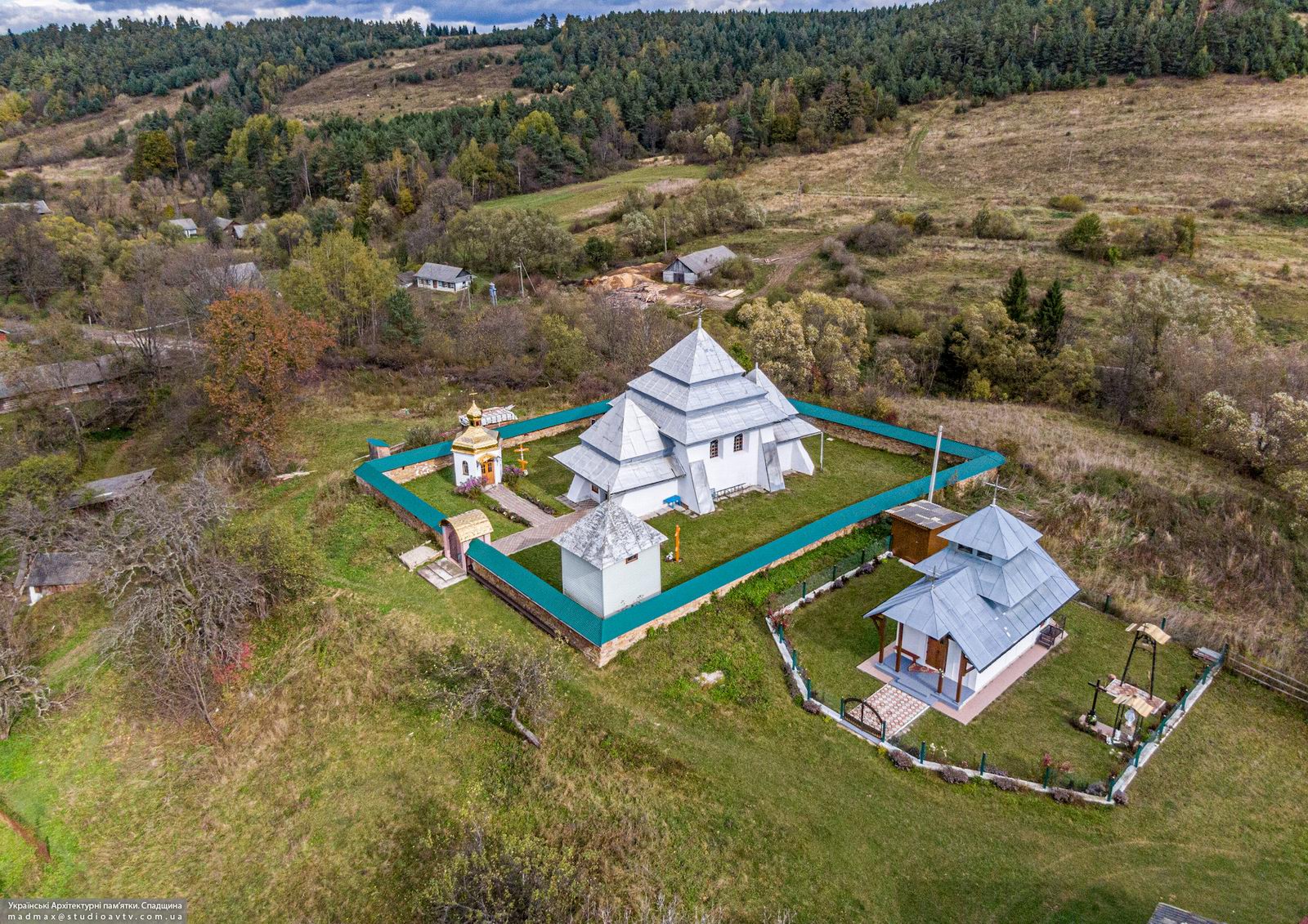
Fortified Church of the Nativity of Our Lady in Rosokhy
No comments · Posted by Sergei Rzhevsky in Architecture, Regions, Travel
Rosokhy is a small village with a population of about 150 people located in Lviv Oblast of Ukraine near the border with Poland, about 123 km southwest of Lviv.
The main attraction of this village is a complex of buildings of the fortified Church of the Nativity of the Blessed Virgin Mary built in the 15th-16th centuries and included in the list of monuments of architecture of national importance. At that time, this region was within the reach of the raids of the Crimean Tatars, therefore there was a need for such fortifications. Rosokhy on Google Maps. Photos by: Maxim Ritus.
Tags: church · Lviv oblast
4
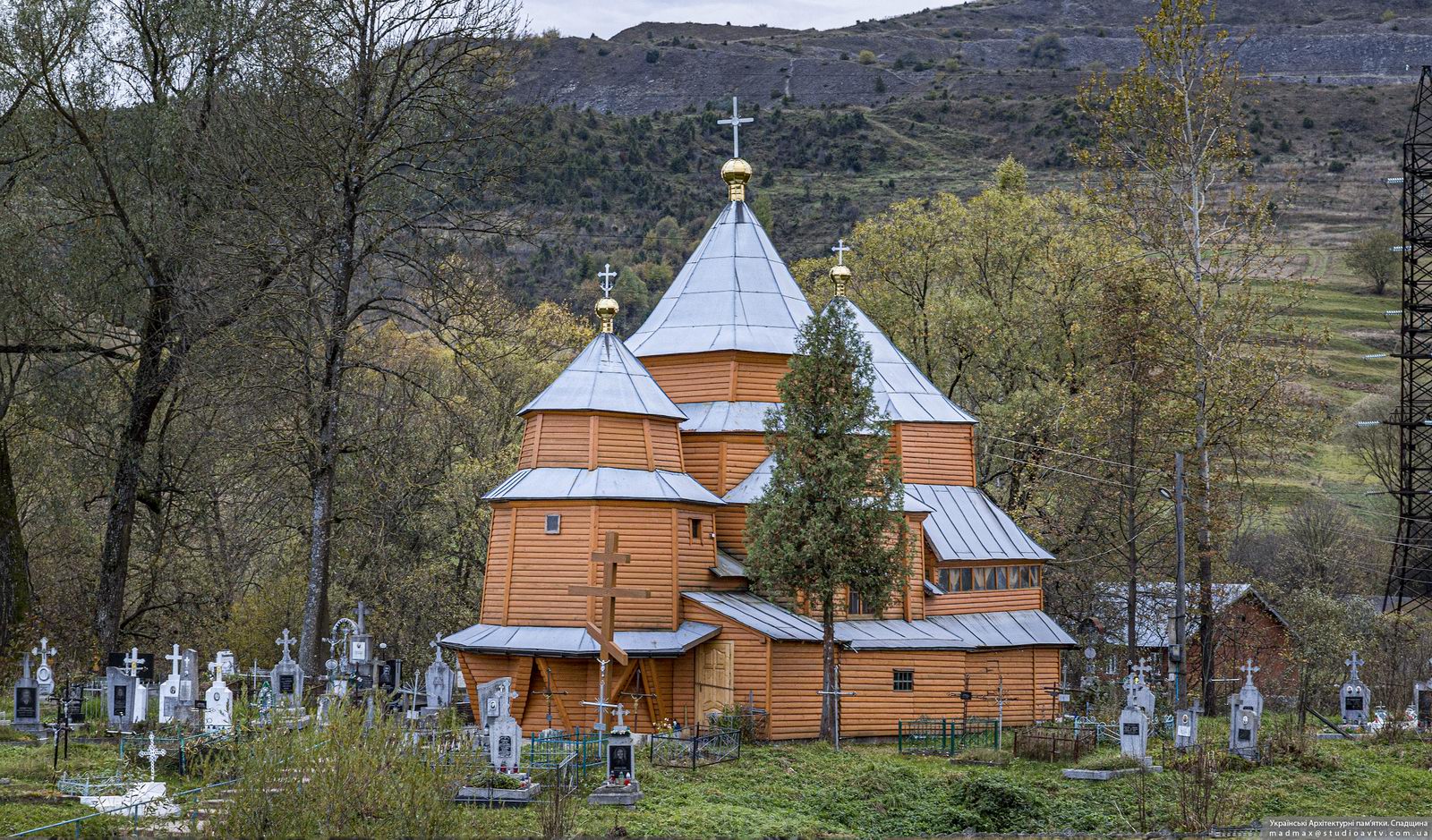
Church of St. Nicholas in Turka
No comments · Posted by Sergei Rzhevsky in Architecture, Regions, Travel
Turka is a town with a population of about 7,000 people located in Lviv Oblast, about 135 km south-west of Lviv, near the border with Poland.
One of the architectural sights of the town is the wooden Church of St. Nicholas (1739) – a monument of architecture of national importance. Inside, there is a preserved carved wooden iconostasis with a red background, gilded carvings, and icons created in 1739. Turka on Google Maps. Photos by: Maxim Ritus.
Tags: church · Lviv oblast
17
Unique Wooden Neo-Gothic Church in Rozluch
No comments · Posted by Sergei Rzhevsky in Architecture, Regions, Travel
Rozluch is a village with a population of about 1,200 people located in Lviv Oblast, about 128 km southwest of Lviv.
The main attraction of the village is the Roman Catholic Church of St. Francis Borgia (1901-1902) – the former chapel of German colonists and a unique for Ukraine example of a wooden church built in the Neo-Gothic style. Rozluch on Google Maps. Photos by: Maxim Ritus.

Tags: church · Lviv oblast
11
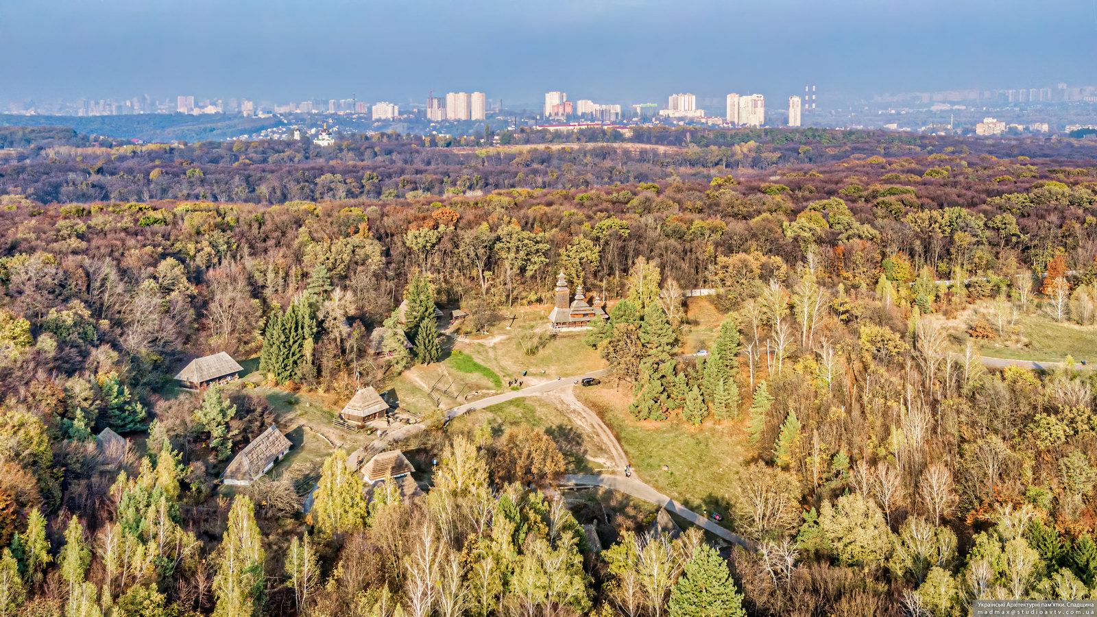
Church of the Intercession of the Holy Virgin in Pyrohiv
No comments · Posted by Sergei Rzhevsky in Architecture, Travel
The National Museum of Folk Architecture and Life of Ukraine is an open-air museum, an architectural and landscape complex of all historical and ethnographic regions of Ukraine. It is located on the southern outskirts of Kyiv, near the village of Pyrohiv.
The exposition devoted to the Carpathians is located on three hills covered with spruce and beech trees resembling the natural conditions of the original localities of the exhibits in the Ivano-Frankivsk, Lviv, Zakarpattia, and Chernivtsi regions. Pyrohiv on Google Maps. Photos by: Maxim Ritus.
Tags: church · Kiev city · museum
28
Wooden Church of St. Michael in Zinkiv
No comments · Posted by Sergei Rzhevsky in Architecture, Regions, Travel
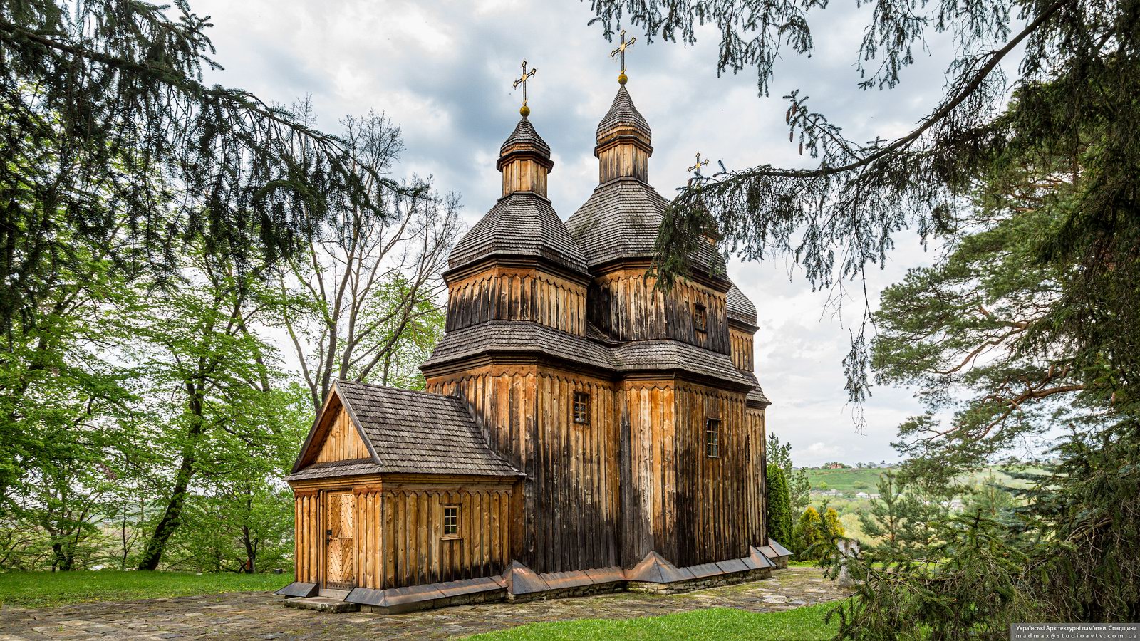
Zinkiv is a village with a population of about 1,600 people located in Khmelnytskyi Oblast, about 56 km south of the city of Khmelnytskyi.
There are several architectural and historical monuments here. One of them is the Church of St. Michael built with funds from parishioners in 1769. This is one of the most impressive monuments of Podolia wooden church architecture. Zinkiv on Google Maps. Photos by: Maxim Ritus.
very picturesque wooden church
Tags: church · Khmelnitsky oblast
11
Amazing Scenery in the Area of the Flooded Village of Bakota
No comments · Posted by Alex Smirnov in Nature, Travel, Video
Bakota, located about 50 kilometers from Kamianets-Podilskyi in the territory of the Podilski Tovtry National Park, in the very south of Khmelnytskyi Oblast, was once a village, but its story ended in 1981, when it was flooded due to the construction of the Dniester hydroelectric complex.
Today, Bakota is a place with amazing nature and beautiful views. Here, from the rocky high bank of the river, you can spend hours watching the water surface and picturesque cliffs. There are also boat excursions available. On the territory of Bakota, you can spend the night in a tent, fish.
Tags: Kamenets Podolskiy city · Khmelnitsky oblast
24
The Medzhybizh Fortress – the view from above
No comments · Posted by Alex Smirnov in Travel, Video
Medzhybizh Fortress is a monument of fortification architecture of the 16th century built in the Renaissance style and located about 40 km east of Khmelnytskyi. This fortress is listed in the State Register of National Cultural Heritage of Ukraine.
The fortress has the shape of an elongated triangle with powerful walls and corner towers that protrude significantly beyond the line of walls. The courtyard has a length of 130 m, the largest width (on the western side) is 85 m. The wall thickness is up to 4 m, the height is up to 17 m.
Tags: fortress · Khmelnitsky oblast
17
Church of the Assumption of the Virgin in Skala-Podilska
No comments · Posted by Sergei Rzhevsky in Architecture, Regions, Travel
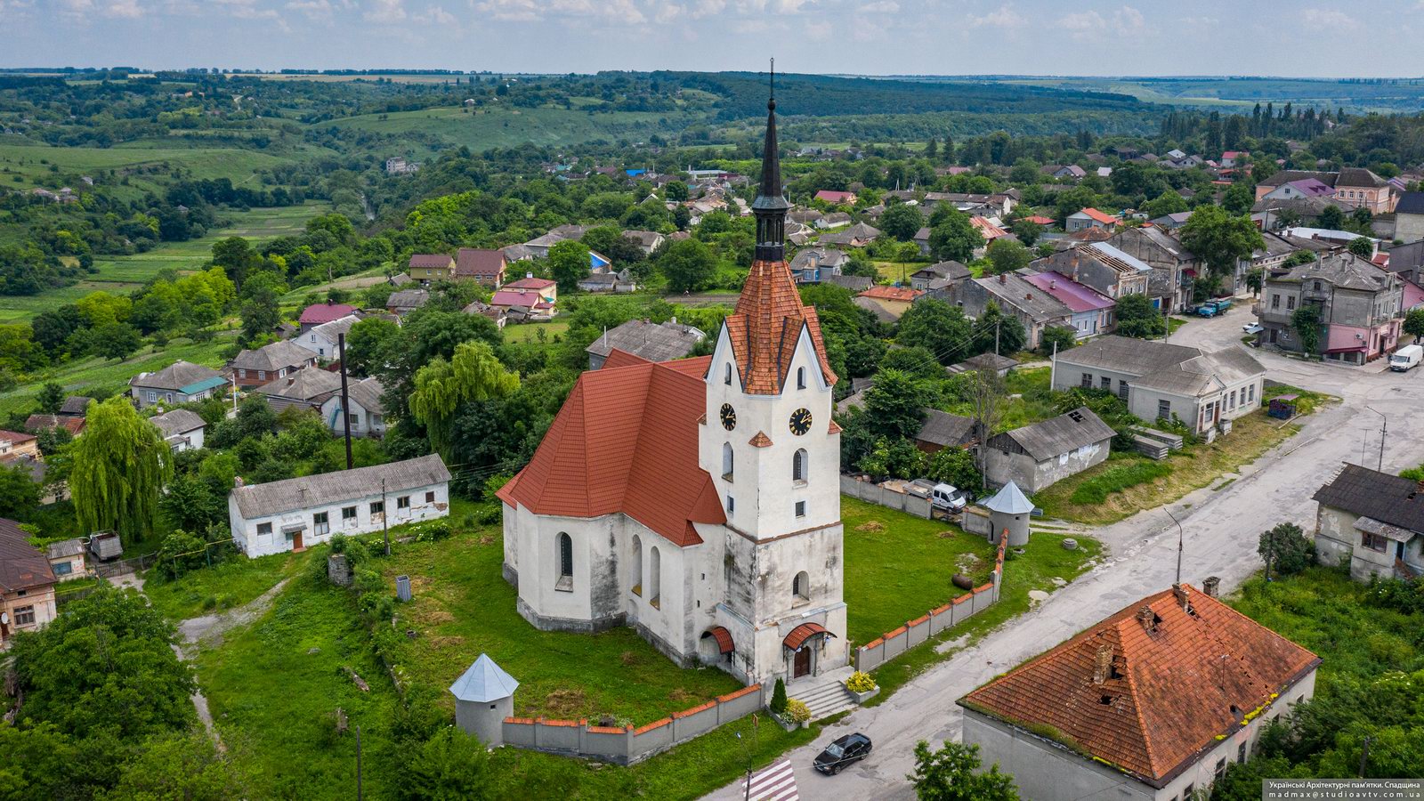
Skala-Podilska is an urban-type settlement with a population of about 4,200 people located in the Borshchiv district of Ternopil Oblast, about 106 km southeast of Ternopil.
One of the main architectural attractions of Skala-Podilska is the Catholic Church of the Assumption of the Blessed Virgin Mary – a stone religious building with Gothic features built in 1719. Skala-Podilska on Google Maps. Photos by: Maxim Ritus.
Tags: church · Ternopil oblast
9
The Gizycki Palace in Novoselytsya
No comments · Posted by Sergei Rzhevsky in Architecture, Regions, Travel
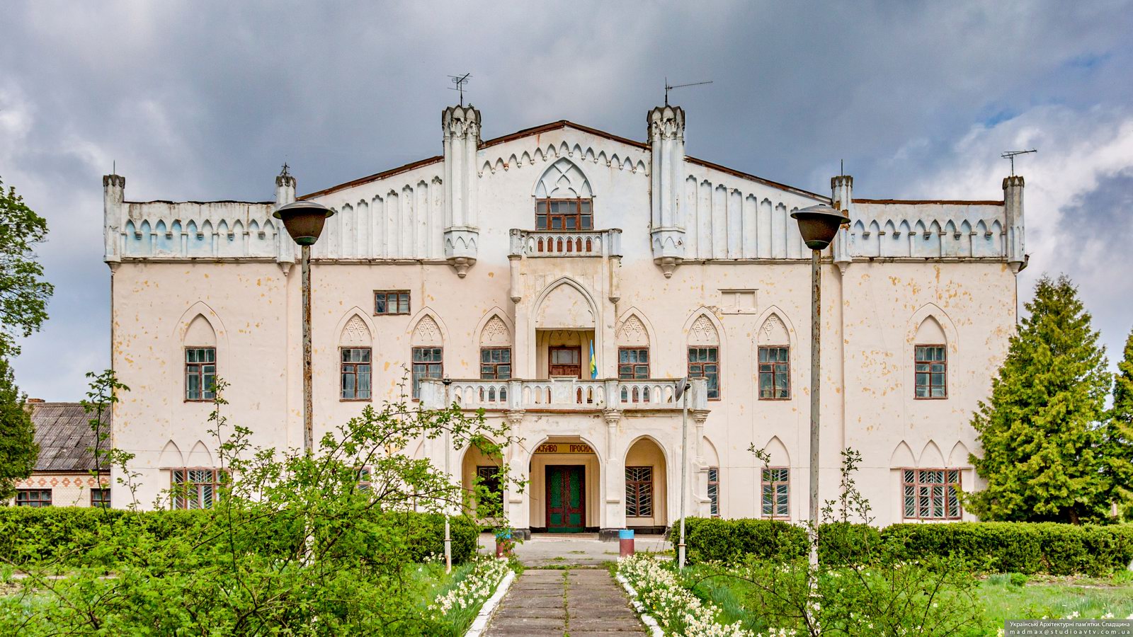
Novoselytsya is a village with a population of about 500 people located in the Starokostiantyniv district of Khmelnytskyi Oblast, about 47 km northeast of Khmelnytskyi. The main attraction of the village is the Gizycki Palace – a monument of architecture of national importance.
This palace in the style of Romanticism with Gothic elements made of specially imported English brick was built by Ludwik Gizycki, who at that time owned the village and surrounding territories, in 1820. Novoselytsya on Google Maps. Photos by: Maxim Ritus.
Tags: Khmelnitsky oblast