CAT | Regions
15
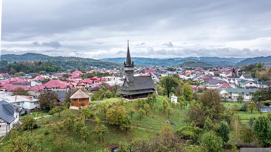
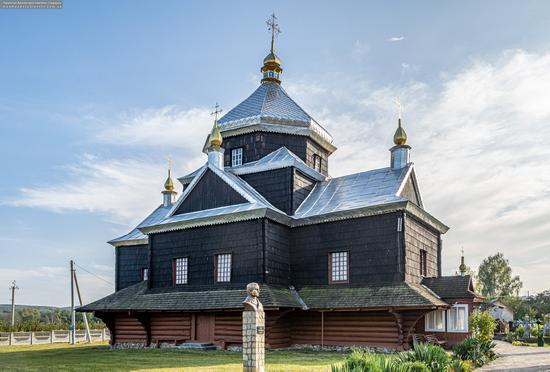
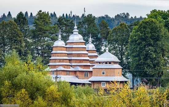
Church of St. Nicholas the Wonderworker in Nyzhnya Apsha
No comments · Posted by Sergei Rzhevsky in Architecture, Regions
Nyzhnya Apsha is a large village with a population of about 7,000 people located in the southeast of Zakarpattia Oblast in western Ukraine.
One of the main attractions of the village is the wooden Church of St. Nicholas the Wonderworker – an architectural monument of national importance. According to some sources, it was built in 1604 (according to others – in 1561) with the following rebuilding in the 18th century. Nyzhnya Apsha on Google Maps. Photos by: Maxim Ritus.
Tags: church · Uzhgorod city · Zakarpattia oblast
4
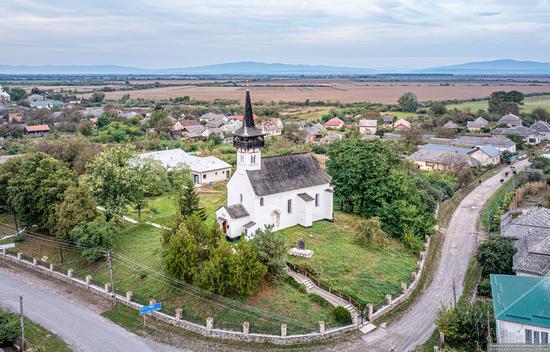
Reformed Church (1729) in Palad-Komarivtsi
No comments · Posted by Sergei Rzhevsky in Architecture, Regions
Palad-Komarivtsi is a village with a population of about 800 people located in Zakarpattia Oblast, about 15 km south-west of Uzhhorod and near the border of Ukraine with Slovakia.
The main attraction of Palad-Komarivtsi is the Reformed Church (1729) – a picturesque architectural monument standing on a hill in the central part of the village and created by a combination of two styles: Baroque and Gothic. Palad-Komarivtsi on Google Maps. Photos by: Maxim Ritus.
Tags: Uzhgorod city · Zakarpattia oblast
15
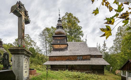
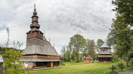
Church of the Presentation of the Virgin Mary in Roztoka
No comments · Posted by Sergei Rzhevsky in Architecture, Regions
Roztoka is a village with a population of about 400 people located in the northern part of Zakarpattia Oblast, about 120 km north-east of Uzhhorod.
Here you can see a picturesque wooden monument of architecture of national importance – the Church of the Presentation of the Blessed Virgin Mary. It is one of the oldest churches in this region built in the middle of the 17th century. The church received its present appearance in 1759. Roztoka on Google Maps. Photos by: Maxim Ritus.
Tags: church · Zakarpattia oblast
31
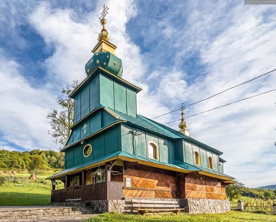
Church of the Holy Spirit in Kotelnytsya
No comments · Posted by Sergei Rzhevsky in Architecture, Regions
Kotelnytsya is a small village of about 400 people located in the north of Zakarpattia Oblast, about 103 km northeast of Uzhhorod.
Here you can see an interesting monument of wooden architecture of the 18th century standing on a hillside – the Church of the Holy Spirit, a classic example of Baroque churches in the upper reaches of the Latoritsa River. Kotelnytsya on Google Maps. Photos by: Maxim Ritus.
Tags: church · Zakarpattia oblast
14
Church of the Exaltation of the Holy Cross in Mykytyntsi
No comments · Posted by Sergei Rzhevsky in Architecture, Regions
Mykytyntsi is a small village located in Ivano-Frankivsk Oblast, about 78 km southeast of Ivano-Frankivsk.
In the center of the village, there is a picturesque wooden monument of architecture of national importance – the Church of the Exaltation of the Holy Cross (1859) renovated in 1987-1990. Today, it is used by the local community of the Ukrainian Greek Catholic Church. Mykytyntsi on Google Maps. Photos by: Maxim Ritus.
Tags: church · Ivano-Frankivsk oblast
24
Church of the Nativity of the Blessed Virgin in Pylypets
No comments · Posted by Sergei Rzhevsky in Architecture, Regions
Pylypets is a village with a population of about 1,000 people and a popular ski resort located in the north of Zakarpattia Oblast, about 120 km east of Uzhhorod.
The Church of the Nativity of the Blessed Virgin Mary (1762), located in this village, is one of the best examples of the Baroque style of wooden church architecture, an architectural monument of national importance. Pylypets on Google Maps. Photos by: Maxim Ritus.
Tags: church · Zakarpattia oblast
29
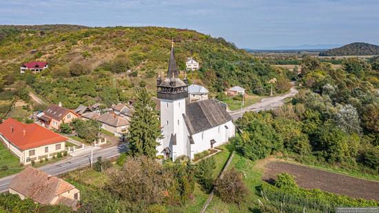
Defensive Catholic Church of the Heart of Jesus in Bene
No comments · Posted by Sergei Rzhevsky in Architecture, Regions
Bene is a village of about 1,400 people located in the southwest of Zakarpattia Oblast, near the border of Ukraine with Hungary.
The main attraction of this place is the Catholic Church of the Heart of Jesus, built in the Gothic style in the late 14th – early 15th centuries – an architectural monument of national importance. Bene on Google Maps. Photos by: Maxim Ritus.
Tags: church · Zakarpattia oblast
21
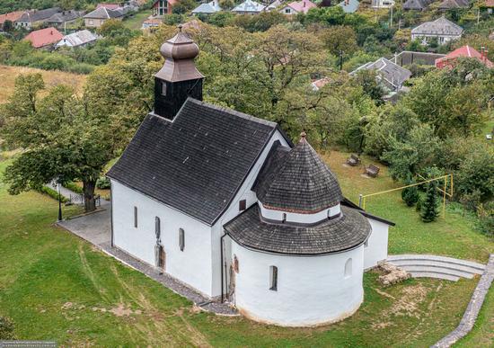
Horyanska Rotunda – one of the oldest churches in Ukraine
No comments · Posted by Sergei Rzhevsky in Architecture, Regions
Horyany is a district within Uzhhorod, the capital of Zakarpattia Oblast. It is located about 3 kilometers east of the city center.
In the distant past, Bela IV (1206-1270), King of Hungary and Croatia, founded a new fortress instead of the destroyed old Uzhhorod castle here. Only a small church (rotunda) of the Gothic style with traces of frescoes of the 14th-15th centuries has survived. The oldest part of the church built in the Byzantine style dates back to the 12th-13th centuries. Horyanska Rotunda on Google Maps. Photos by: Maxim Ritus.
Tags: church · Uzhgorod city · Zakarpattia oblast
12
Church of the Holy Virgin in Matkiv
No comments · Posted by Sergei Rzhevsky in Architecture, Regions
Matkiv is a village with a population of about 400 people located in the very south of Lviv Oblast. Here you can see several monuments of architecture of national importance.
The main attraction of this place is the monumental wooden Church of the Holy Virgin (1838) of the Ukrainian Greek Catholic Church. Matkiv on Google Maps. Photos by: Maxim Ritus.
Tags: church · Lviv oblast
4
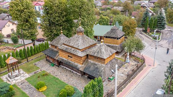
Church of St. Paraskevi in Skole
No comments · Posted by Sergei Rzhevsky in Architecture, Regions
Skole is a town with a population of about 6 thousand people located in the valley of the Opir River in the Ukrainian Carpathians in the south of Lviv Oblast. The historical center of the ethnographic region of Boykivshchyna, it is included in the list of historical settlements of Ukraine.
The main architectural attraction of this place is the wooden Church of St. Paraskevi (1597) – an architectural monument of national importance. Skole on Google Maps. Photos by: Maxim Ritus.
Tags: church · Lviv oblast

