
CAT | Travel
22
The Museum of Folk Architecture and Rural Life in Uzhhorod
No comments · Posted by Sergei Rzhevsky in Culture, History, Travel
The Transcarpathian Museum of Folk Architecture and Rural Life is an open-air museum located in the city of Uzhhorod, the capital of Zakarpattia Oblast of Ukraine.
It features architectural monuments from old Transcarpathian villages and examples of the oldest and widespread forms of folk applied art. The Museum of Folk Architecture in Uzhhorod on Google Maps. Photos by: Taras Kashchak.
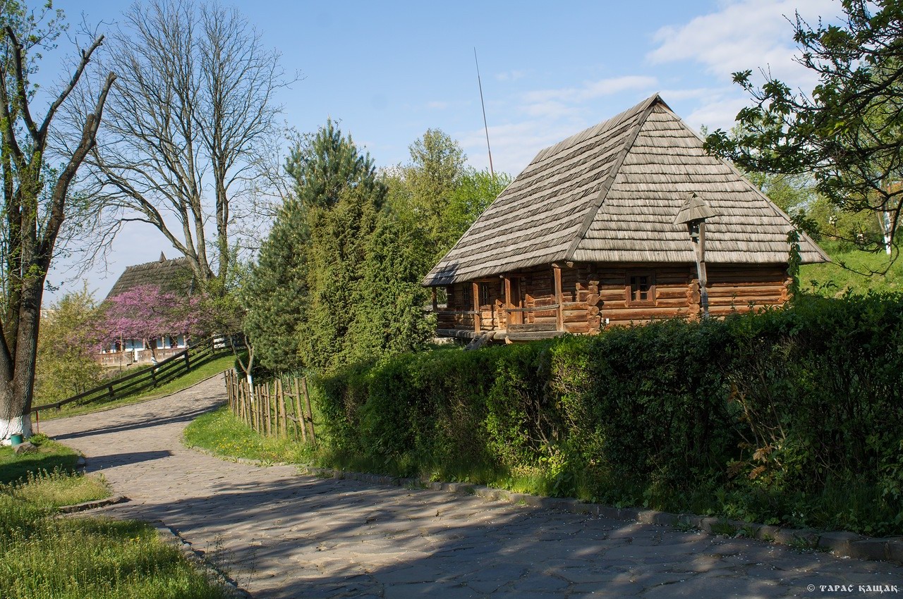
scenic museum in the center of Uzhhorod

Tags: museum · Uzhgorod city · Zakarpattia oblast
4
Snowy Winter on Mount Pip Ivan Chornohora
No comments · Posted by Sergei Rzhevsky in Nature, Regions, Travel
In the Ukrainian Carpathians, there are two peaks named Pip Ivan. One of them is located in Ukraine’s highest and most popular mountain range, Chornohora, hence the peak’s name, Pip Ivan Chornohora (2,028 m), or Pipivan, or Black Mountain. It is the third-highest peak in the Carpathians and the easternmost of the six two-thousanders. Its significantly lower namesake, Pip Ivan Marmaroshsky (1,936 m), is located in the Marmarosy mountain range.
The mountain is located in the southeastern part of the mountain range, on the border of Ivano-Frankivsk Oblast and Zakarpattia Oblast. Mount Pip Ivan Chornohora on Google Maps. Photos by: Alexander Kotenko.
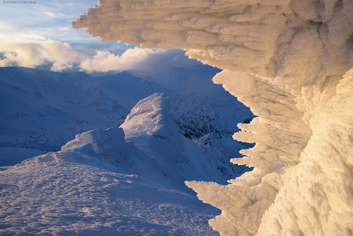
the main sight of the mountain
Tags: Ivano-Frankivsk oblast · Zakarpattia oblast
10
The Museum of Folk Architecture in Pyrohiv – Polissia
No comments · Posted by Sergei Rzhevsky in Architecture, Culture, Travel
Polissia is a historical, cultural and physical-geographical region located on the territory of the Polissia Lowland.
It is located primarily in the south of Belarus and the north of Ukraine, but also partially covers the territories of the Lublin Voivodeship of Poland and the Bryansk Oblast of Russia.

10
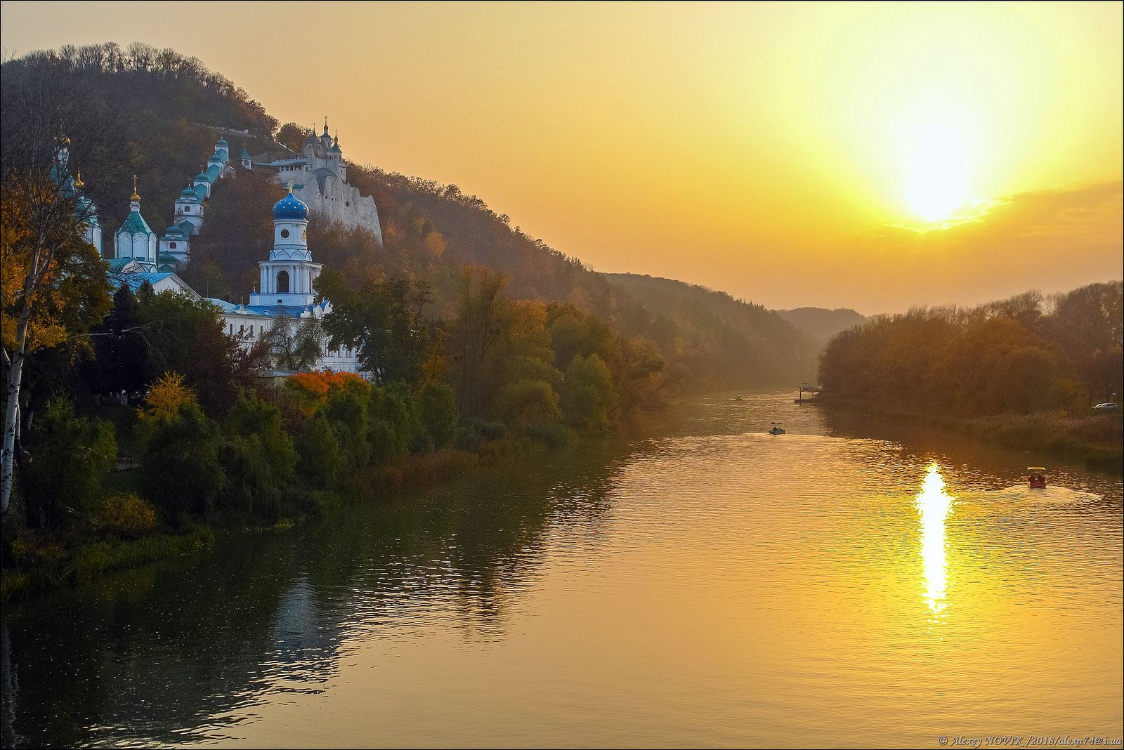
The Sviatohirsk Lavra – the Most Picturesque Monastery of Ukraine
No comments · Posted by Sergei Rzhevsky in Regions, Religion, Travel
In Ukraine, there are only three monasteries, which have the highest spiritual title of Lavra – Kyiv-Pechersk Lavra, Pochayiv Lavra and Sviatohirsk Lavra.
The Holy Assumption Sviatohirsk Lavra (also known as The Holy Mountains Lavra, Sviatohirsk Cave Monastery), an important spiritual center of eastern Ukraine and southern Russia, was first mentioned in written sources in 1526. Sviatohirsk Lavra on Google Maps. Photos by: Alexey Novik.
Tags: church · Donetsk oblast
12
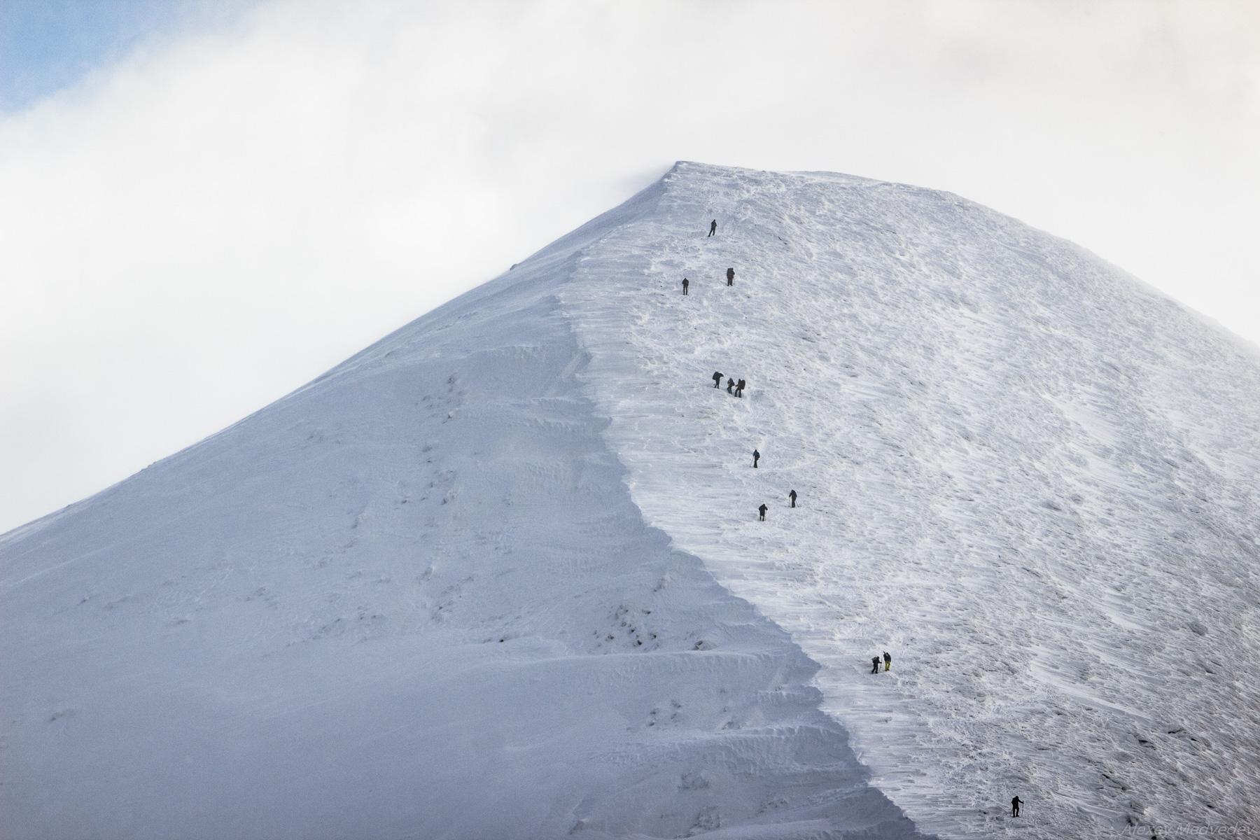
Climbing Mount Hoverla in Winter
No comments · Posted by Sergei Rzhevsky in Nature, Regions, Travel
Hoverla (in Romanian, “Howarla” means “insurmountable height”) is the highest mountain and the highest point in Ukraine (2,061 m above sea level). It is located on the border of Zakarpattia Oblast and Ivano-Frankivsk Oblast, approximately 17 km from the Ukrainian border with Romania.
It’s a popular destination for summer and winter tourism. The first hiking route up the mountain was opened in 1880. In the north, you can see the cities of Ivano-Frankivsk Oblast: Ivano-Frankivsk, Kolomyia, and Snyatin. Mount Hoverla on Google Maps. Photos by: Alexey Medvedev.
Tags: Ivano-Frankivsk oblast · Zakarpattia oblast
29
The Fortified Monastery of the Barefoot Carmelites in Berdychiv
No comments · Posted by Sergei Rzhevsky in Architecture, Photos, Travel
Berdychiv, a historic city with a population of about 73 thousand people, is located 41 km south of Zhytomyr. In total, there are more than 90 monuments of history, architecture and monumental art here.
One of the most interesting architectural monuments of Berdychiv is the monastery-fortress of the Barefoot Carmelites – the Sanctuary of the Mother of God of the Holy Scapular. For Roman Catholics in Ukraine, it is the main pilgrimage site. Berdychiv on Google Maps. Photos by: Maxim Ritus.

beautiful architectural monument
Tags: Berdychiv city · Zhitomir oblast
3
Abandoned and Flooded Korostyshivsky Granite Quarry
No comments · Posted by Sergei Rzhevsky in Regions, Travel
Korostyshivsky quarry is a picturesque flooded granite quarry located on the outskirts of the town of Korostyshiv in Zhytomyr Oblast, about 30 km east of Zhytomyr and 100 km west of Kyiv.
The landscape around the quarry is unusual, the shore is covered with spruces and birches, which resembles Karelia (Russia). The height of the rocks reaches about 10 m, the depth of the artificial lake is up to 20 m. This place has become a popular object of industrial tourism and a natural landmark. Korostyshiv Quarry on Google Maps. Photos by: Igor Golovach.
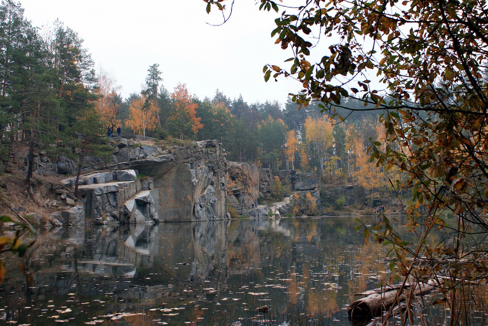
walk along the shore of an artificial lake
Tags: abandoned · Zhitomir oblast
8
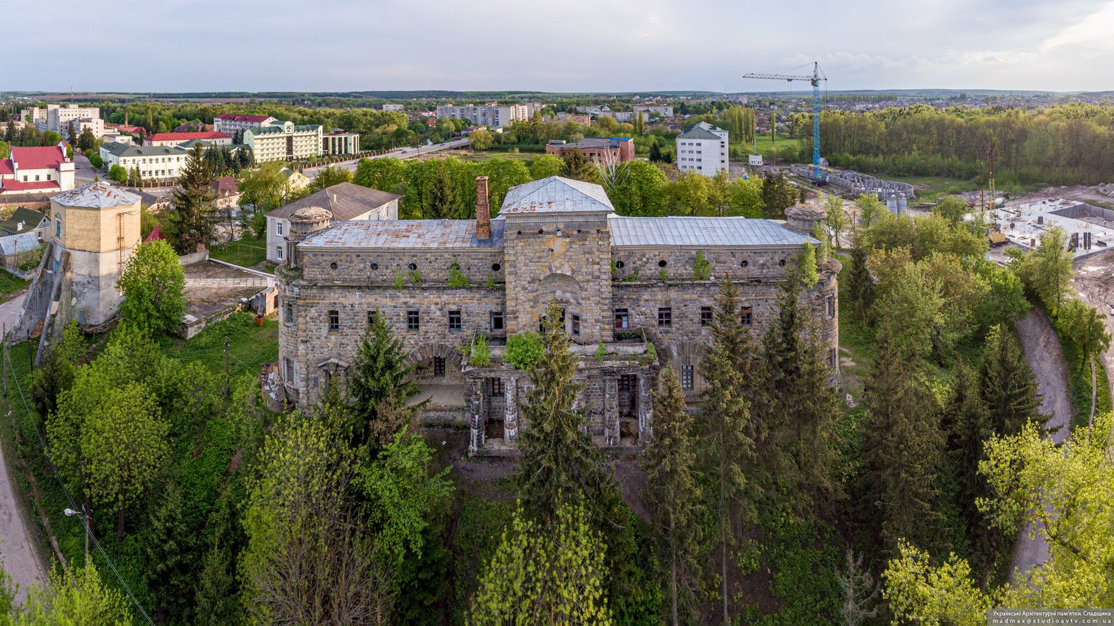
Palace of Count Ksido in Khmilnyk
No comments · Posted by Sergei Rzhevsky in Architecture, Cities, Travel
Khmilnyk is a resort town (a balneological resort, one of the radon resorts in Ukraine) with a population of about 27 thousand people located in the north-west of Vinnytsia Oblast, about 63 km from Vinnytsia.
The most interesting architectural monument of this town is the Palace of Count Konstantin Ksido (1911-1915), built by the architect Ivan Fomin on the foundations of a 16th-century Lithuanian castle. Khmilnyk on Google Maps. Photos by: Maxim Ritus.
Tags: Vinnitsa oblast
11
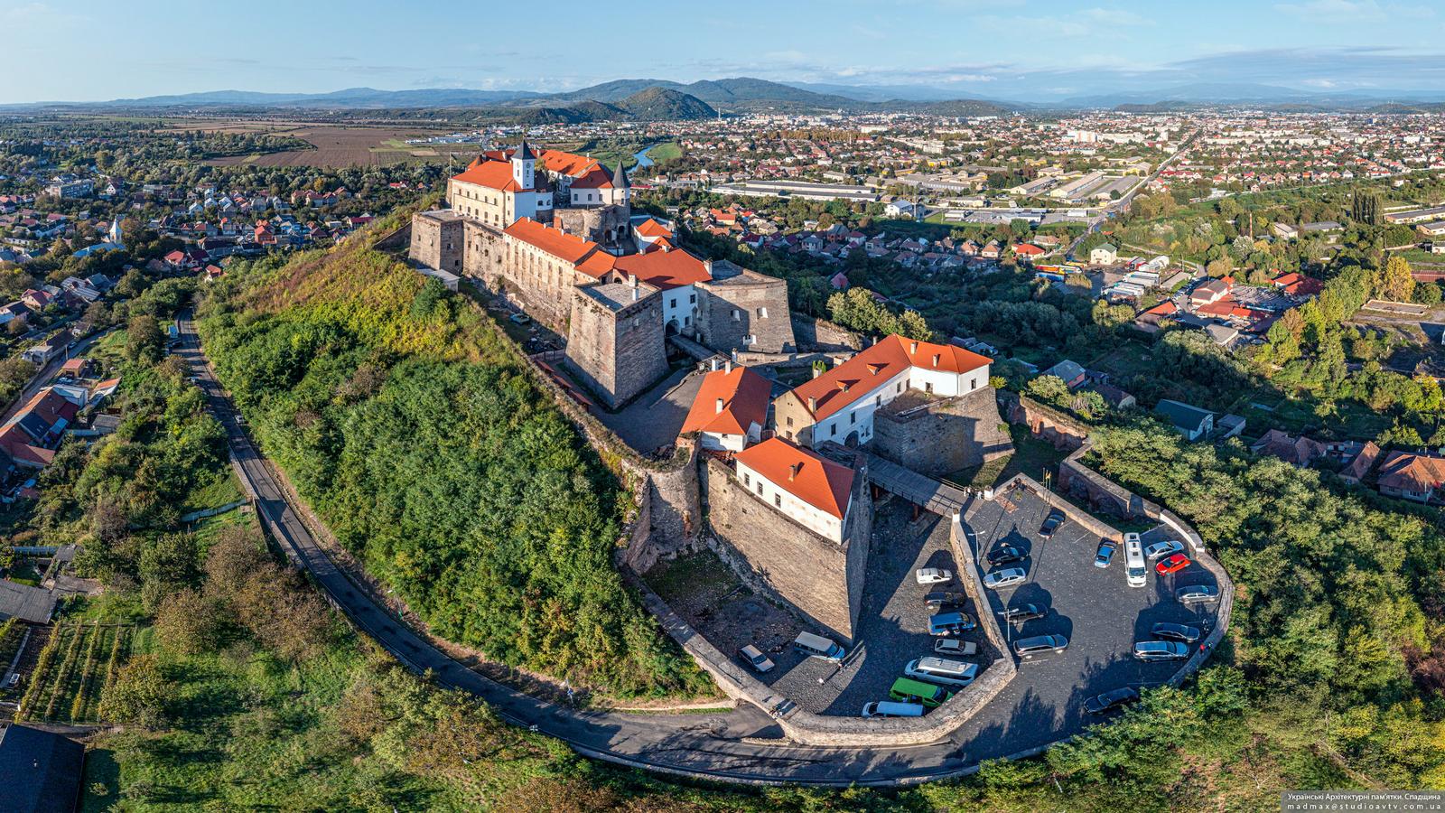
The Palanok Castle in Mukachevo
No comments · Posted by Sergei Rzhevsky in Architecture, Travel
The Palanok Castle or Mukachevo Castle is a very picturesque castle located in the city of Mukachevo in Zakarpattia Oblast of Ukraine.
It is a unique example of medieval fortification architecture with a combination of different styles, an architectural monument of national importance. Today, the Mukachevo Castle houses a historical museum. Photos by: Maxim Ritus.
Tags: fortress · Mukachevo city · Zakarpattia oblast
14
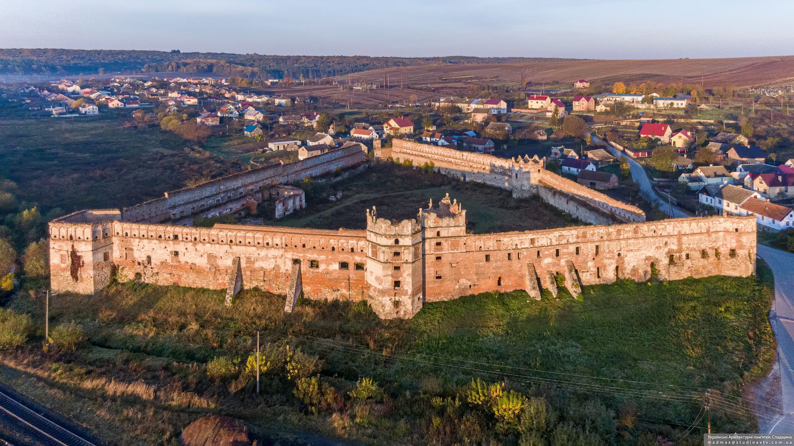
Stare Selo Castle – One of the Largest Castles in Ukraine
1 Comment · Posted by Sergei Rzhevsky in Architecture, Regions, Travel
Stare Selo is a village with a population of about 2,100 people located in Lviv Oblast, about 27 km southeast of the center of Lviv. Stare Selo was first mentioned in 1442. In 1498, it was destroyed by the Ottomans, in 1648 – by the Crimean Tatars.
The main attraction of this place is its gradually crumbling castle – an architectural monument of national importance, the largest castle in Lviv Oblast and one of the largest castles in Ukraine. The Stare Selo Castle on Google Maps. Photos by: Maxim Ritus.
Tags: fortress · Lviv oblast